
Dominion of Canada
$95.00
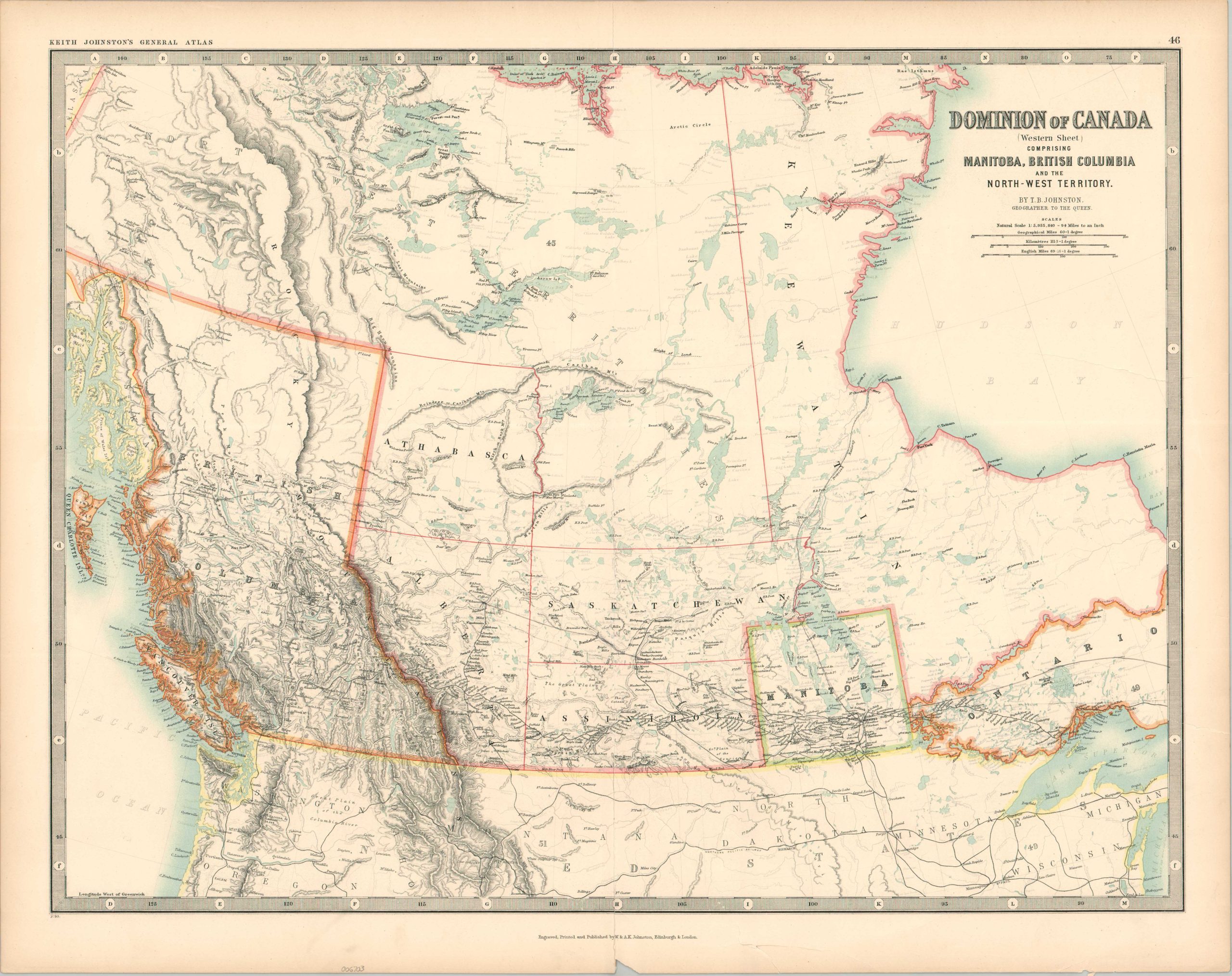
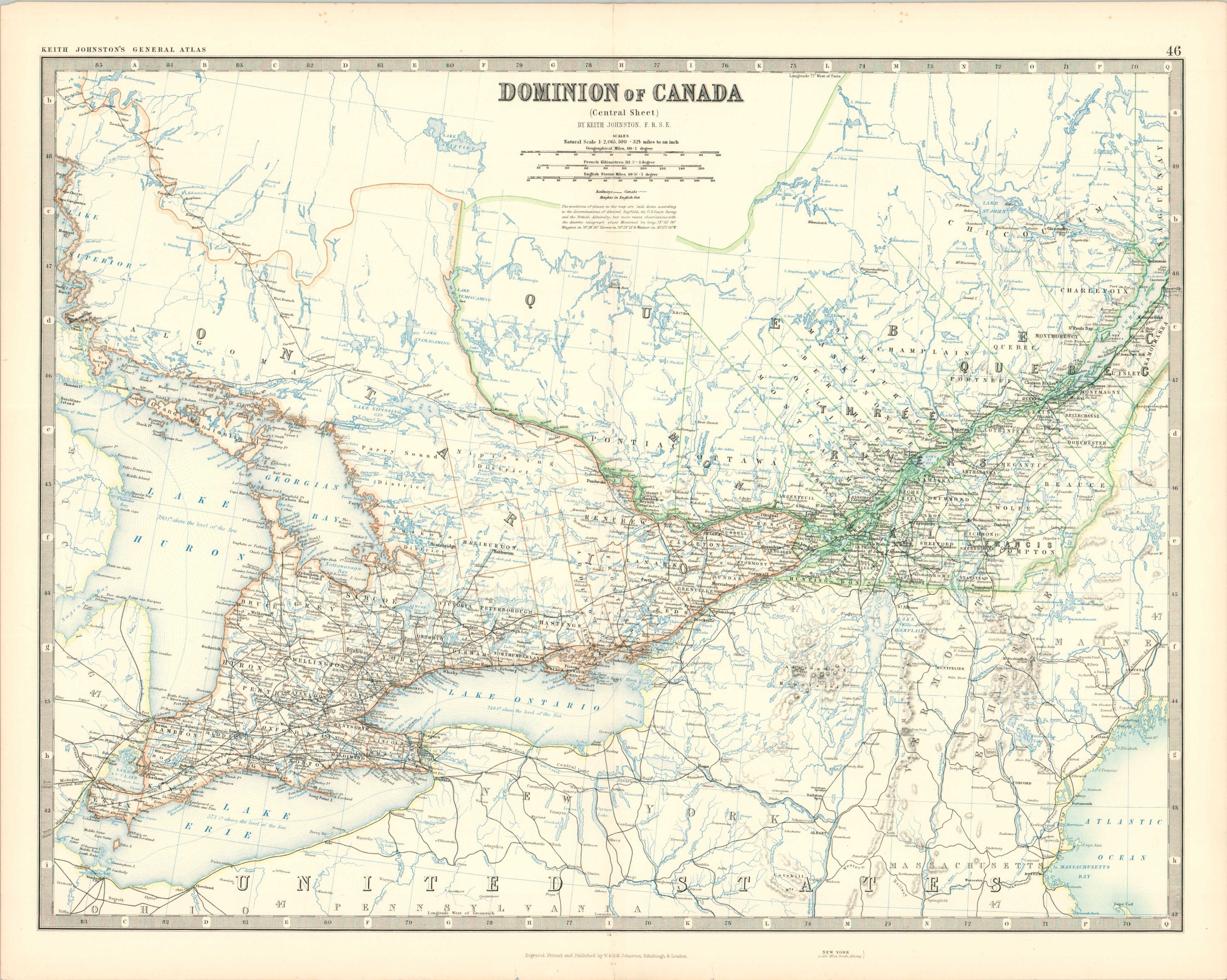
The Great White North across three sheets.
1 in stock


Description
This trio of incredibly detailed maps was compiled by Keith Johnston and engraved, printed, and published by the firm of W. & A.K. Johnston around 1890. It shows the territorial extent of the Dominion of Canada across three colored sheets. The sparsely populated western areas of Manitoba, British Columbia, and the Northwest Territories are shown at a much smaller scale than the denser eastern regions.
Finely lithographed toponyms identify geographic features, settlements, transportation routes (notably, railroads), and much more. Vast expanses of the country’s northern regions remained largely unexplored at the time of publication, though the image reflects late 19th-century trends of urbanization and development.
Map Details
Publication Date: c. 1890
Author: Keith Johnston
Sheet Width (in): 24.5
Sheet Height (in): 19.5
Condition: B+
Condition Description: Three-double page color lithograph sheets with original color (size given for each). Issued on sheets that have become somewhat brittle and lightly toned along the outer edges. The Western sheet has two large irregular tears (lower center and center right) repaired on the verso with archival tape. Good condition overall.
$95.00
1 in stock