
DOD Evasion Chart EVC 500-2 (S.E.A) [and] DOD Evasion Chart EVC 500-3 (S.E.A)
$350.00
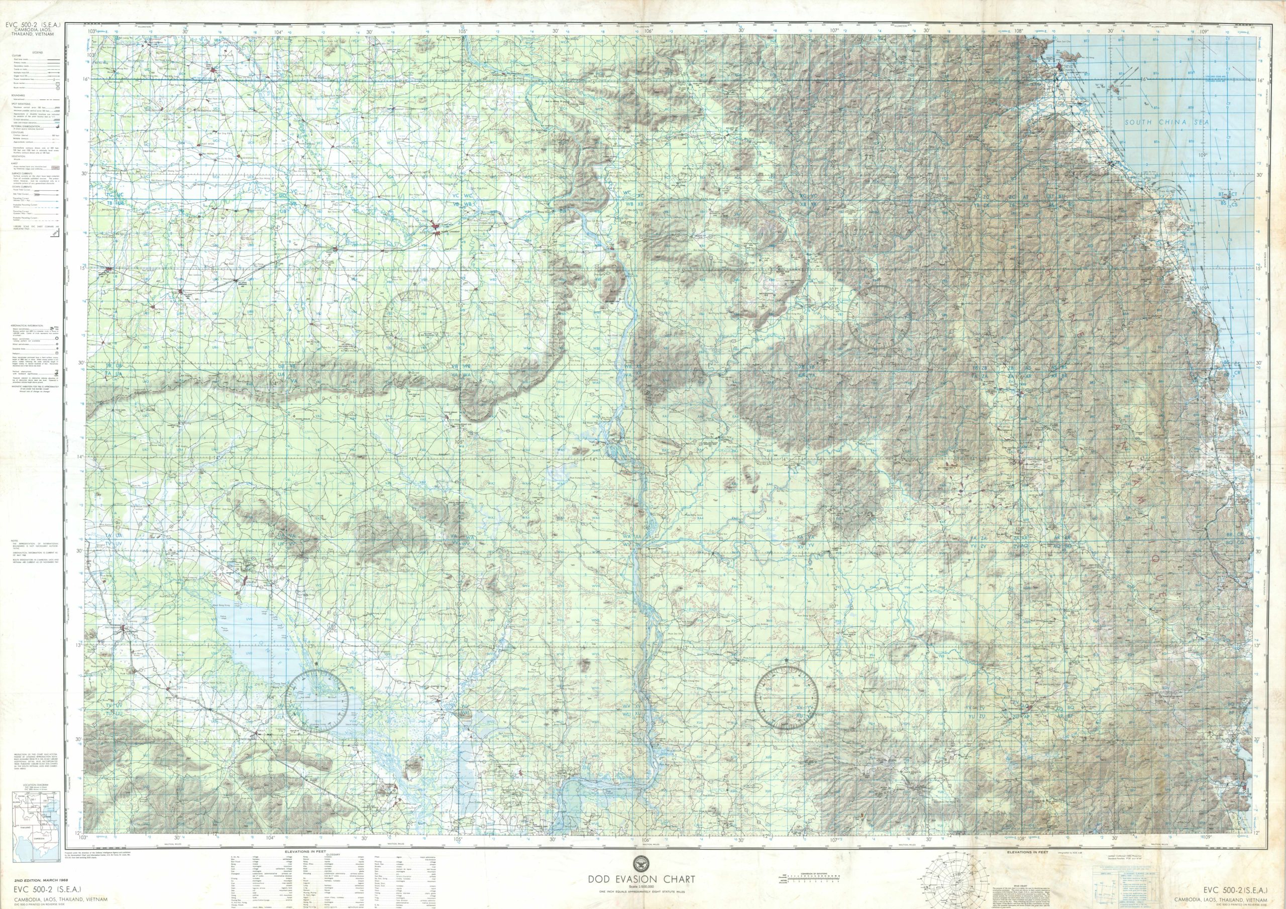
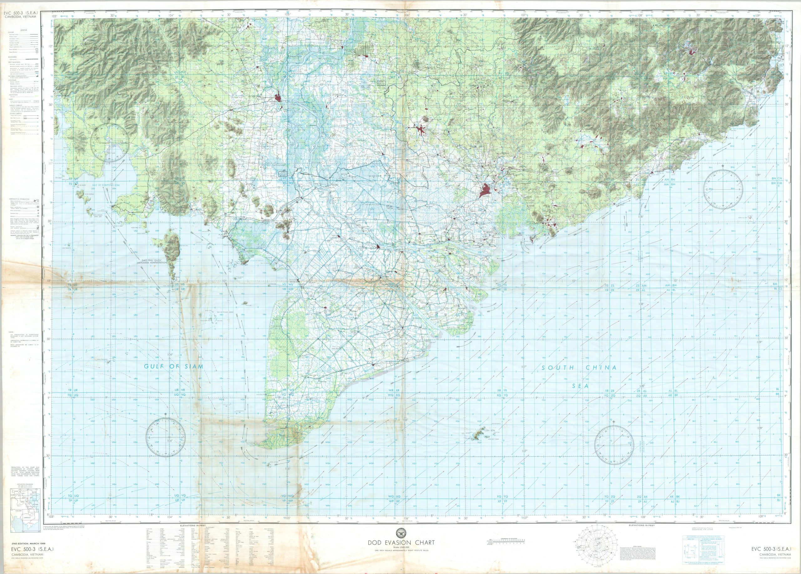
An aviation evasion map from the Vietnam War, covering most of South Vietnam and Cambodia.
1 in stock
Description
This double-sided Evasion Chart covers the southern half of Indochina, from the Khorat Plateau of northeastern Thailand down to the Mekong Delta. This second edition was published in March 1968 under the direction of the Defense Intelligence Agency and lithographed by the U.S. Air Force Aeronautical Chart and Information Center (ACIC), “from best existing DOD charts,” for issue to aircrews flying over hostile territory during the Vietnam War. Printed on a durable sheet, such charts could also serve as a ground sheet, water carrier, or signal panel if a crew member was shot down.
The base map, at 1:500,000, shows settlements, terrain, and the transportation network, including a good many airstrips annotated as abandoned or unusable. Blue overprinting adds a reference grid for radio communication with rescue forces, worked through step by step in the margin. The rest of the margin is given over to the evader rather than the pilot: tidal and seasonal surface currents, drawn as arrows out across the water; a star chart for finding north after dark; and a glossary of the Thai, Lao, Khmer, Vietnamese, and French terms that make up local place names.
As the Location Diagram shows, six sheets in a 1:250,000 series covered North Vietnam, northern South Vietnam, and Laos, supplemented by three at 1:500,000 extending south. This example pairs EVC 500-2 with 500-3 on the reverse. The first takes in the southern Laotian panhandle and the Central Highlands, the country crossed by the lower reaches of the Ho Chi Minh Trail. The reverse centers on Saigon and the Delta and runs west across the Cambodian frontier (shown here as a “Military Operational Boundary”) to the islands of the Gulf of Siam.
Map Details
Publication Date: 1968
Author: U.S. Air Force Aeronautical Chart and Information Center
Sheet Width (in): 57.5
Sheet Height (in): 41.75
Condition: B+
Condition Description: Double-sided map printed on a plastic/vinyl material. A sharp image on a dry and non-tacky surface (uncommon for these issues) though it does have some staining and toning visible in the scan. Creased along old folds. Good to very good condition overall.
$350.00
1 in stock