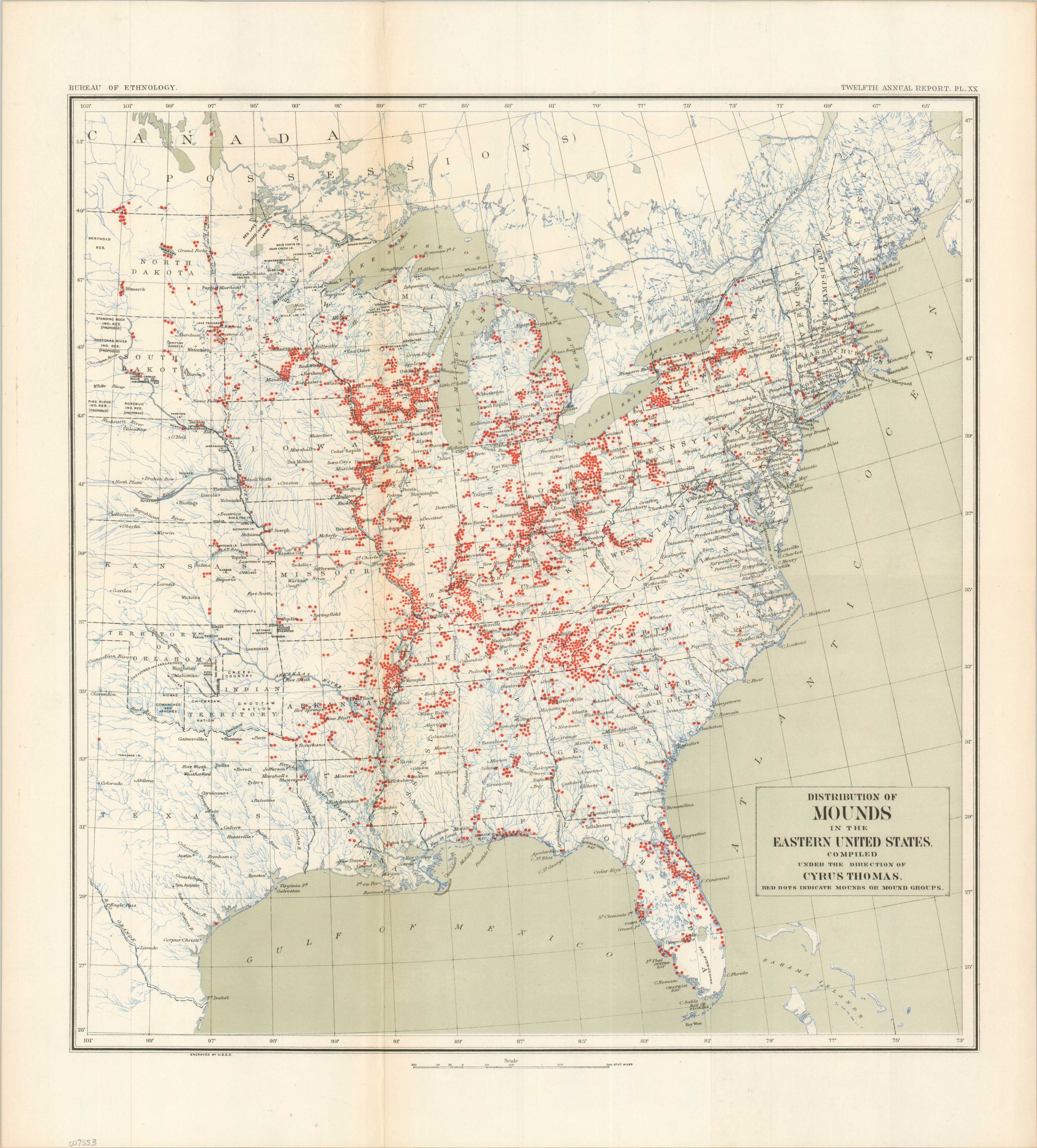
Distribution of Mounds in the Eastern United States
Early indigenous sites across the Eastern United States.
Out of stock
Description
This ‘pocked’ map of the Eastern United States was compiled under the direction of Cyrus Thomas and engraved by the United States Geological Survey for publication in the Twelfth Annual report of the U.S. Bureau of Ethnology.
Each red dot represents a mound or mound groups attributed to the indigenous inhabitants of North America. Heavy concentrations are evident along the major rivers throughout the Midwest, most notably the Mississippi, Ohio, and Wabash. Southern Wisconsin and eastern Tennessee are also home to many such sites.
Map Details
Publication Date: c. 1892
Author: Cyrus Thomas
Sheet Width (in): 18.75
Sheet Height (in): 20.75
Condition: A
Condition Description: Color printed map sharply creased along original folds and lightly toned, consistent with age. Very good to near fine overall.
Out of stock