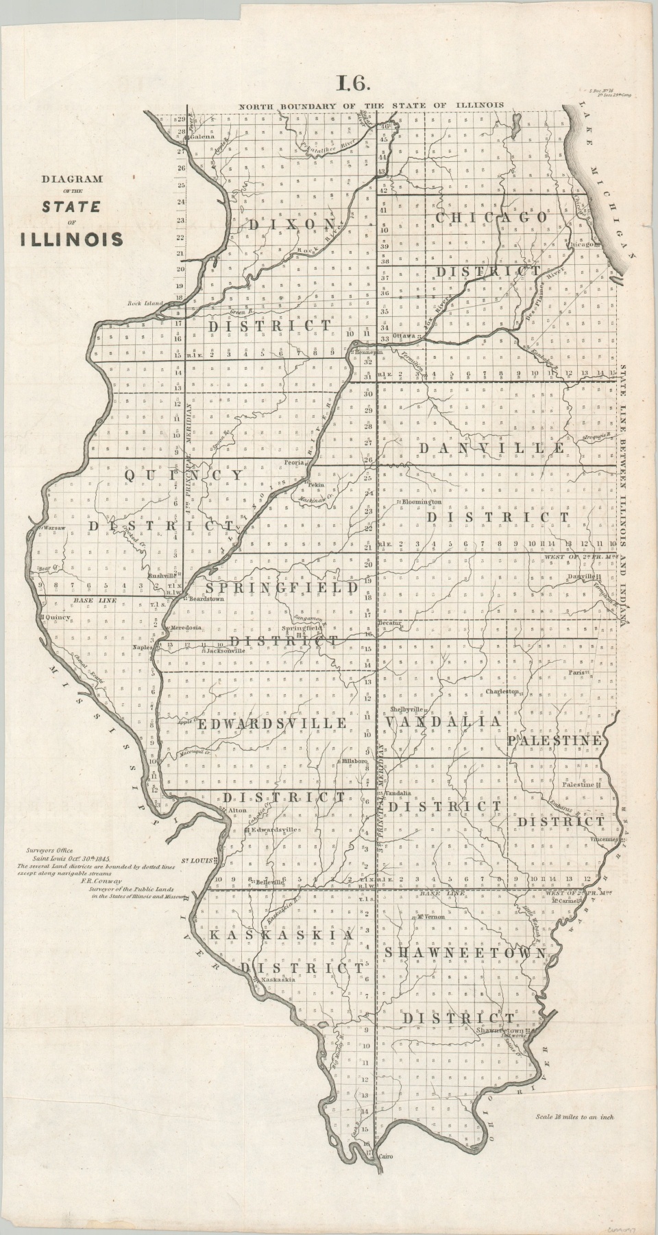
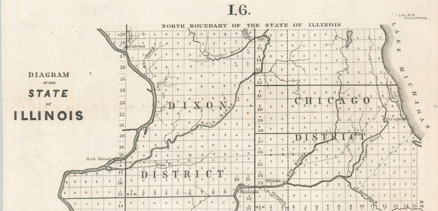
Diagram of the State of Illinois
$110.00
Illinois about a decade after Chicago was incorporated as a town.
1 in stock
Description
This early map of the state of Illinois was published by the General Land Office in 1845 as part of its annual report to the United States Congress. The process of surveying the state is shown as almost entirely complete, with townships individually outlined across ten separate districts (including an early use of the Chicago District). Baselines and meridians, key components of the GLO surveys, are also shown.
Prominent settlements, water features, and a handful of other scattered contemporary details are noted. Of particular interest are the boundaries of the Treat of St. Louis (1816), which saw various native tribes cede a strip of land about 20 miles wide along the Chicago River (location of the future Illinois & Michigan canal). It was later superseded by the 1833 Treaty of Chicago, which saw the U.S. ‘acquire’ all land west of Lake Michigan to Lake Winnebago in Wisconsin.
Map Details
Publication Date: 1845
Author: General Land Office
Sheet Width (in): 12.3
Sheet Height (in): 23.1
Condition: A-
Condition Description: Lightly creased along original fold lines, plus a few extraneous near the bottom of the sheet. Lightly toned around the edges, consistent with age, and a few light ink smudges.
$110.00
1 in stock