Deutschland in der Grenzen von 1937
A rose tinted look at Germany prior to the outbreak of WWII.
Out of stock
Description
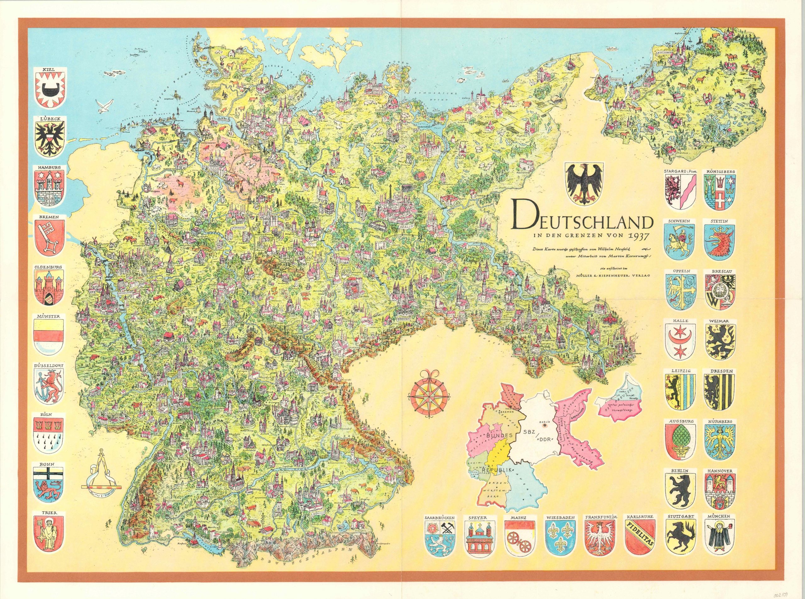
This stunning pictorial map of Germany reflects the borders of the country as of 1937, just two years before the invasion of Poland would forever change the face of the continent. Few hints of the impending devastation can be seen within the carefully crafting illustrations of major urban centers, geographic features, and local industries. However, the inclusion of the Rhineland to the east and Saarland to the southeast reflects earlier territorial expansion that directly contravened the Treaty of Versailles.
Interestingly, the map appears more of a historical reflection than an effort to whitewash the ambitions of the Third Reich (though it could be both). The lower right shows an inset of the contemporary state of affairs during the Cold War. The ‘Bundes Republik’ of West Germany is partitioned against the ‘Deutsche Demokratische Republik’ (DDR) under the Soviets in the East. Combined with the decorative coats of arms, the charming German countryside provides a wistful look at what might have been.
The image was created by Wilhelm Neufeld in collaboration with Martin Kornrumpf and published by Mueller & Kiepenheuer.
Map Details
Publication Date: c. 1968
Author: Wilhelm Neufeld
Sheet Width (in): 24.30
Sheet Height (in): 18.10
Condition: A-
Condition Description: Creasing and faint wear along vertical and horizonal fold lines. Very good overall.
Out of stock