Detailed Map of Honolulu (Fair Haven) Also the Island of Oahu (Gathering Place)
$125.00
A popular tourist map of Hawaii issued during World War II.
1 in stock
Description
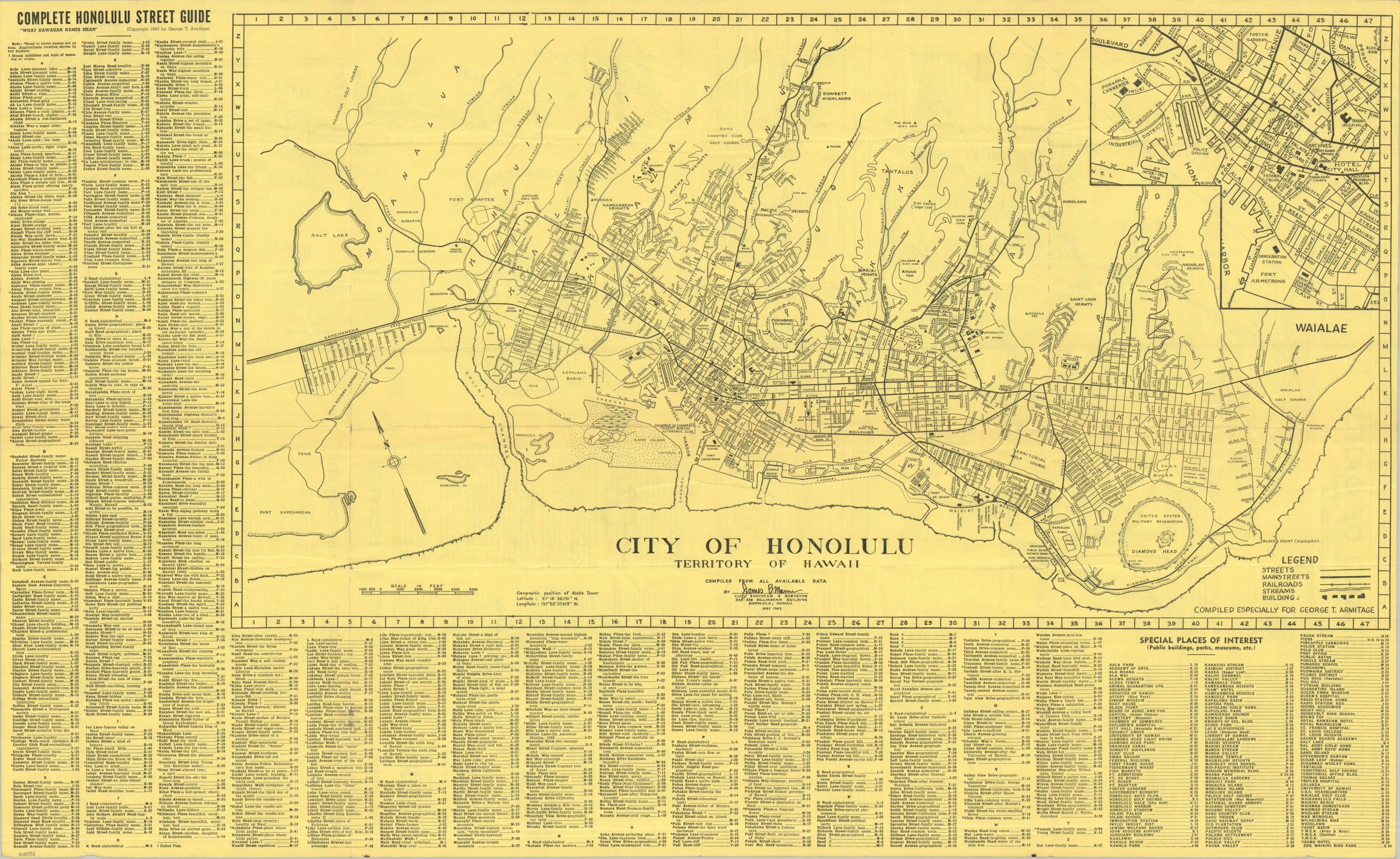
This utilitarian and densely informative street plan of Honolulu presents the Hawaiian capital in the midst of its revolutionary wartime transformation. While many military details remain deliberately obfuscated or outdated (likely to accommodate censorship requirements), several large installations are shown – Fort Kamehameha, Honolulu Harbor, Fort Armstrong, and the Reservation at Diamond Head among them.
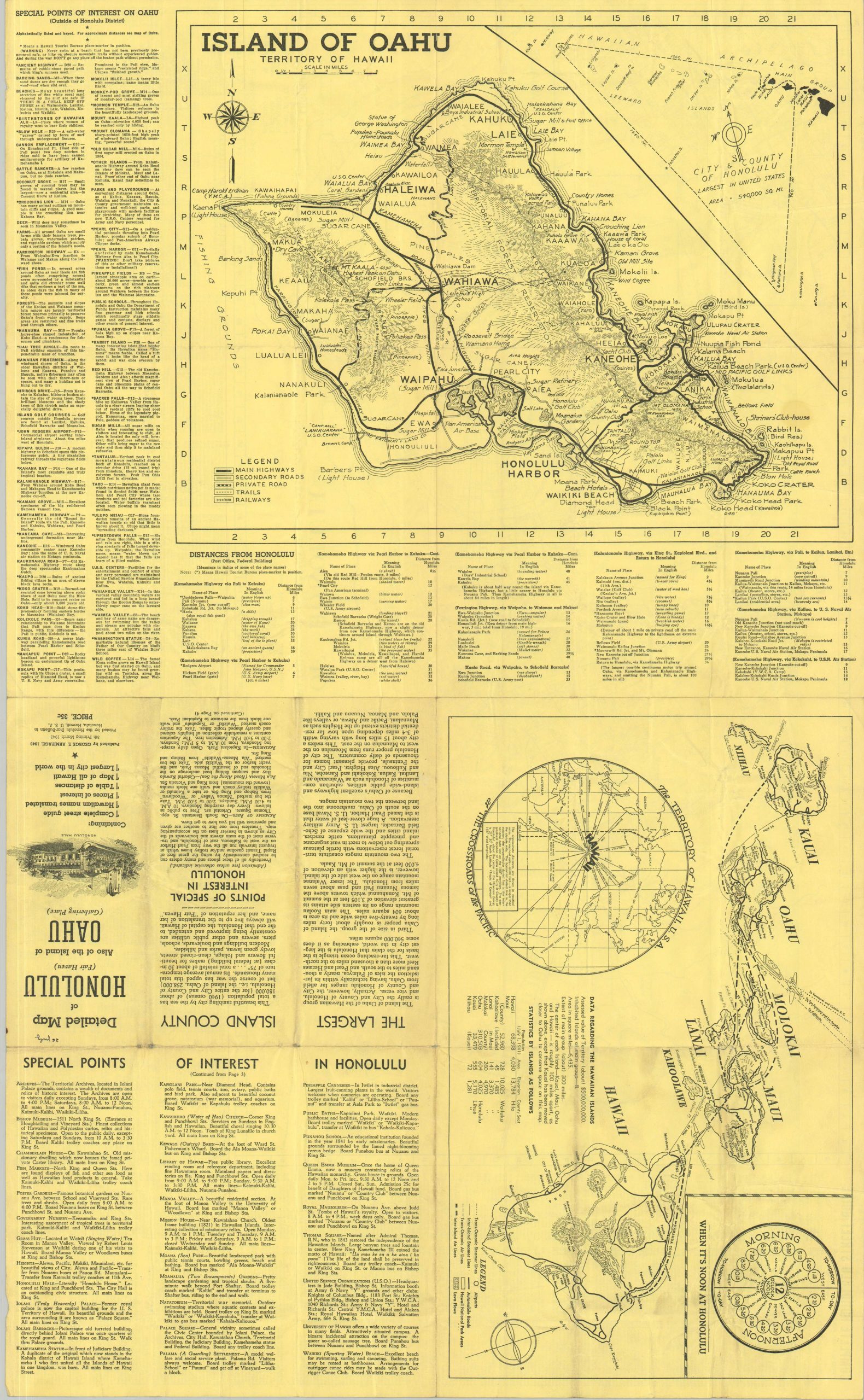
Leisure opportunities, geographic features, and commercial facilities are also labeled, offering a broad look at the coastal city. An inset of the affluent Waialae neighborhood can be seen in the upper right, while the lower right lists numerous Special Places of Interest. Another interesting feature is the comprehensive street guide, which offers the meaning behind the Hawaiian names. The verso of the sheet contains a topographic map of the Island of Oahu and a transportation overview of the Hawaiian Islands, with points of interest listed for each.
The map was drawn by Civil Engineer James B. Mann and originally issued before the outbreak of war by the Hawaiian Tourist Bureau. This is the 5th printing, published in March 1943 by George T. Armitage. Printed locally by the Honolulu Star-Bulletin and originally sold for thirty five cents – an inexpensive reference for the throngs of sailors, soldiers, and nurses who crowded the island during WWII.
Map Details
Publication Date: 1943
Author: James B. Mann
Sheet Width (in): 33.75
Sheet Height (in): 20.75
Condition: B+
Condition Description: Double-sided map brochure with moderate wear along folds and some extraneous wrinkling throughout. A circular stain, about a quarter sized, on the island map. Good condition overall.
$125.00
1 in stock