Denver & Rio Grande Western Railroad Scenic Line of the World
$75.00
From Denver to Salt Lake City and Santa Fe – the lines of the Denver & Rio Grande Western Railroad.
1 in stock
Description
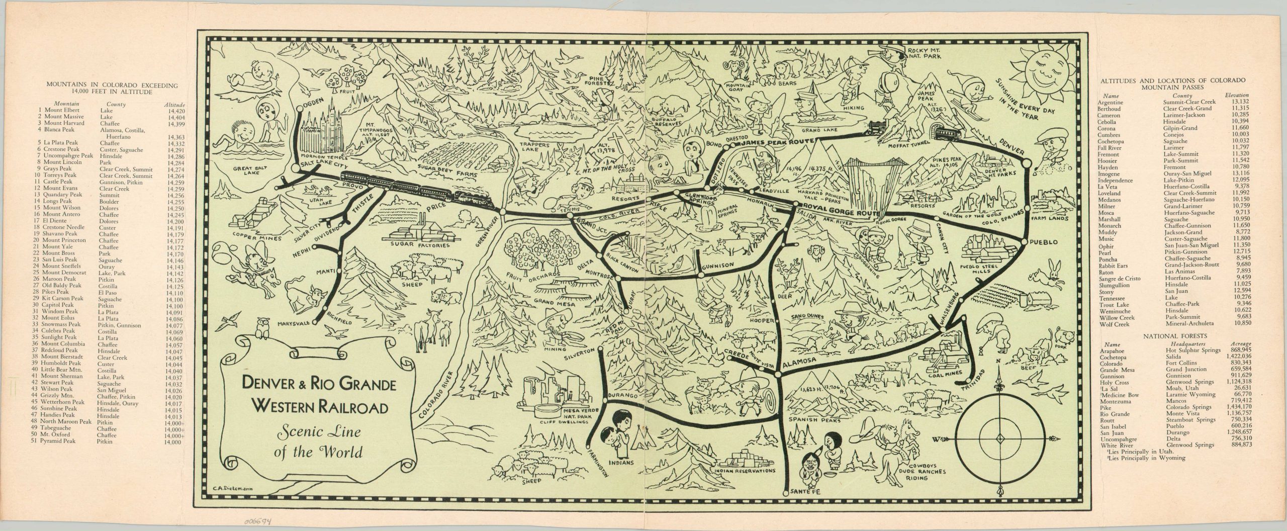
This charming pictorial map of portions of Colorado, Utah, and New Mexico was illustrated by C.A. Dietermann (signed, lower left) and originally issued in a brochure for the Denver & Rio Grande Western Railroad. The image presents a heavily stylized perspective of the ‘Scenic Line of the World’ as it traverses the mountains, mesas, canyons, and plains between Denver, Santa Fe, and Salt Lake City (as well as numerous other cities).
Caricatured figures enjoy a variety of recreational activities and numerous regional attractions (including stereotypical Native Americans) are shown in a whimsical manner. Lists of geographic features (mountains, passes, and National Forests) are provided on either side of the sheet.
A more practical route map, noting single and double-tracked lines, can be found on the verso. Dated based on the presence of the Dotsero Cutoff, completed in 1934.
Map Details
Publication Date: c. 1936
Author: C.A. Dietermann
Sheet Width (in): 22.4
Sheet Height (in): 9
Condition: B+
Condition Description: Centerfold map extracted from a brochure, with a clean split down the central seam (repaired on verso). Creased along folds, with some light wrinkling and wear. Good condition overall.
$75.00
1 in stock