
Denver Colorado and Vicinity
$150.00
Depression-era street map of Denver.
1 in stock
Description
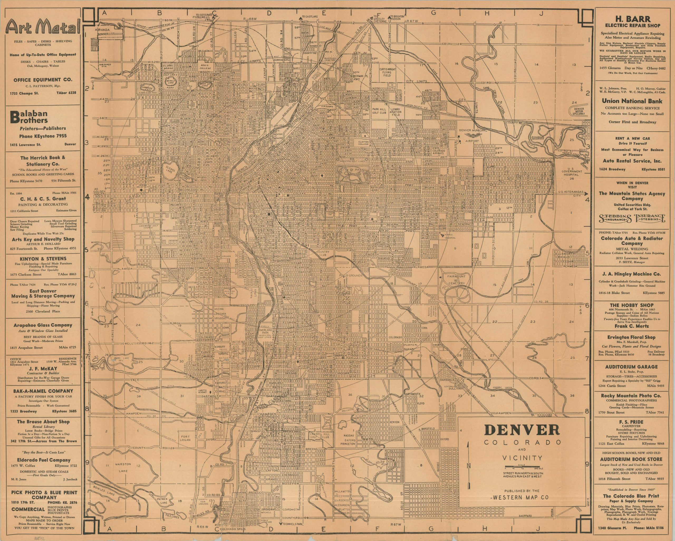
This uncommon city plan of Denver, Colorado, was published locally by the Western Map Company in 1934. A utilitarian street map is punctuated by concentric circles given in 1-mile increments – a handy way to measure distances about town. Various geographic features and civic elements are labeled throughout the image, including cemeteries, schools, public buildings, airfields, and golf courses. Specific places of interest include the Denver Municipal Airport, Fort Logan, the Denver Motor Speedway, and the Jewish Relief Society (among many others).
Advertisements for numerous local businesses are provided on the left and right sides of the sheet – financial support likely subsidized the costs of production. The ads offer an interesting survey of the Depression-era economy of Denver and include manufacturers, professional services, retailers, and more. Several more are found on the verso, along with Facts and Figures about the City, an index of streets and public buildings, and a highway map of the Southwestern United States.
Map Details
Publication Date: 1934
Author: Western Map Company
Sheet Width (in): 26.75
Sheet Height (in): 22.00
Condition: B+
Condition Description: Double-sided folding map printed on toned and somewhat wrinkled paper. A few irregular marginal tears, repaired with archival tape. Good condition overall.
$150.00
1 in stock