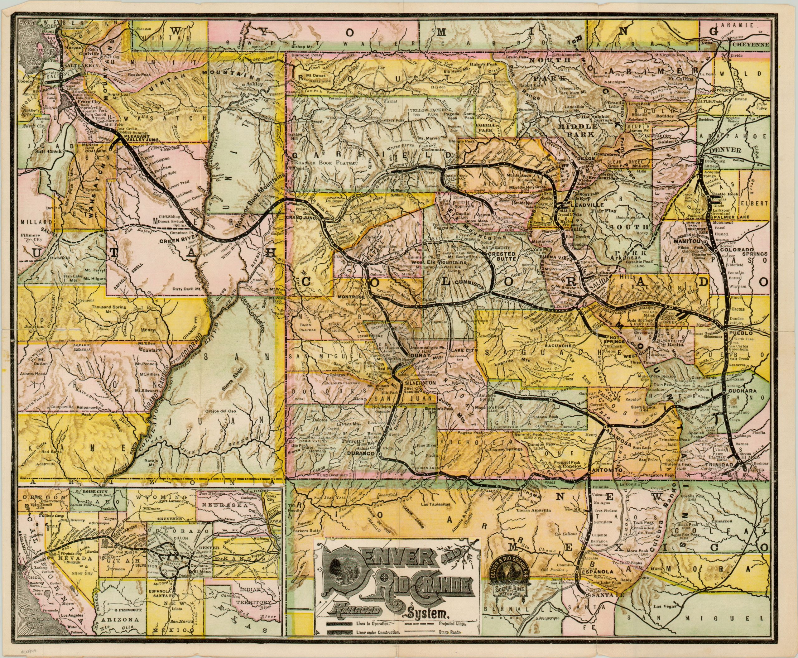
Denver and Rio Grande Railroad System
Beautiful late 19th century railroad map of Colorado and Utah.
Out of stock
Description
The partnership of Andrew McNally and William Rand built much of their business publishing timetables and tickets for railroads in the booming transportation hub of Chicago. The company printed its first map in 1872 as part of its annual Railroad Guide.
That tradition continues over a decade later with this c. 1887 map of the Denver and Rio Grande system, which operated primarily in the states of Colorado, New Mexico and Utah. The early county configurations of the states can be seen in bold color, with the routes of operational lines, lines under construction and proposed lines all shown crisscrossing the deserts and mountains of the region.
This varied topography is what gave the Rio Grande one of its nicknames – “Scenic Line of the World.” Little differentiation can be seen in the lines used to distinguish operational routes and those under construction – perhaps intentionally as a way to exaggerate the scope of the rail network.
Also included is an inset map of the American southwest, which shows the Denver and Rio Grande and its connection to larger systems, like that of the Union Pacific. Dated using the completion of the Ouray Branch and the line reaching Antelope Springs.
Map Details
Publication Date: c. 1887
Author: Rand McNally
Sheet Width (in): 18.20
Sheet Height (in): 15.00
Condition: A-
Condition Description: Slight wear in the margins and two tears along the centerfold have been repaired on the verso with archival tape. One or two very small spots of foxing are barely noticeable next to the topographical detail.
Out of stock

