De l’Amérique en General
Original price was: $300.00.$225.00Current price is: $225.00.
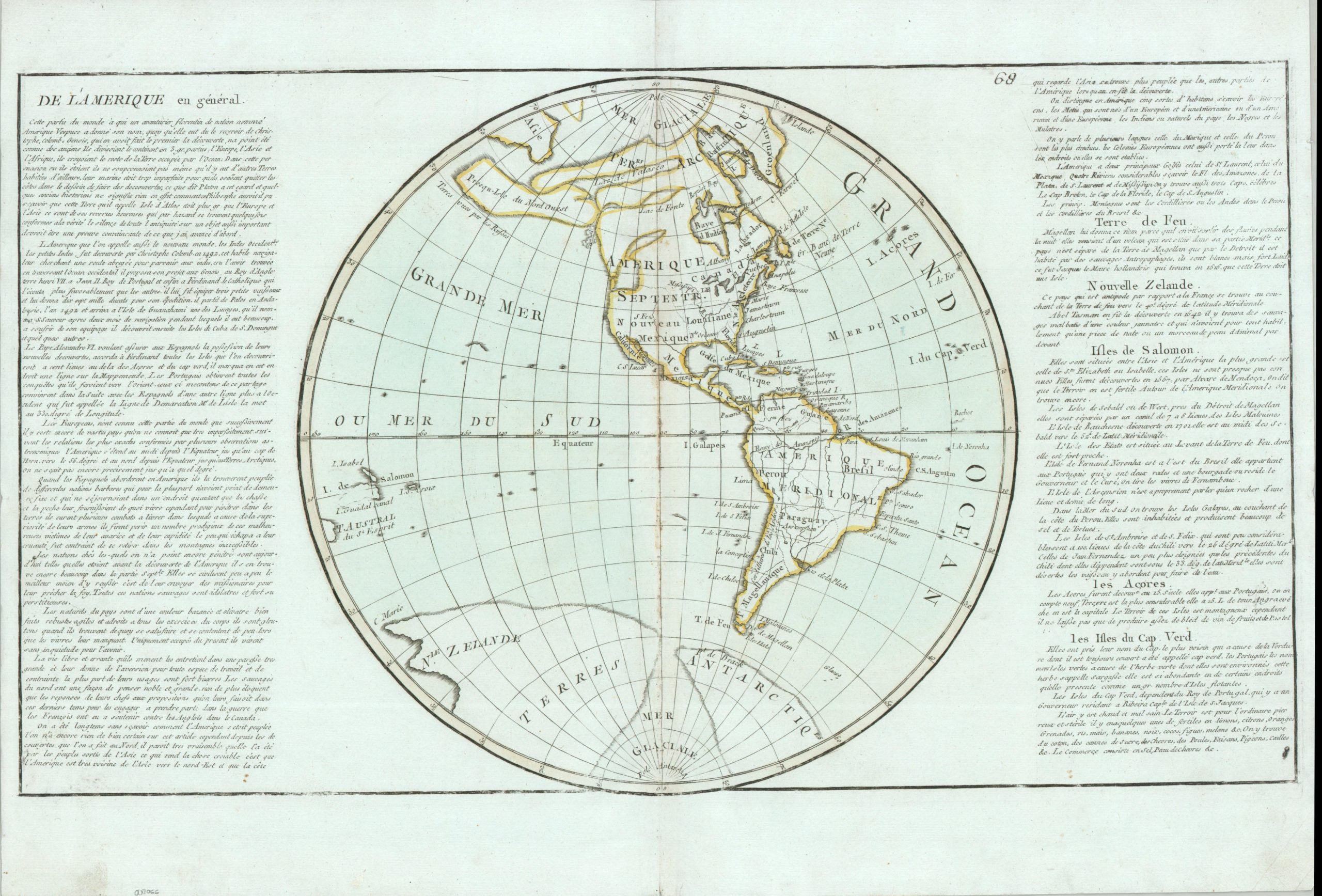
A late 18th-century map of the Western Hemisphere featuring striking cartographic inaccuracies.
1 in stock
Description
This intriguing antique map of the Western Hemisphere was designed by French cartographer Jean Baptiste Louis Clouet and published in the late 18th century. While much of the continental outline is immediately recognizable, the huge irregular landmasses in the Pacific Northwest immediately catch the eye. Similar ambiguous coastlines can be seen in the south, with New Zealand connected to a massive Antarctic Lands. Political delineations are also vague, with a handful of toponyms identifying European colonial claims, important cities, and notable geographic features.
The adjacent French text offers a succinct historical summary of the New World and islands of the Atlantic and Pacific, providing valuable insight into contemporary priorities and colonial expansion. Due credit is given to Columbus as the discoverer of America, though the indigenous populations are characterized as wandering barbarians. One quote reads, “the free and wandering life they lead keeps them in great laziness and gives them an aversion to any kind of work and constraint.”
Map Details
Publication Date: c. 1780
Author: Jean Baptiste Louis Clouet
Sheet Width (in): 22.3
Sheet Height (in): 15.4
Condition: B+
Condition Description: Copperplate engraved map with outline color on a thick sheet of watermarked, slightly bluish paper. Moderate wear and discoloration along the vertical centerfold. A somewhat faint plate strike casues some lightening along the borders and outer edges. Marginal wear including creased corners, a few small tears, and narrow left/right sides. Good condition overall.
Original price was: $300.00.$225.00Current price is: $225.00.
1 in stock