
Dated Events World War Map
An early (possibly first) edition of the Dated Events War Map Series.
Out of stock
Description
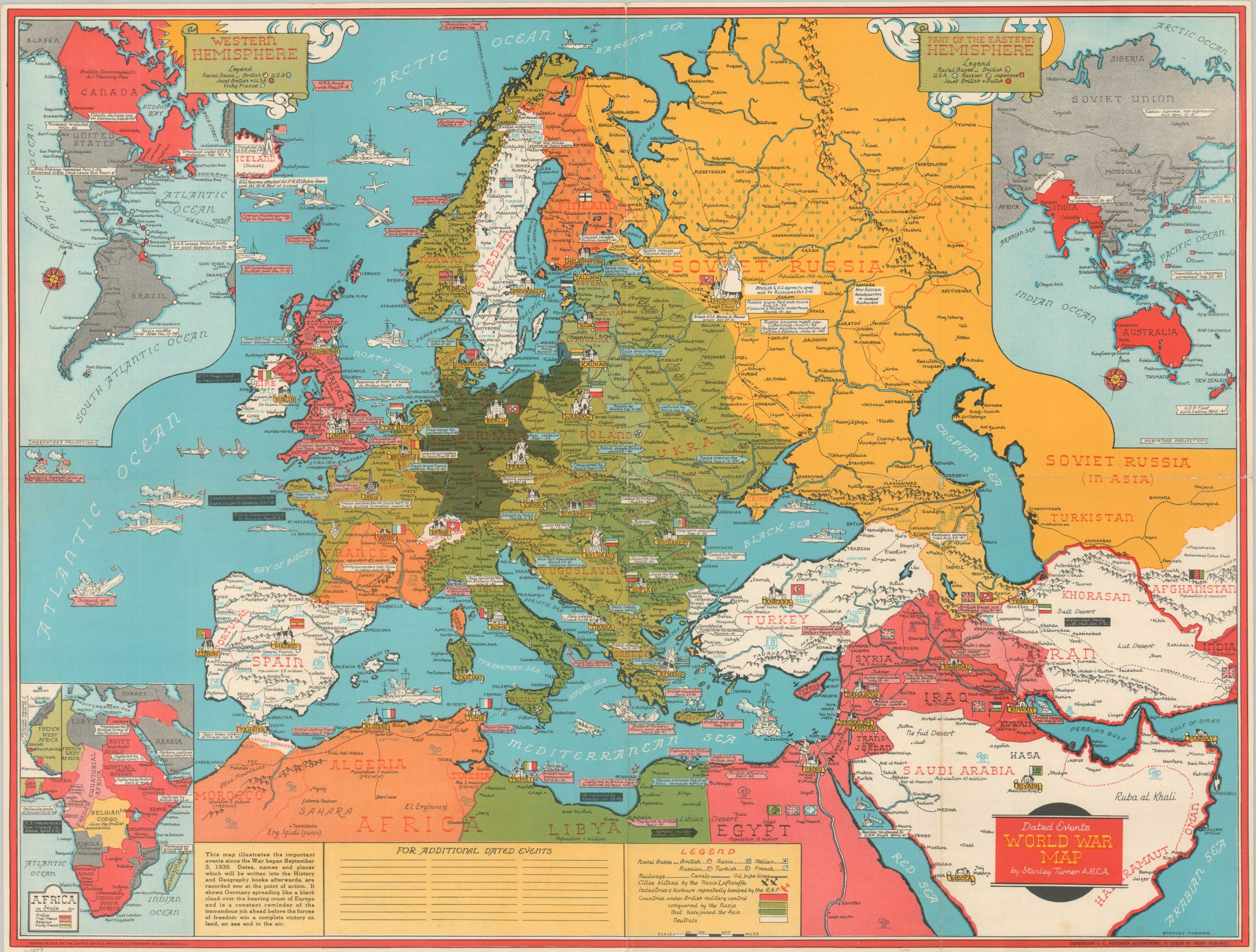
“It shows Germany spreading like a black cloud over the heaving crust of Europe and is a constant reminder of the tremendous job ahead before the forces of freedom win a complete victory on land, on sea and in the air.” – text, bottom.
The Dated Events War Map Series was first introduced in 1942 as a collaboration between artist Stanley Turner and the C.C. Petersen Advertising Firm of Toronto. Audiences on the homefront were eager for information about the major battles, strategic locations, and important leaders of World War II – especially as their loved ones began deployment overseas in large numbers. The brightly colored images were regularly re-issued with new information on the global conflict, with nearly 30 different serialized editions and numerous variants. Local businesses, purchasing in bulk, would often overprint advertisements prior to distribution.
This is a nice example of an unmarked early edition (possibly the first) of the Dated Events War Map, printed in mid-1942 by The United States Printing and Lithograph Company of Brooklyn. Territory is colored according to political alignment and military bases are identified throughout; the legend in the lower center offers more detail. Insets provide similar details for the Western Hemisphere (upper left), Eastern Hemisphere (upper right), and Africa (lower left).
Small vignettes and historic notes offer further elements of interest. Important wartime events, somewhat skewed to favor the Allied narrative, are listed and dated across every affected region. The most recent entry is the British Commando raid on St. Nazaire. Other recent causes for celebration and consternation include the arrival of U.S. troops in Ireland, signing of the The Tripartite Treaty of Alliance, and the escape of the Scharnhorst, Gneisenau, and Prince Eugen to Germany.
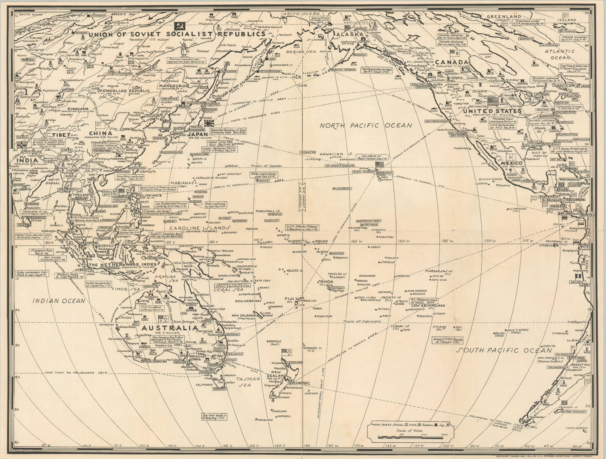
A more updated black and white map of the Pacific Theater is printed on the verso showing the calamitous situation of the Allies. Of particular note are the losses of Corregidor, Bataan, Singapore, and nearly all Pacific island possessions except Australia and New Guinea. Numerous historic events (i.e. the wreck of the Bounty, death of R.L. Stevenson) are included, possibly to soften the blow of so many defeats in the region. For more information on Dated Events War Maps, check out my blog post here.
Map Details
Publication Date: 1942
Author: Stanley Turner
Sheet Width (in): 26.4
Sheet Height (in): 20
Condition: A-
Condition Description: Creasing and light wear along fold lines, with very small closed tears at the edges. Faint toning in the margins, consistent with age. Very good condition overall.
Out of stock