Dated Events War Map – 20th edition
The 20th edition of the Dated Events War Map, issued in late 1944.
Out of stock
Description
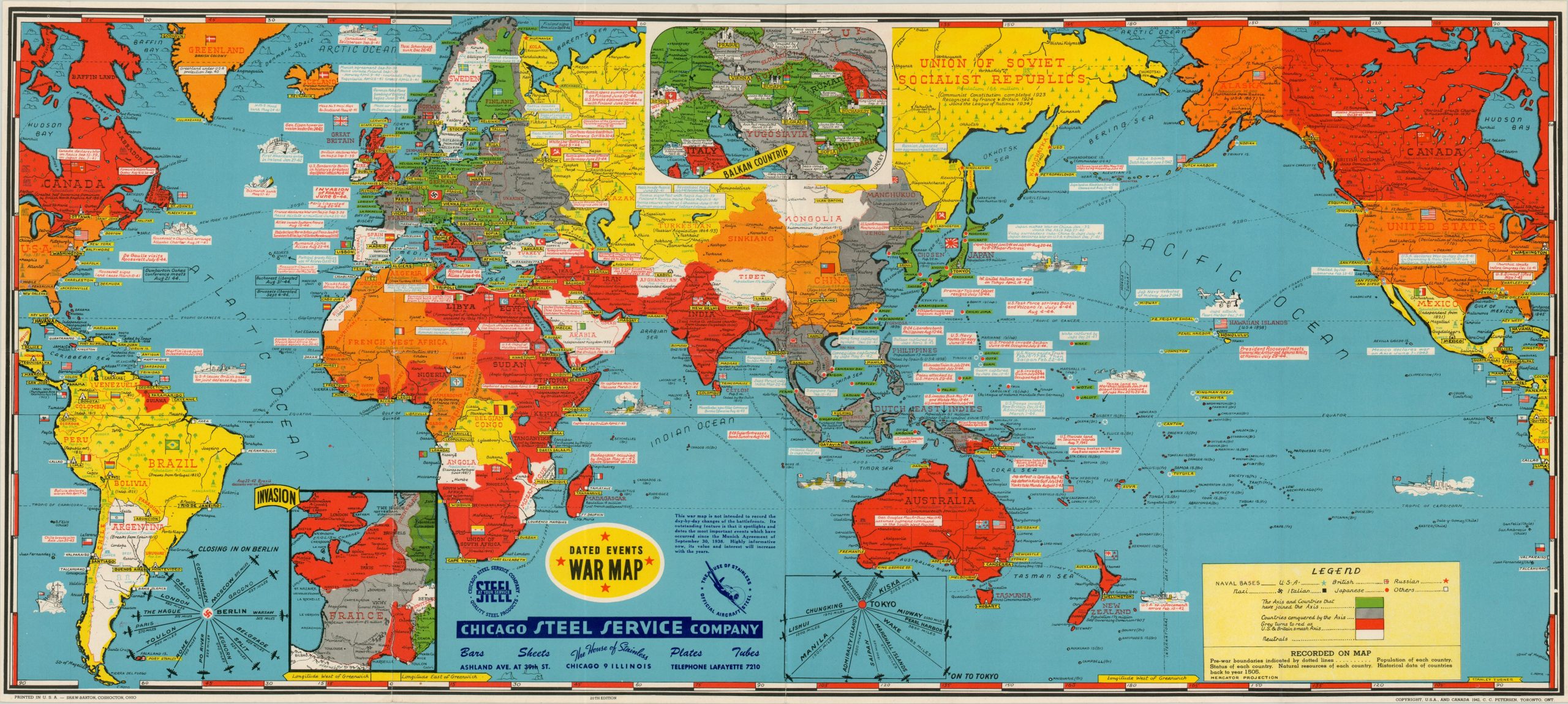
Although little has changed on the underlying world map for this edition of the Dated Events War Map, the invasion inset shows the Allied noose tightening around Nazi Germany. Based on the progress of the depicted advance through France and Belgium, it was issued likely in September or October of 1944. Interestingly, the map shows American and British forces up to Nancy, France, which was liberated on September 19th. But the inset map of the Balkan countries only shows the Red Army advancing to Bucharest, when in reality it had already captured Sofia in Bulgaria!
This may reflect the time it took to obtain reliable information on the Eastern Front, or perhaps less popular interest in that theater. Two charts showing aerial distances to the Axis capitals are also provided – at this point Berlin was susceptible to bombardment from nearly all sides and was suffering heavily as a result. Printed in Ohio by Shaw-Barton with an advertisement for the Chicago Steel Service Company.
Map Details
Publication Date: 1944
Author: Stanley Turner/C.C. Petersen
Sheet Width (in): 38.7
Sheet Height (in): 17.2
Condition: A-
Condition Description: Creasing and minor wear along the originally issued fold lines. Faint wear along the outer edges, but near fine overall.
Out of stock