Dated Events On To Tokyo Invasion Map of the Far East
Double-sided map from the Dated Events series published in late 1944.
Out of stock

Description
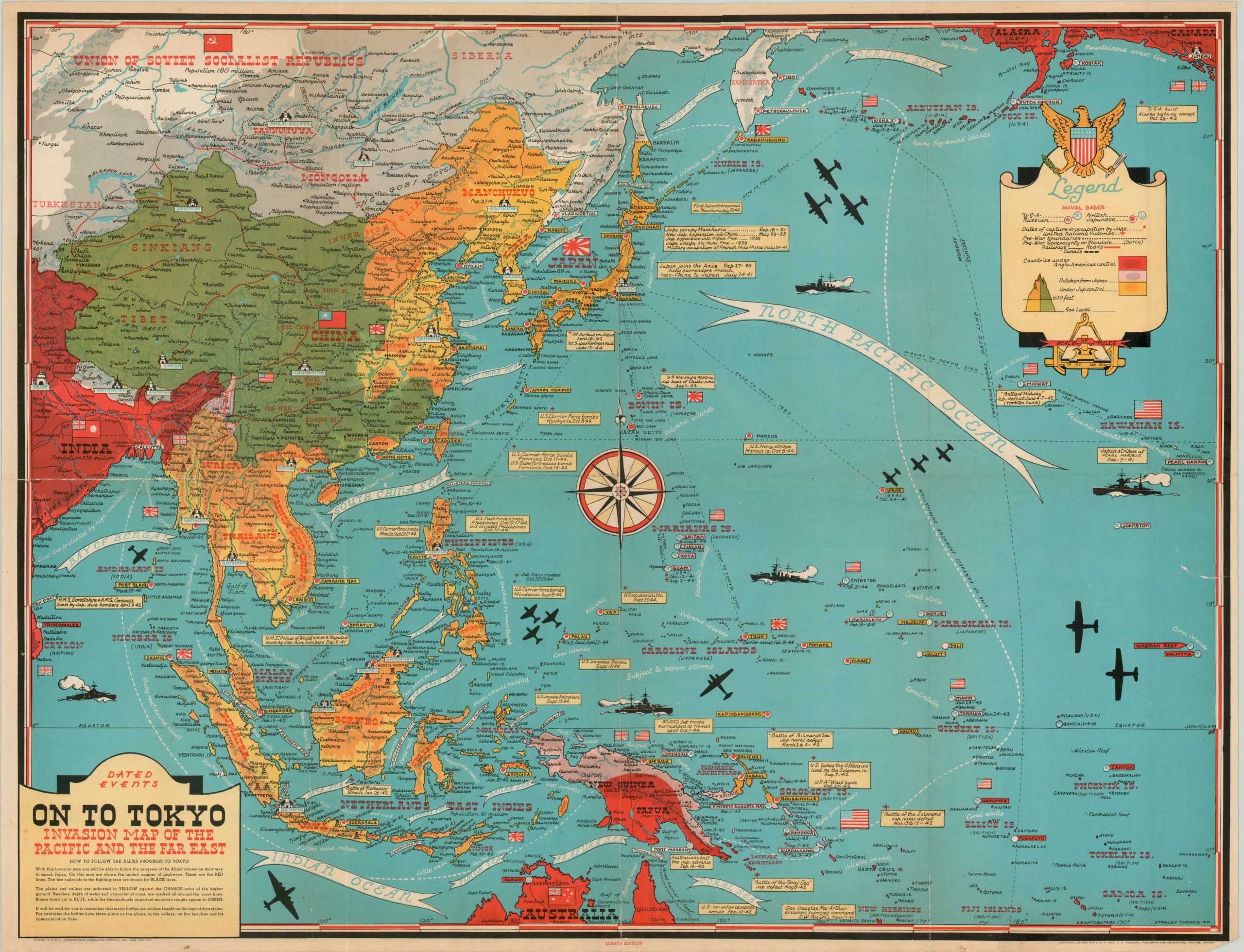
A copy of the uncommon eighth edition in the Dated Events map series drawn by Stanley Turner and licensed by C.C. Petersen Publishing of Toronto. The primary image is focused on the north Pacific Ocean and territories formally within the Greater East Asia Co-Prosperity Sphere of Japan. It’s been updated to reflect the Allied advance into the Philippines in October of 1944, with territory colored according to occupational control and topography. Numerous annotations identify specific events and their dates, including grievances against the Japanese as early as 1931.
The opposite side of the sheet features a black and white map of Europe and two inset maps of the Northern and Southern Hemispheres. Although text boxes near the edges reference Allied victories well into 1944, the map itself reflects an earlier state from 1943. Since the legend appears to reference color, it’s likely the earlier issue was used for convenience and speed during production.
Map Details
Publication Date: 1944
Author: Stanley Turner/C.C. Petersen
Sheet Width (in): 26.4
Sheet Height (in): 20
Condition: B+
Condition Description: Creasing and wear along originally issued fold lines and minor soiling in the outer margins. A few tears along the fold lines have been repaired with archival tape. Faint discoloration on the black and white image, but remains very good overall.
Out of stock