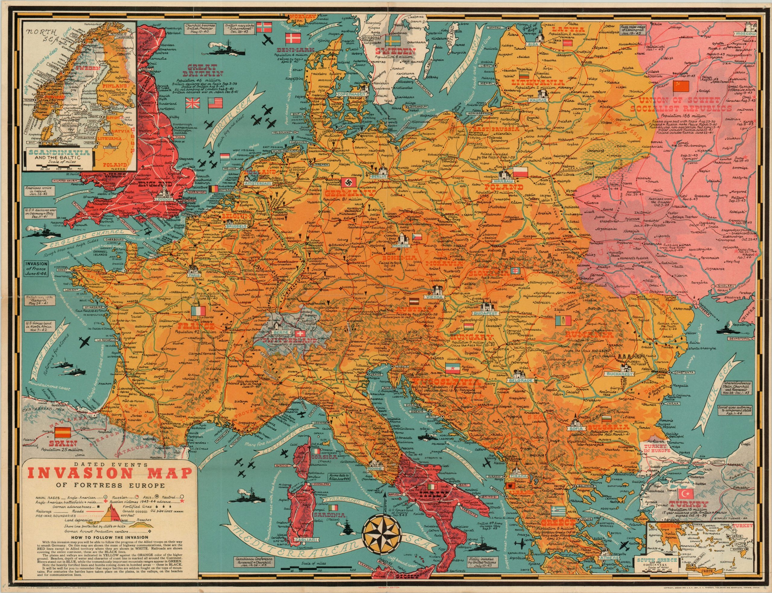
Dated Events Invasion Map of Fortress Europe
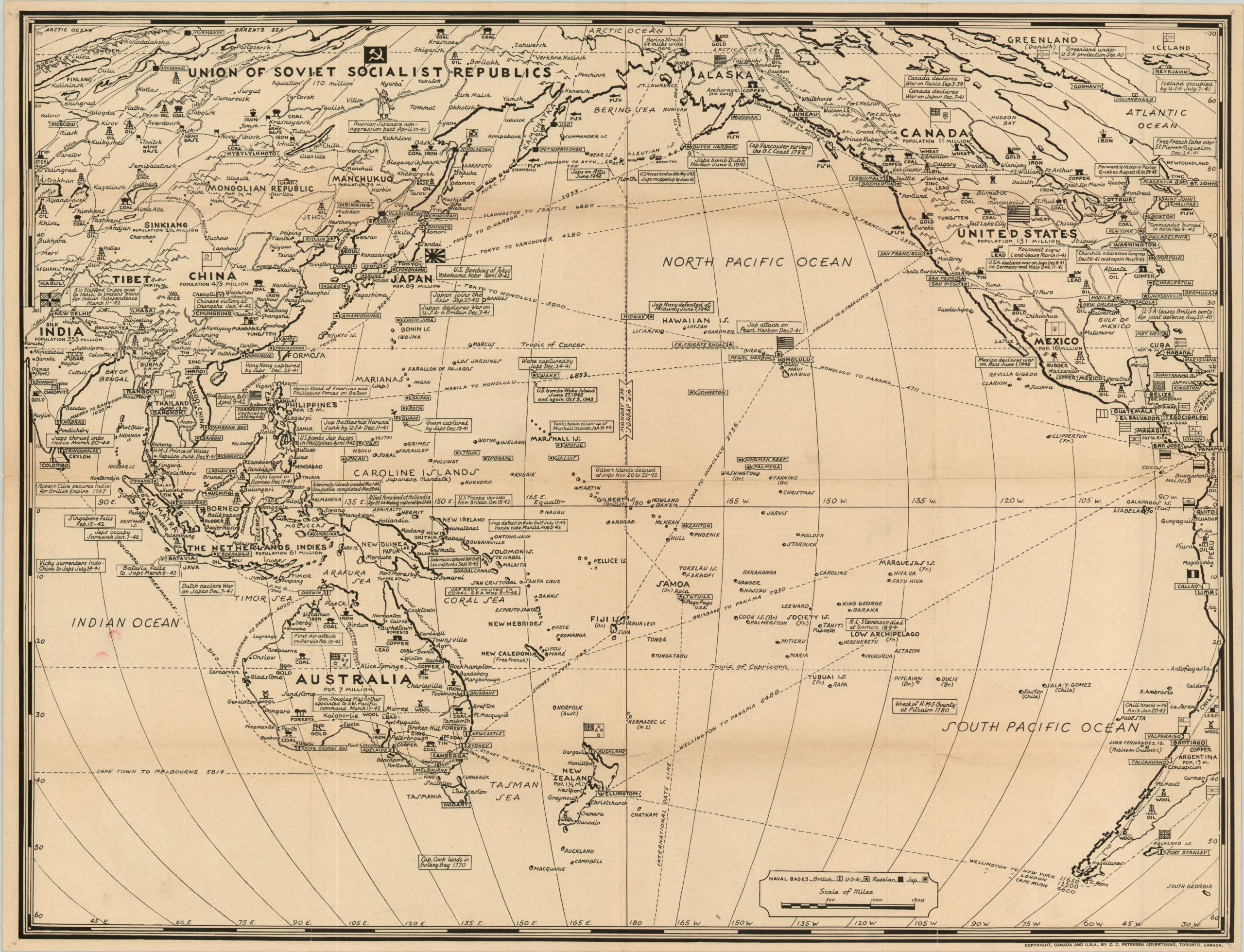
Double sided map in the Dated Events series showing Fortress Europe and the Pacific Theater.
Out of stock
Description
This scarce map is the seventh edition in the Dated Events series drawn by artist Stanley Turner and licensed by the publishing firm of C.C. Petersen. Based on the dates of events included (and excluded), it was likely issued in mid-June of 1944, shortly after the Allied invasion at Normandy.
One side is boldly colored and details the military bases, critical infrastructure and topography of “Fortress Europe.” Text boxes in the negative space provide dates for specific events, while bright red and pink shades denote the advance into Axis territory (though it is lagging behind, since Rome is still shown in Italian hands). Inset maps of southern Greece and Scandinavia are also provided and show similar information.
The verso of the sheet is designed in a similar style, but is focused on the Pacific Theater and is entirely in black and white. It lists a litany of Japanese offenses in the region and notes a few instances where the Allies had been able to strike back, though it makes no reference to either the Battle of the Philippine Sea or the end of the Burma campaign, helping to date the map. Land ownership is denoted with flags, since no color has been applied. There are also a number of interesting historical references included, perhaps to fill empty space?
Map Details
Publication Date: 1944
Author: Stanley Turner/C.C. Petersen
Sheet Width (in): 26.4
Sheet Height (in): 20
Condition: A-
Condition Description: Pinholes in each corner and creasing along the originally issued fold lines. Otherwise near fine condition.
Out of stock