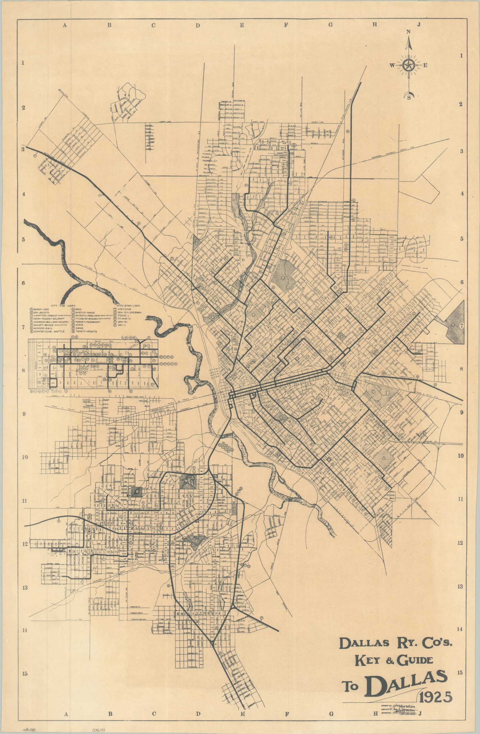
Dallas Ry. Co’s Key & Guide to Dallas
The height of the Dallas interurban railway network.
Out of stock
Description
This uncommon street plan of Dallas was drawn by J.H. Burch, Office Engineer of the Dallas Railway Company, in 1925. An extensive network of interurban railways is shown with bold lines and associated alphabetical routes – nearly two dozen in total.
Various attractions and locations of interest are also identified with letters, but the corresponding guide is not present. An inset in the center left shows the density of the railway lines operating in the downtown district. According to the city of Dallas,
“Dallas Railway & Terminal Company was the largest and longest-running streetcar and bus system, beginning in 1917. Streetcar lines were abandoned in 1956, and the company changed its name to the Dallas Transit Company.”
Map Details
Publication Date: 1925
Author: J.H. Busch
Sheet Width (in): 16.75
Sheet Height (in): 25.75
Condition: B
Condition Description: Mechanically printed map on a folded sheet, toned along an irregular (but straight) border that mirrors the borders. Light wear along the edges and faintly wrinkled in a few places. Good condition overall.
Out of stock