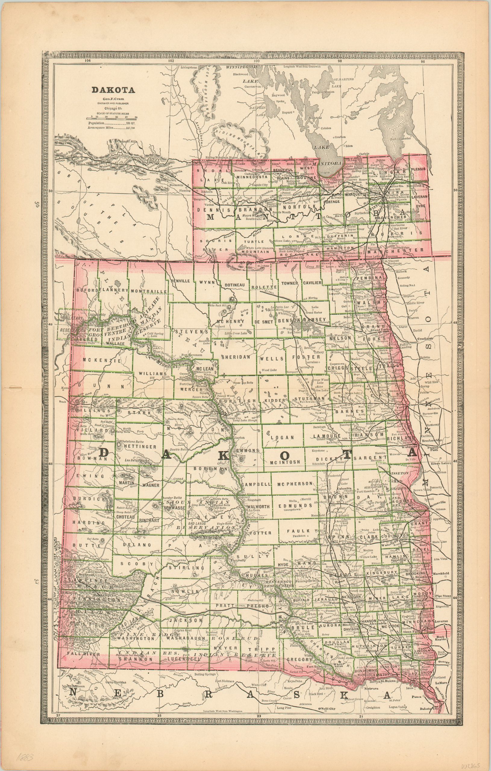
Dakota
$40.00
The Dakotas on the verge of statehood.
1 in stock
Description
This attractive map of the Dakota Territory was created and published by George Cram in 1883, just six years before splitting and being admitted into the Union as the states of North and South Dakota. Despite it’s unofficial status, the eastern portion of the territory is shown as inundated with railroads and settlements. The western areas are obviously more sparsely populated, and include a number of Native American reservations, mines, and forts.
Topography is shown in simple hachure, notably the Black Hills in the southwest. Bismarck is shown as the territorial capital, having been moved from Yankton the same year of publication. Total population of the territory (according to the figures in the upper left): 135,177.
Map Details
Publication Date: 1883
Author: George Cram
Sheet Width (in): 13.50
Sheet Height (in): 21.25
Condition: A-
Condition Description: Toned and a few faint smudges in the margins (see top and bottom). One small tear along the centerfold on the left side, but it does not enter the image.
$40.00
1 in stock

