Dakota
$60.00
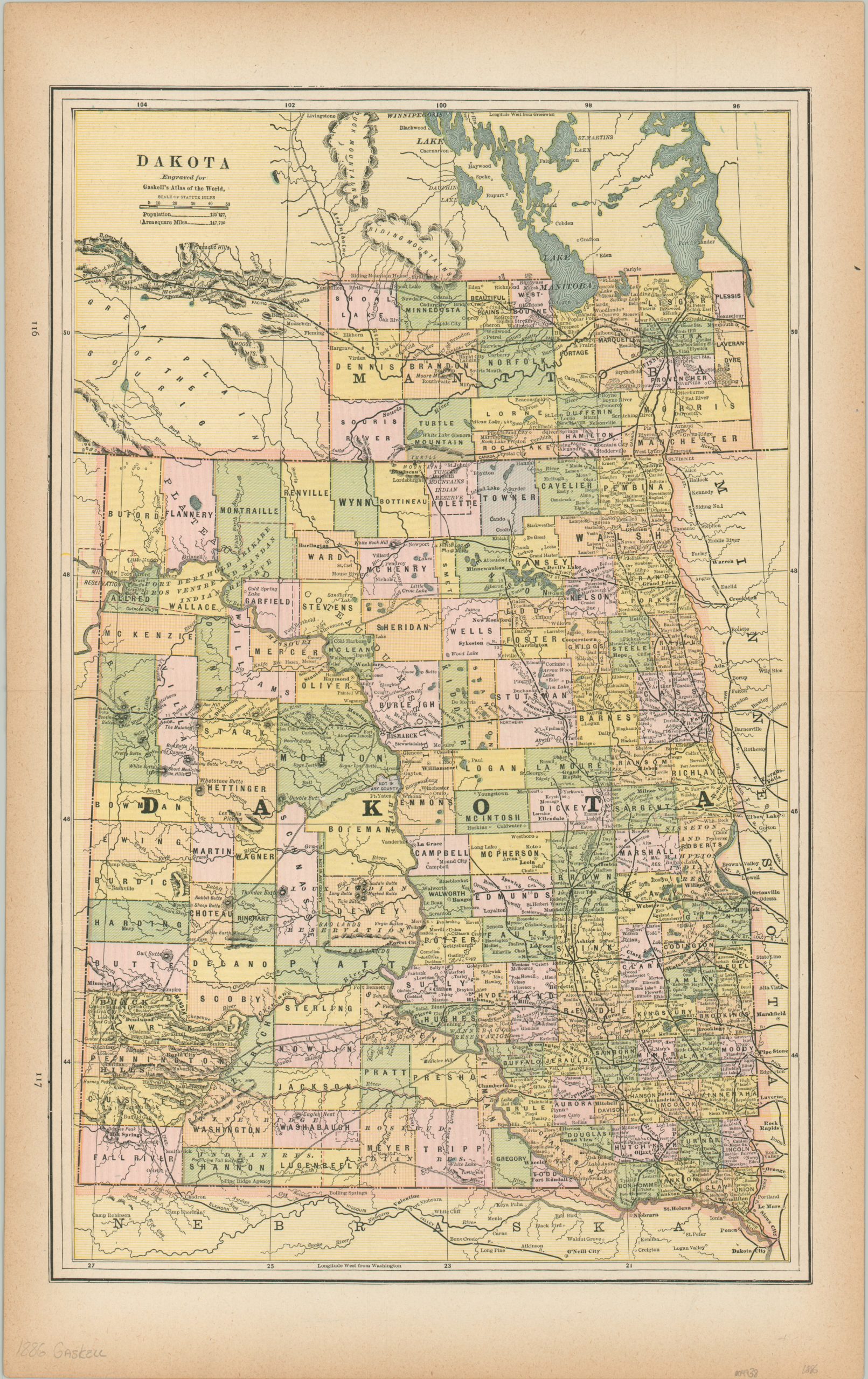
An odd presentation of the Dakota Territory from 1886.
1 in stock
Description
This attractive map of the Dakota Territory was published in Chicago by Charles Gaskell, originally as part of his Atlas of the World, in 1886. Three years prior to publication, the territorial capital moved to Bismarck, and three years afterward, the territory would be split into the newly admitted states of North and South Dakota. Interestingly, the map extends into the Canadian province of Manitoba – almost presenting it as part of the U.S., but also emphasizing the robust rail connections between the two nations.
The image presents a detailed overview of the territory; naming numerous settlements, geographic features, Native American tribes, and other locations of interest. A growing network of railroads connects much of the region, with distances between points noted in most circumstances. Topography is depicted in hachure, emphasizing the Black Hills in the lower left and numerous buttes that are scattered throughout.
Map Details
Publication Date: 1886
Author: Charles Gaskell
Sheet Width (in): 13.5
Sheet Height (in): 21.5
Condition: A-
Condition Description: Mild toning visible around the outer edges of the sheet. Very good overall.
$60.00
1 in stock

