CTA North-South Route
CTA North-South Route Card from 1978.
Out of stock
Description
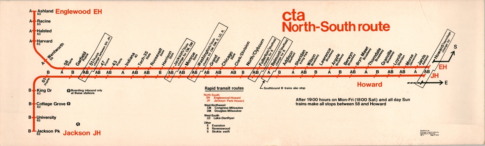
For those of us riders familiar with the modern CTA map, organized by color, this ‘North-South route’ subway card looks extremely confusing at first glance. Two lines, Englewood-Howard (A) and Jackson-Park Howard (B) comprise the parallel tracks that run between the stations in their names. Transfers between lines, as well as the six other routes in operation, are noted at the ‘AB’ and change stations, respectively.
In 1993, the CTA re-organized the lines of the ‘L’ and gave them the color-coded system we know and love today. The Dan Ryan branch was combined with portions of the North-South route and State Street subway, and the Red Line was born.
Map Details
Publication Date: 1978
Author: Chicago Transit Authority
Sheet Width (in): 36
Sheet Height (in): 10.75
Condition: B+
Condition Description: Route card from a late 1970's-era CTA train. Printed on cardstock that is moderately spotted and worn around the outer edges. One seam in the upper right, but remains in good to very good condition overall.
Out of stock