CTA Brown Line
$55.00
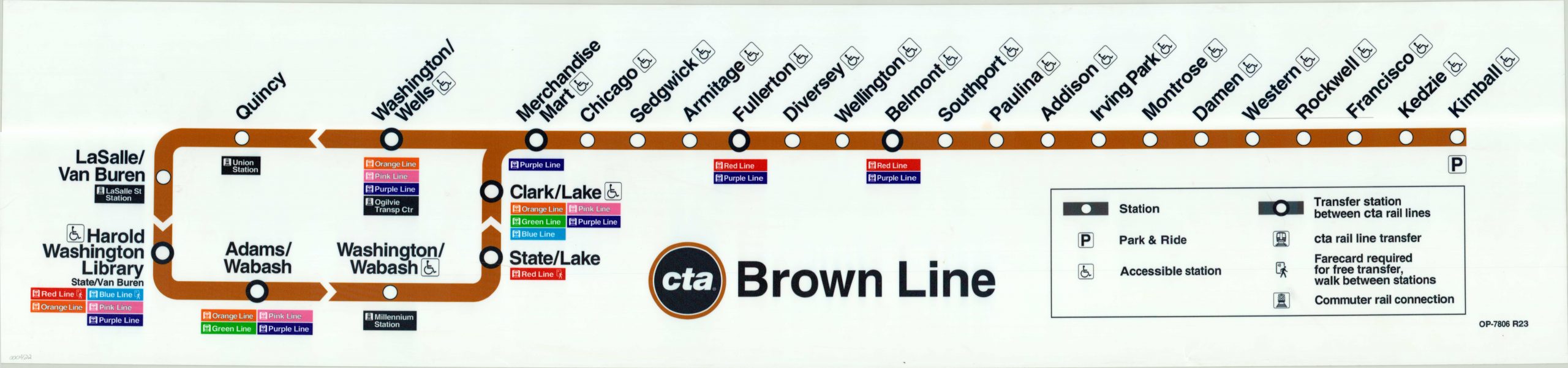
Subway-style map of Chicago’s Brown Line.
1 in stock
Description
This is a modern map of the Brown Line, which runs from Chicago’s downtown northeast to the Albany Park neighborhood.
It is part of the transit system known colloquially as the ‘L’ (as spelled by the CTA). The name is derived from the elevated rails that make up many of its most prominent lines.
Includes an index. Printed on vinyl.
Map Details
Publication Date: c. 2017
Author: Chicago Transit Authority
Sheet Width (in): 47.00
Sheet Height (in): 11.00
Condition: A
Condition Description: The transit map, printed on vinyl, is in excellent condition with no visible wear.
$55.00
1 in stock