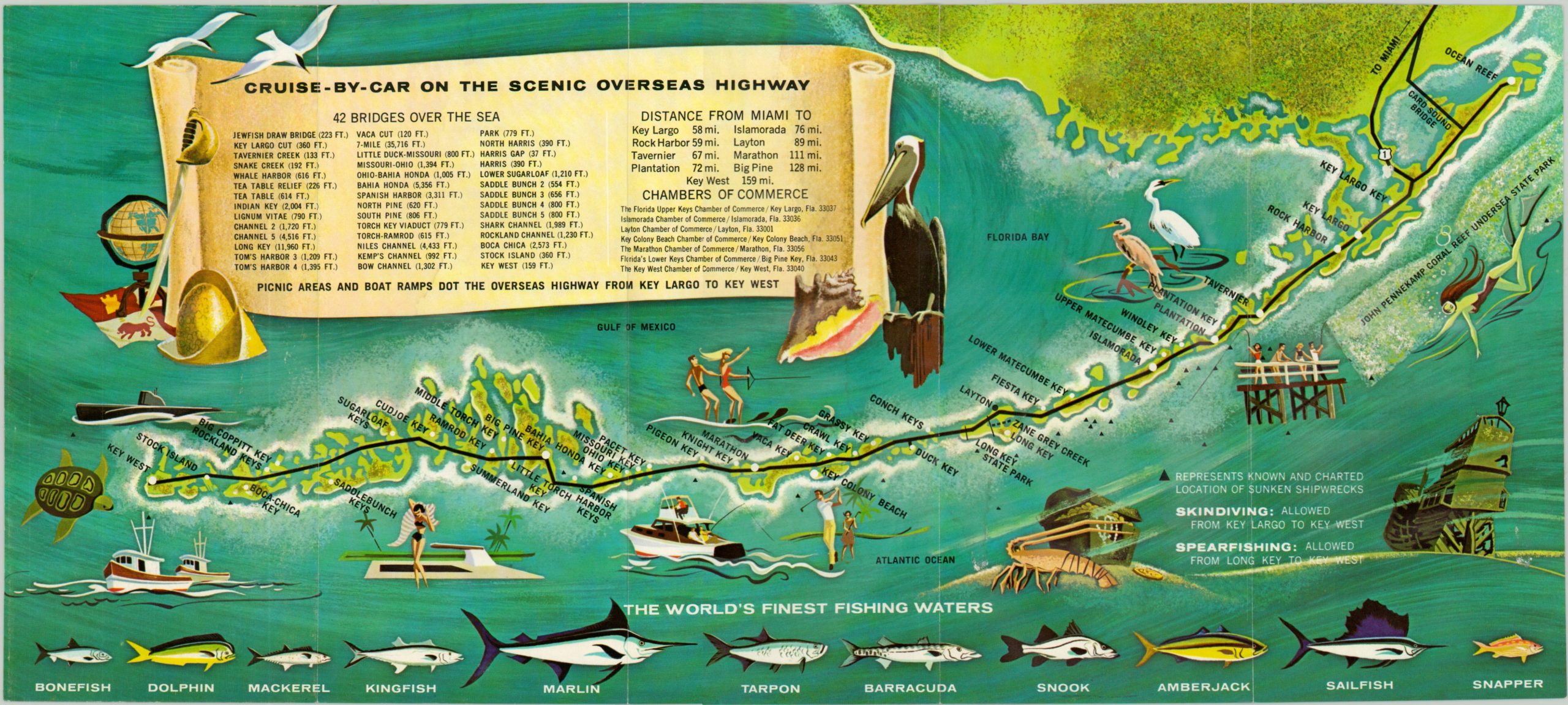
Cruise by Car on the Scenic Overseas Highway
$60.00
Colorful promotional fold out of the Florida Keys.
Description
One could imagine the myriad of infrastructure challenges required to connect the numerous islands in the Florida Keys. The Overseas Railroad made the first attempt in the early 20th century, connecting Key West to the major line of the Florida East Coast Railway. Damage from numerous hurricanes and high maintenance costs eventually led to bankruptcy, and much of the route was sold to the State of Florida, who used the land to build the Overseas Highway.
This map shows the path of Route 1 through the Florida Keys and lists 42 individual bridges under the title, ranging from the immense Seven Mile Bridge to the short Harris Gap. In addition to awesome engineering feats, the region also offers a variety of recreational activities and fishing opportunities, all pictorially displayed on this map issued by the local Chambers of Commerce. Shipwrecks are individually noted – lighthouses and safe harbor facilities are also difficult to maintain in this area frequented by hurricanes.
Map Details
Publication Date: c. 1965
Author: E.J. Scheaffer & Associates
Sheet Width (in): 19.00
Sheet Height (in): 8.50
Condition: A-
Condition Description: The map has fold lines as issued, and two very faint damp spots on the verso.
$60.00

