Cruchley’s New Plan of London
$825.00
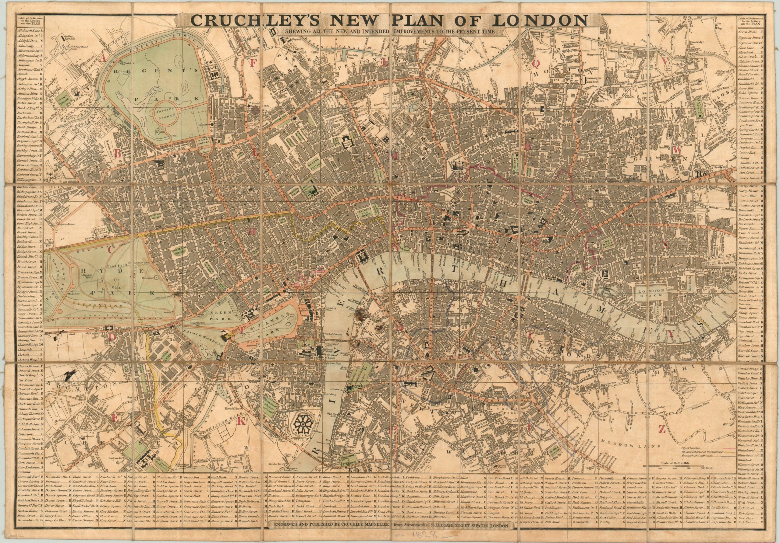
Fantastic pre-Victorian city plan of London.
Description
London experienced explosive growth in the first decades of the 19th century, and by 1825 was the largest city in the world. To cope with the expanding population; new methods of transportation, public welfare, utility distribution and civic organization would be required.
George Cruchley has neatly organized the chaos of “The Big Smoke” with this plan, published in 1828. The city of London and nearby Westminster and Southwark are delineated using red, yellow and blue lines, respectively. Major thoroughfares are highlighted in orange, while the green parks and blue Thames reflect an idealized perspective of those “natural” urban elements. Public buildings are boldly outlined and labeled amidst the dense urban backdrop.
The map is divided into 25 separate sections; each assigned a letter which is referenced in the street index bordering the image. The ability to transform such a haphazard environment into an orderly two-dimensional system likely came from Cruchley’s experience with the firm of Aaron Arrowsmith, where he began his cartographic career. Although he set up shop independently in 1823, the year of Arrowsmith’s death, Cruchley still credits his former associate in the imprint of this map.
Map Details
Publication Date: 1828
Author: George Frederick Cruchley
Sheet Width (in): 24.00
Sheet Height (in): 16.75
Condition: B
Condition Description: Minor toning and discoloration to the sheet from age and several small ink stains. The map is dissected and folds into 18 sections with original marbled covers and green paper slipcase (with publisher's stamp). Edges of slipcase are rubbed, but very good overall.
$825.00