Crossing Operations on the Rhine River by Third US Army
American engineering and industriousness at its finest during World War II.
Out of stock
Description
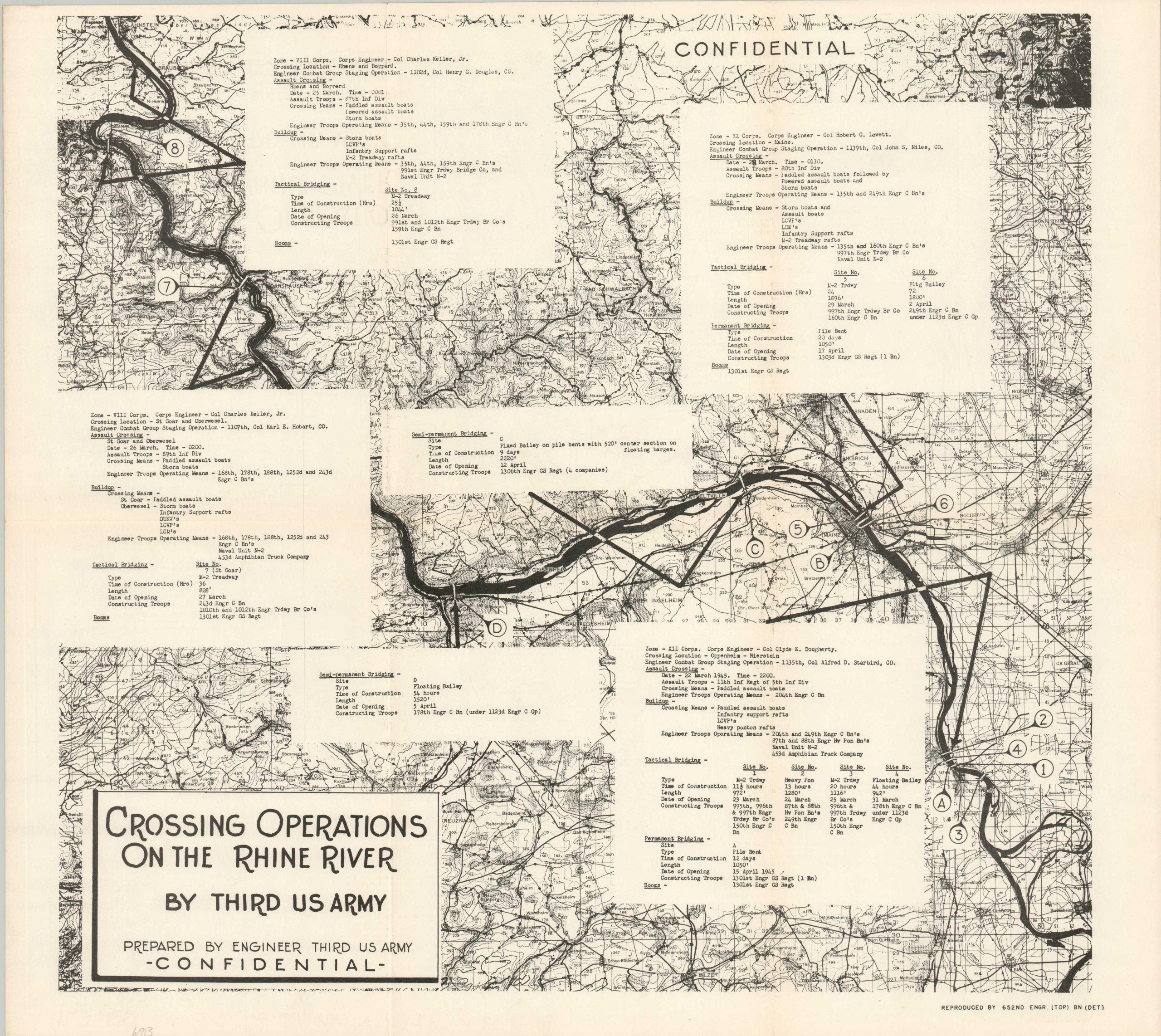
This fascinating booklet and map, both marked CONFIDENTIAL, documents in detail the efforts of the Third U.S. Army to cross the Rhine River during its advance through Germany. The responsibility fell largely to the Corps of Engineers, who designed several bridges and ferry systems to transport troops, vehicles, and supplies across the imposing waterway.
The 34-page volume includes a brief history of the massive operation, forty photographs, and a tally of supplies. The last category notes the use of over a mile of floating bailey bridges, nearly fifty miles of rope, 1,500 M-2 assault boats, and 20,000 cable clips. The detailed map, reproduced by the 652nd Engineer Topographic Battalion, pinpoints the locations of the various bridges constructed across several different zones. Length, time of construction (usually measured in hours), contributing units, and opening date are among the data points provided for each project.
Published in 1945 by the Third U.S. Army Office of the Engineer. Uncommon, with only six examples listed in WorldCat as of May 2024. OCLC# 5143257.
Map Details
Publication Date: 1945
Author: Engineer Third U.S. Army
Sheet Width (in): 22.6
Sheet Height (in): 20.1
Condition: A
Condition Description: Large folding map accompanied by 34 pp. booklet with stapled binding and original paper covers. Wraps are slightly worn and soiled, but contents and map are in very good condition.
Out of stock