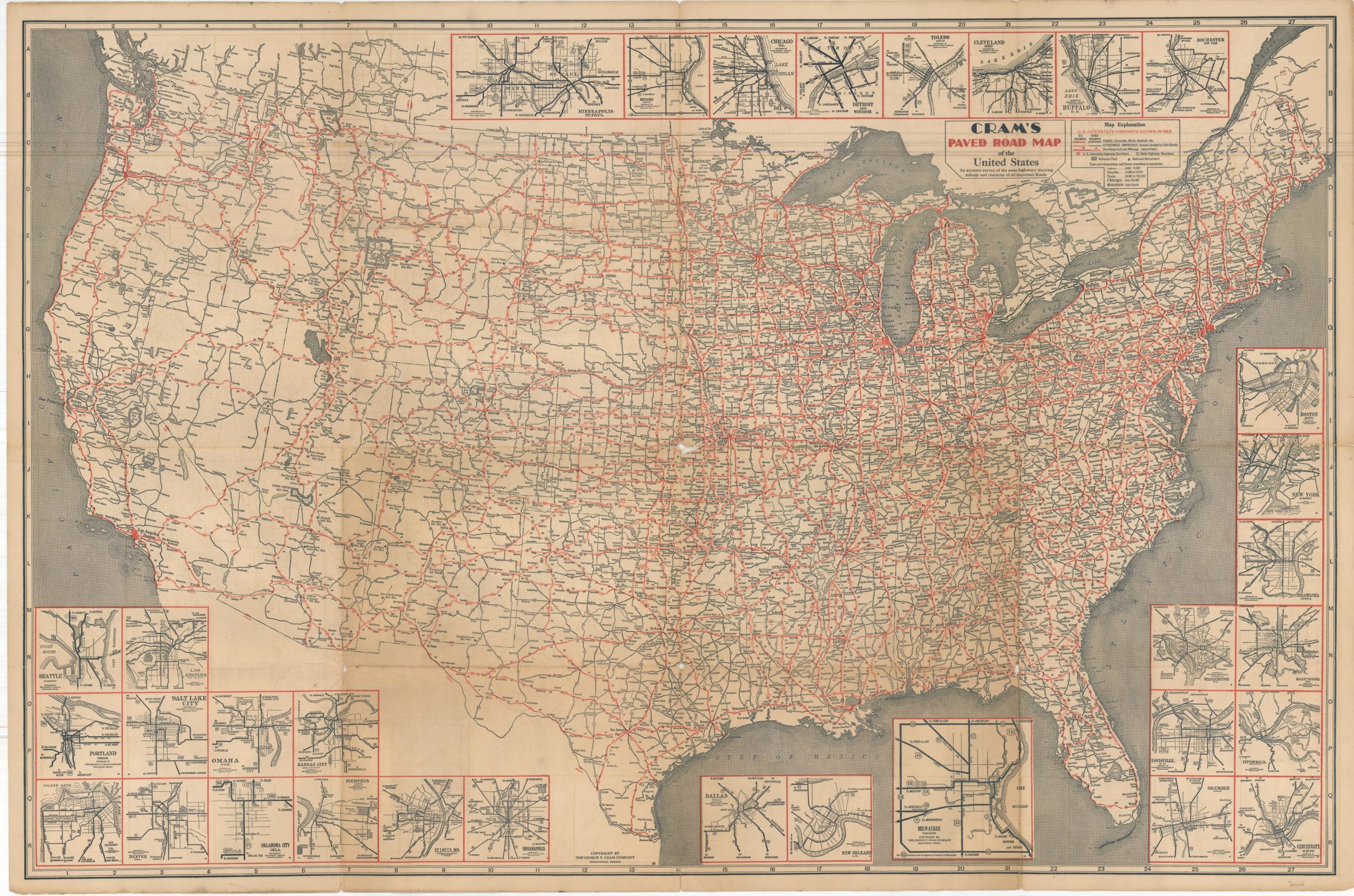
Cram’s Paved Road Map of the United States
$135.00
The U.S. Highway System at the end of the Roaring 20’s.
1 in stock
Description
This handy map of U.S. Highways was published by George F. Cram in Indianapolis in 1929. The nationwide network of Interstate Highways is colored in bright red, reflecting tremendous growth since first designated as a unified system in 1926.
Distances between points are noted and National Parks and National Monuments are identified according to the legend in the upper right. Thirty-two insets along the top and bottom of the sheet provide basic street plans for large urban centers from coast to coast. Further maps on the verso show views of Eastern and Western Canada, as well as a diagrammatic route map that shows distances ‘as the crow flies’, harkening to airline maps of later decades.
Distributed by the Milwaukee Journal, with wonderful contemporary advertisements on the front covers. “Ever since distant points were made accessible to the motorist by good roads and better automobiles, The Milwaukee Journal has fostered the idea of Wisconsin as the Vacationland of the Middle West.”
Map Details
Publication Date: 1929
Author: George F. Cram
Sheet Width (in): 42
Sheet Height (in): 27.5
Condition: B+
Condition Description: Double sided road map, formerly folded into 16 panels, with heavy wear along old fold lines. Numerous areas of separation have been repaired on the verso with archival materials. Some spots are toned, and there are small areas of image loss at the fold intersections. About good condition overall.
$135.00
1 in stock


