County Map of the State of New York
$75.00
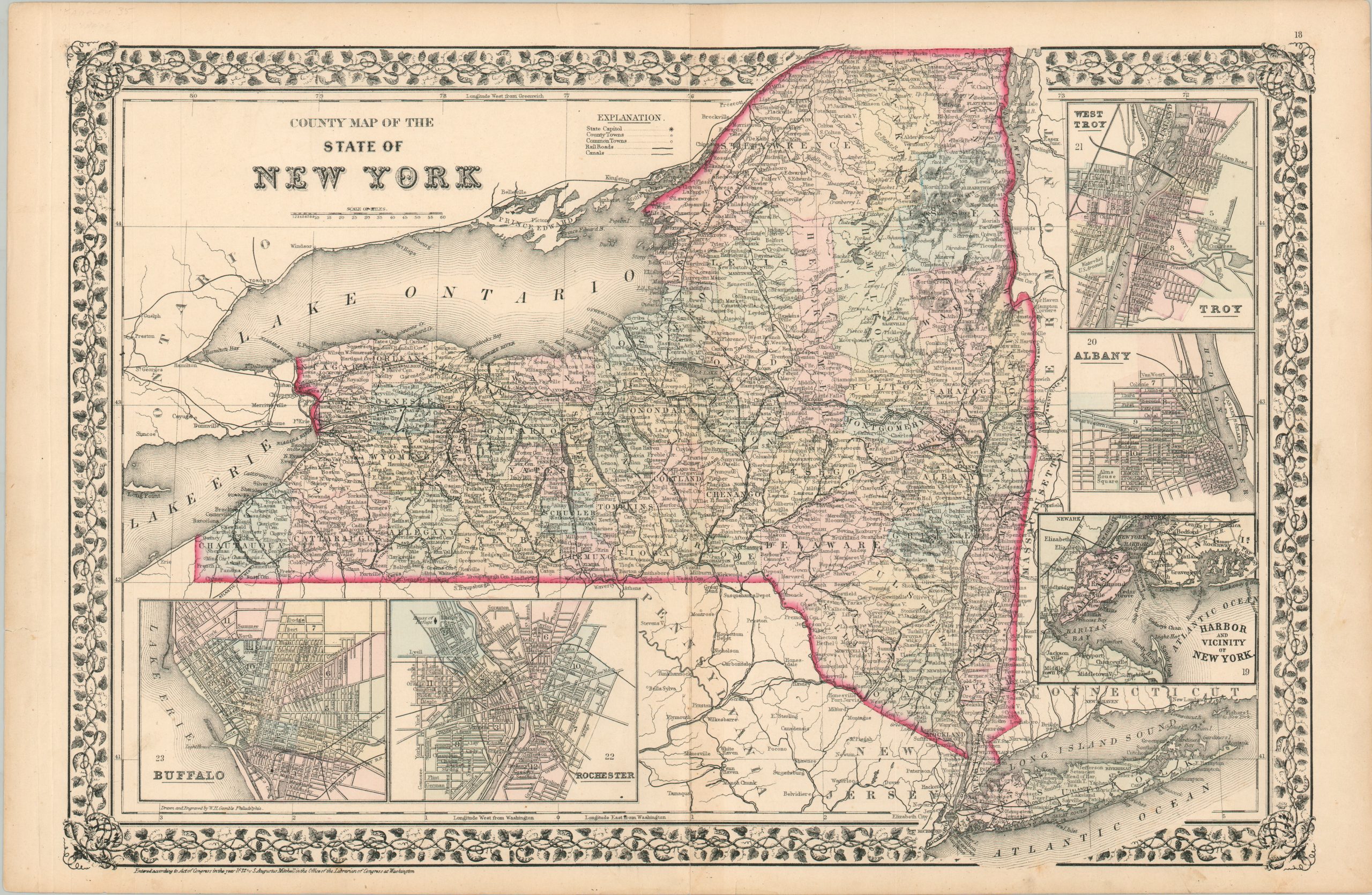
Detailed map of New York from 1872.
1 in stock
Description
This engaging map of New York was drawn and engraved by W.H. Gamble and published in Philadelphia by Samuel Augustus Mitchell in 1872. Mitchell was one of the most prominent American mapmakers of the 19th century, and initially got involved with cartography as a school teacher who was frustrated with the quality of available maps. He collaborated with skilled engravers and produced high-quality maps and atlases that contained the most up-to-date information available.
Mitchell’s son (of the same name) would take over the business after his death in 1860 and continue the tremendous output. His attention to detail is evident within the image, which provides an engaging snapshot of The Empire State near the end of the Reconstruction Era. Railroads are shown with dark black lines, connecting much of the state to port cities on the Great Lakes and Atlantic Ocean and beyond. One notable exception is the northeast.
Canals are also identified according to the legend in the upper center, though by this point the ‘iron horse’ had usurped the waterways in utility and expanse. Inset plans around the map show Troy/West Troy, Albany, New York City Harbor, Rochester, and Buffalo.
Map Details
Publication Date: 1872
Author: Samuel Augustus Mitchell
Sheet Width (in): 23.25
Sheet Height (in): 15.1
Condition: B+
Condition Description: Moderate toning visible down the vertical centerfold. Creased left margin and some scattered soiling and several closed tears visible elsewhere in the margins. Light scattered spotting in the image, consistent with age. Good to very good overall, with lightly faded original color.
$75.00
1 in stock