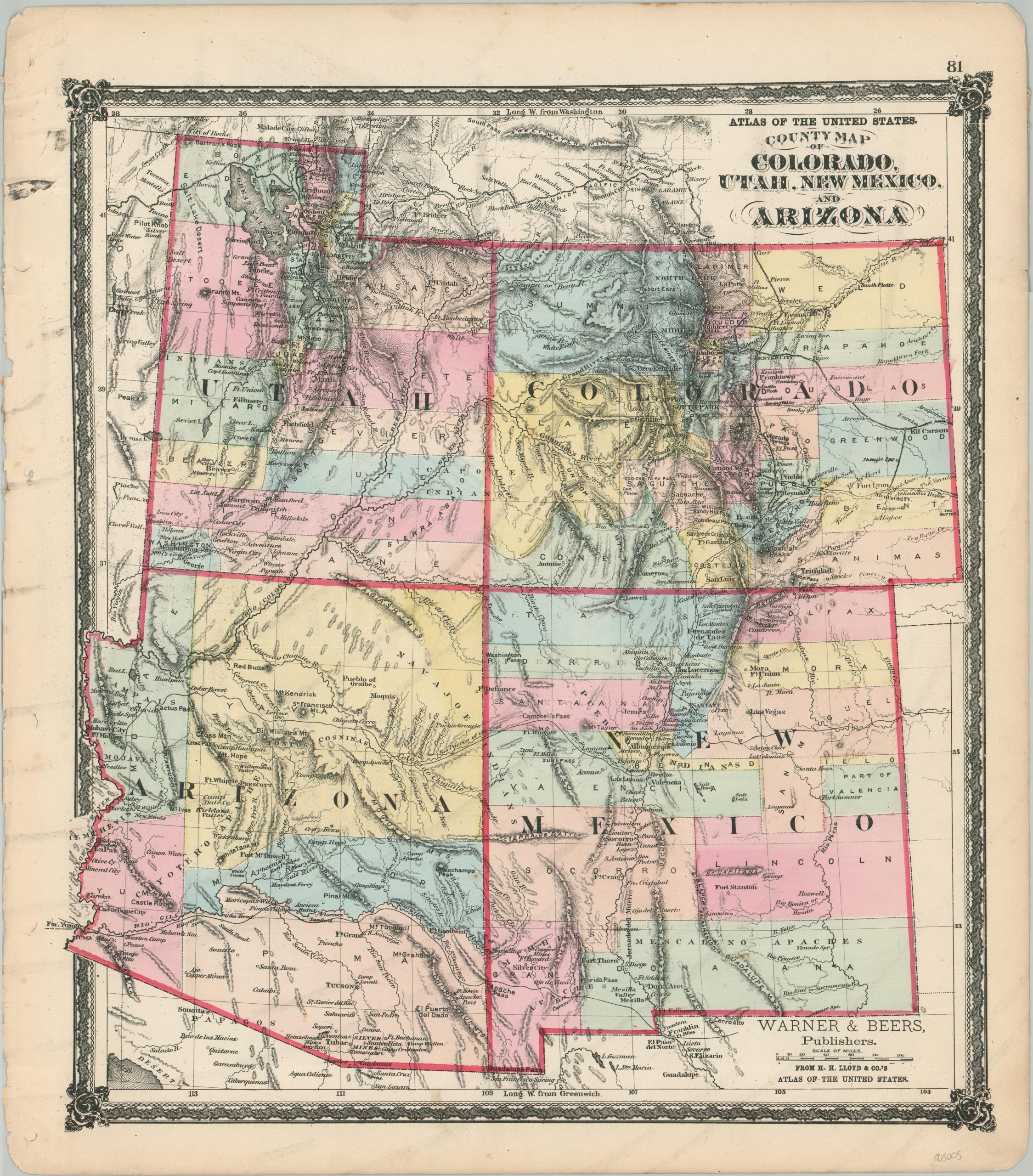
County Map of Colorado, Utah, New Mexico, and Arizona
The vast American West in the last quarter of the 19th century.
Out of stock
Description
This beautiful steel-engraved map of Utah, Colorado, Arizona, and New Mexico was published in Chicago by Warner & Beers in 1875 as part of H.H. Lloyd & Co’s Atlas of the United States. Though the image and titles make no mention, none of the regions have yet to be admitted to the Union and all remain in territorial status, though Colorado would become the 38th state the year following publication.
Original hand color outlines each territory, along with the counties, districts, and Native American reservations contained therein. Topography is depicted in hachure, emphasizing the region’s rugged terrain, and a number of mountain peaks, ranges, and passes are labeled throughout the image. Also named are an interesting variety of settlements, forts, and other geographic features.
A handful of railroads are shown in operation, concentrated mostly in the mineral-rich regions of Colorado and near Utah’s Great Salt Lake. Also of note is the railway from Pinoche, Nevada, the first independent short line in the territory, organized to haul silver ore.
Source: Utah Rails
Map Details
Publication Date: 1875
Author: Warner & Beers
Sheet Width (in): 15.9
Sheet Height (in): 18.1
Condition: A-
Condition Description: Moderate wear and soiling visible in the margins, including several small tears and some faint hole punches on the left side, creased corners, and toning. The image remains clean - a crisp impression with original hand color. Very good overall.
Out of stock