County Map of California and Nevada
Detailed county map of California and Nevada from the late 19th century.
Out of stock
Description
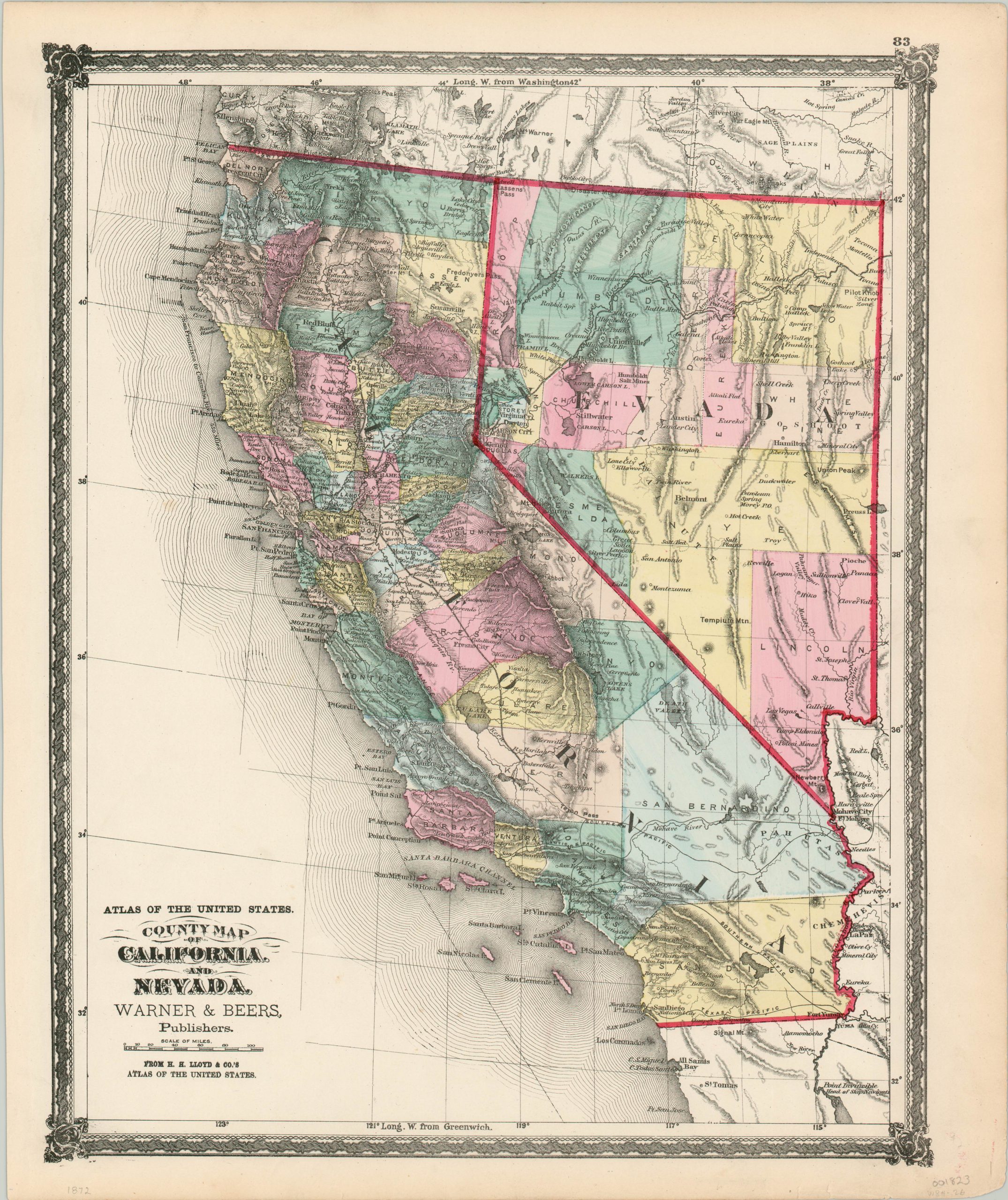
This detailed map of California and Nevada visibly highlights how influential the railroads were in the growth of the American west. The Southern Pacific can be seen traveling from north to south through the Central Valley, with connections to San Francisco and the east made possible by the recently completed Transcontinental Railroad (1869). Nevada’s lines provide access to the valuable silver mines around Carson City. Numerous proposed routes are also shown.
The region’s rugged topography is depicted in hachure, with notable geographic features and mountain ranges individually labeled. These place names, plus the large county configurations, are indicative of how both states still retained their ‘Wild West’ attitude even into the late 19th century.
The map was published in 1872 by Warner & Beers for inclusion in H.H. Lloyd & Co’s Atlas of the United States.
Map Details
Publication Date: 1872
Author: Warner & Beers
Sheet Width (in): 15.60
Sheet Height (in): 18.00
Condition: A-
Condition Description: Margins are slightly soiled and toned, consistent with age, but the image itself is vivid and clean. Features bright original hand color.
Out of stock