Corridor Wildlife Map Series
$110.00
Surveying the environmental impacts of Alaska’s oil pipelines.
1 in stock


Description
The discovery of Alaska’s massive Prudhoe Bay Oil Field in 1968 sparked significant interest in the oil, natural gas, and petroleum reserves available across ‘The Last Frontier.’ Transportation across the vast and largely empty territory was a primary concern and numerous efforts were underway by the early 1970s to facilitate the movement of crude oil to the Lower 48.
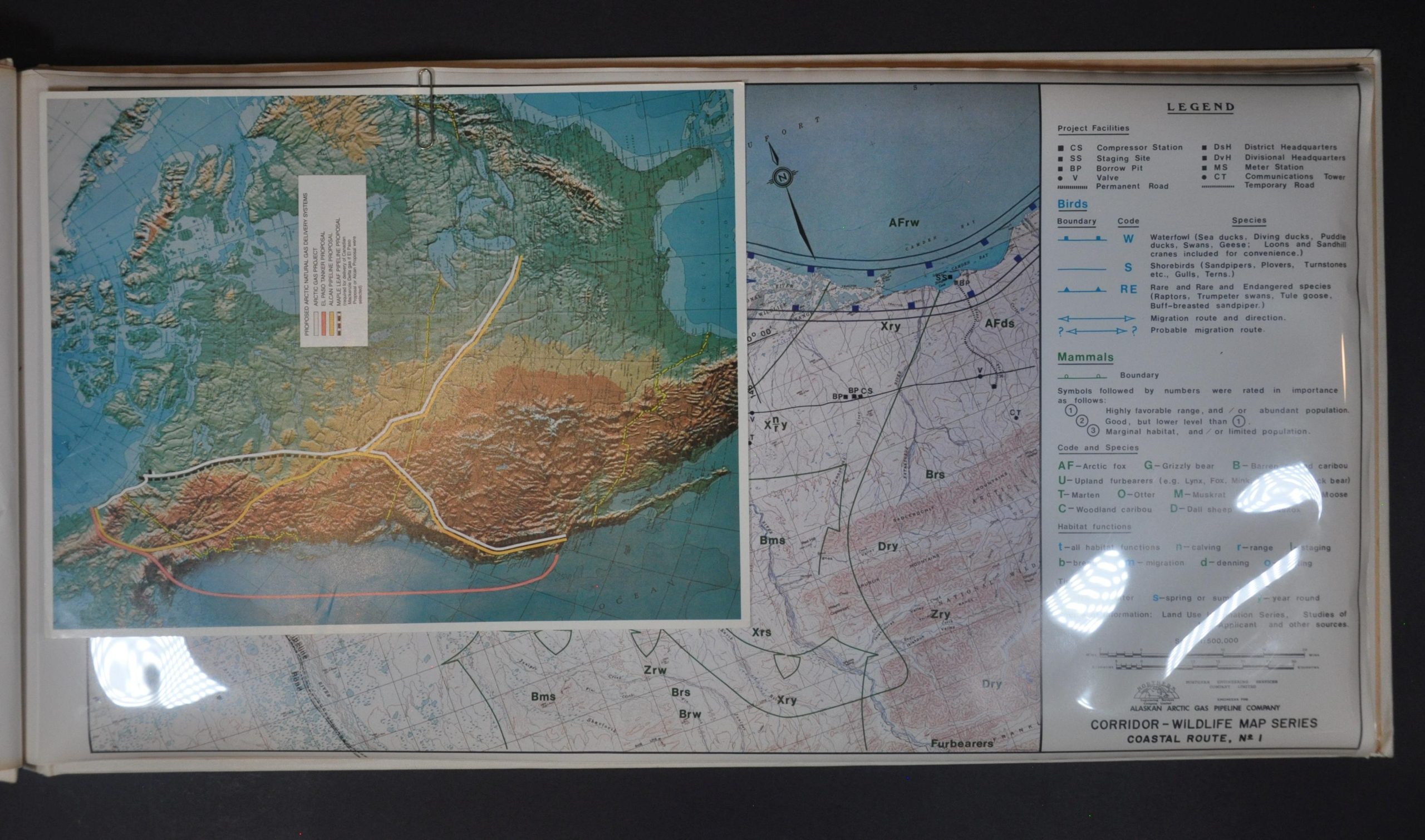
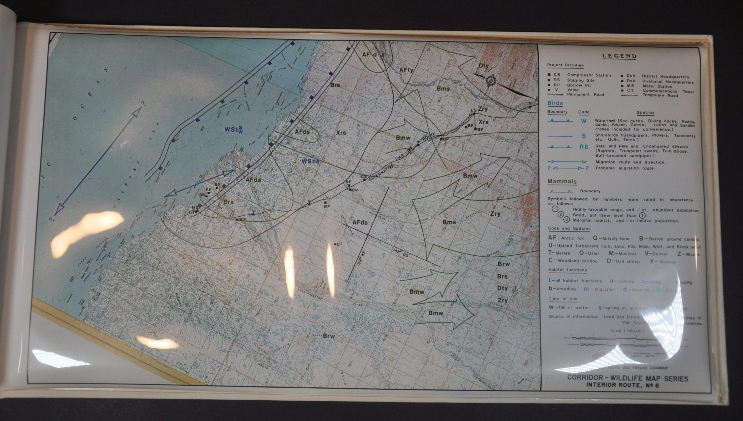
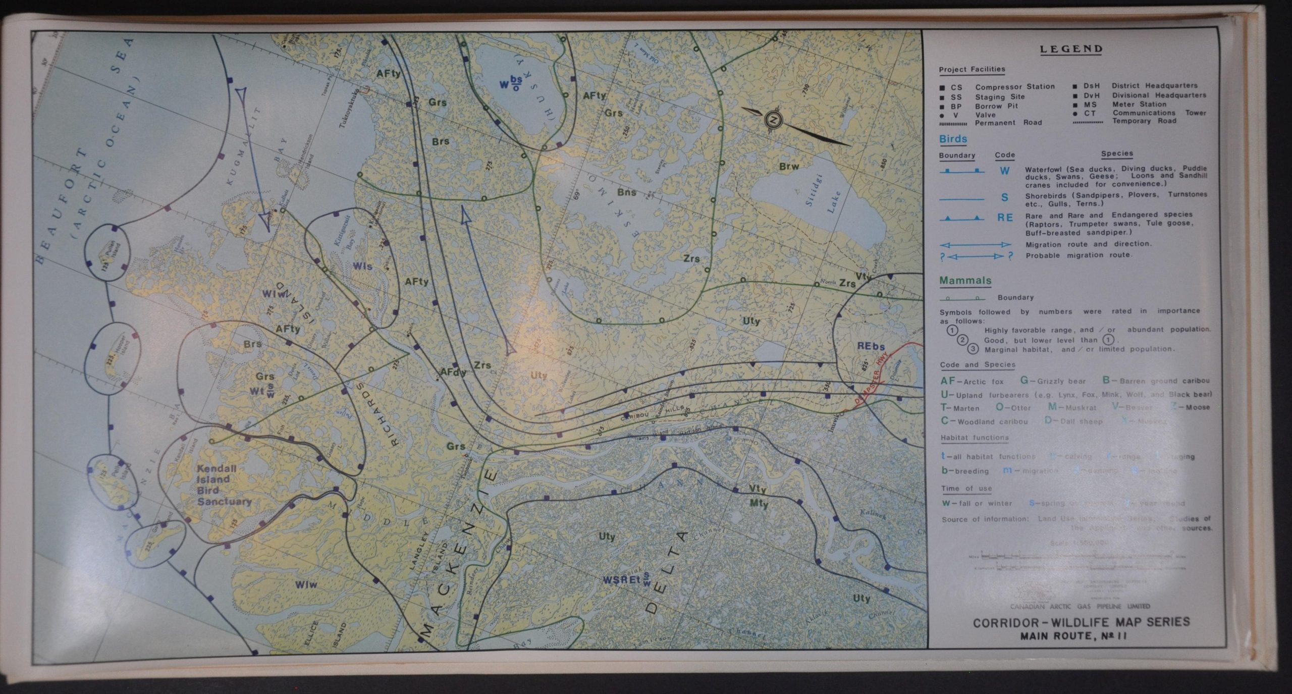
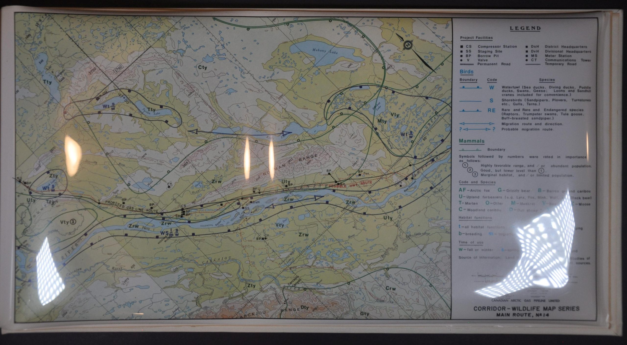
This compilation of maps is emblematic of such endeavors. It was published around 1974 by the Alaskan Arctic Gas Pipeline and shows a proposed course from the Arctic Circle to distribution points near Los Angeles and Chicago. Eighteen base maps prepared by the Northern Engineering Services Company Limited and issued at a scale of 1:500,000 offer a detailed overview of regional topography.
A formal system of symbols, lines, and letters notes the activity patterns of numerous species of birds and mammals, with the former divided into generalized groups (waterfowl, shorebirds, and rare birds). Transparent overlays accompanying each sheet denote the proposed path of the pipeline and related infrastructure like roads, meter stations, communications towers, staging sites, etc.
Map Details
Publication Date: 1974
Author: Northern Engineering Services Company Limited
Sheet Width (in): 21
Sheet Height (in): 11
Condition: A-
Condition Description: 18 lithographed maps, each with an accompanying transparent overlay, bound in original white covered cloth boards. Covers shows some wear and light soiling. Contents are generally quite good, with some light wrinkling and wear along the outer edges, consistent with age. Registered Set #248 and includes a small map of competing pipeline projects across North America. Good to very good condition overall
$110.00
1 in stock