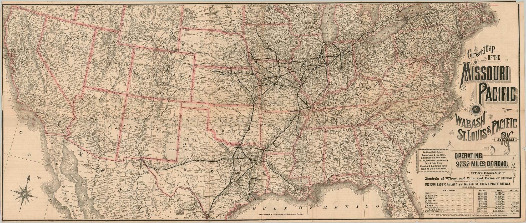
Correct Map of the Missouri Pacific and Wabash & St. Louis & Pacific Systems
$295.00
Routes of the Missouri Pacific – “The First Railroad West of the Mississippi.”
1 in stock
Description
This fantastic map of the United States was published in Chicago by Rand McNally in 1884 to promote the lines of the Missouri Pacific and Wabash, St. Louis & Pacific Railroad systems. The former was under the control of New York financier Jay Gould at the time the map was issued and he oversaw a period of rapid expansion across the Southwest in subsequent years.
Skewed state outlines, such as an enlarged Texas, exaggerate the importance of the company rail lines and allow the audience to read the densely packed station names along each route. Text and tables of statistics in the lower right advertise nearly 10,000 miles of rail in operation that carried a large proportion of the nation’s commodities like wheat, corn, and cotton. Timetables, text, illustrations, and a map of the principal railroad depots in Chicago can be seen on the verso.
Map Details
Publication Date: 1884
Author: Rand McNally
Sheet Width (in): 41.25
Sheet Height (in): 17.25
Condition: B+
Condition Description: Originally issued folded into 20 segments, with moderate wear and several spots of separation along former creases. Two spots, about 5" cumulatively, have been repaired on the verso with archival tape. Some light wear along the outer edges and faint discoloration and soiling, consistent with age. Remains in good to very good condition overall.
$295.00
1 in stock

