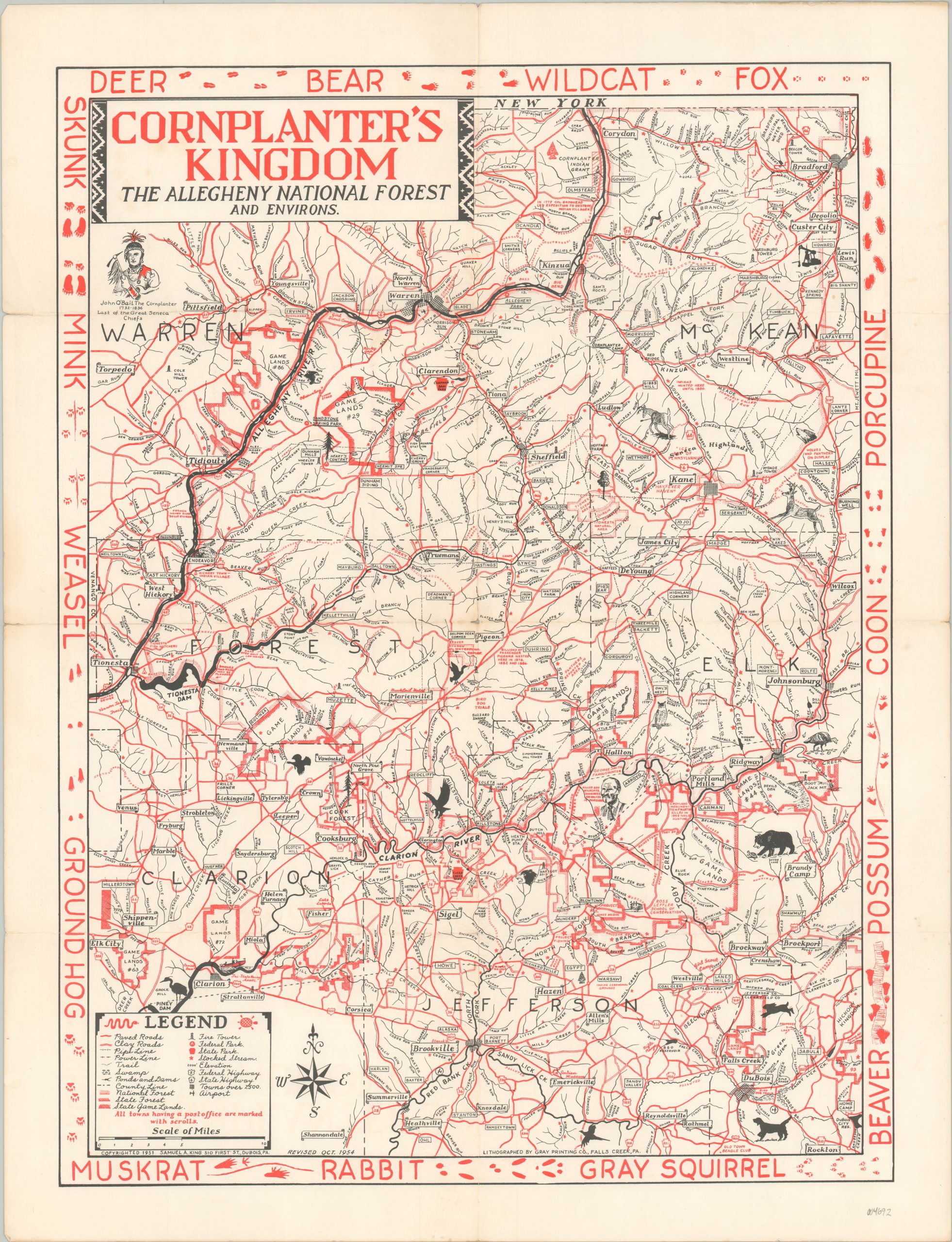
Cornplanter’s Kingdom The Allegheny National Forest and Environs
Cornplanter’s Kingdom’ in Pennsylvania about a decade before its dismemberment.
Out of stock
Description
This detailed map covers approximately 5,000 square miles in northwestern Pennsylvania, much of it part of the Allegheny National Forest. A legend in the lower left identifies the various symbols used to label transportation options, infrastructure, geographic features, and boundary lines. The pictorial elements and decorative border highlight the area’s rich biodiversity and appeal for outdoor enthusiasts (especially hunters).
Two vignettes identify famous local inhabitants – George Smith, killer of over 5,000 animals, and John O’Bail (alternatively spelled Abeel), a Seneca war chief known as Cornplanter. It is his ‘kingdom’ that the map claims to encompass.
The tract of land was deeded by the state of Pennsylvania to Cornplanter and his descendants in 1791 in recognition for his diplomatic efforts on behalf of the Iroquois Confederacy. For over 150 years, the small community operated as the only self-governing indigenous population in the state (akin to, but not officially a reservation). The last heir, Jesse Cornplanter, died in 1957 and much of the land was flooded a few years later as a result of the construction of the Kinzua Dam on the Allegheny River.
The map was originally copywritten in 1951 by Samuel A. King of Dubois, Pennsylvania. This example has been updated to 1954 and was lithographed by the Gray Printing Company of Falls Creek, PA.
Sources: Explore Pennsylvania History; Pennsylvania Historic Preservation
Map Details
Publication Date: 1954
Author: Samuel A. King
Sheet Width (in): 19
Sheet Height (in): 24.75
Condition: A-
Condition Description: Moderate creasing along old fold lines, including minor wear and a few small tears along the outer edges of the sheet (confined to the margins). Very good overall.
Out of stock