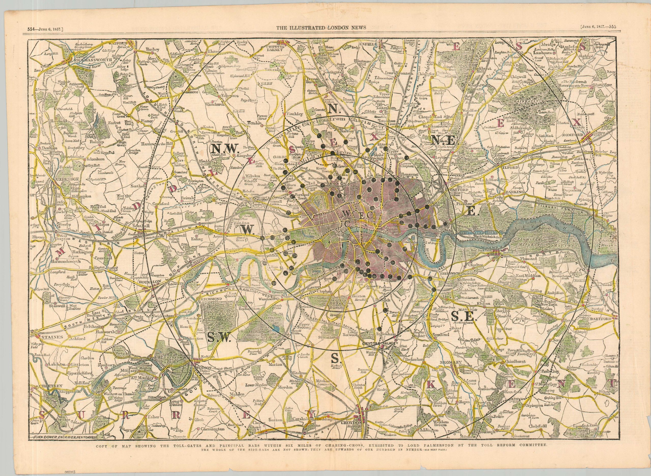
Copy of Map Showing the Toll-Gates and Principal Bars within Six Miles of Charing-Cross, Exhibited to Lord Palmerston by the Toll Reform Committee
$80.00
Reforming London’s Metropolitan Turnpike Trust.
1 in stock
Description
The Metropolitan Turnpike Trust was established in 1826 to manage and maintain the major roads leading into and around London, funding improvements through tolls collected at turnpike gates. By the mid-19th century, as London’s population and traffic surged, the trust’s roads had become vital arteries for commerce, transport, and urban expansion (though facing strict competition from railways).
This 1857 map, prepared for the Reform Committee, reflects a city shaped by these toll roads, just as growing public pressure began to call for their abolition and the modernization of urban infrastructure. Large black dots represent the location of toll gates or bars – over four dozen within a four-mile circle of the city center.
The Metropolitan Roads Act 1863 would remove the majority of the toll gates in London. The map was engraved by John Dower and published in the June 6th, 1857 issue of the Illustrated London News.
Map Details
Publication Date: 1857
Author: John Dower
Sheet Width (in): 21.9
Sheet Height (in): 16
Condition: B+
Condition Description: Woodcut map with nice modern hand color. Moderate wear and several small holes and tears along the centerfold has been extensively repaired on the verso. Toning and a few small chips and spots in the margins. Good condition overall.
$80.00
1 in stock