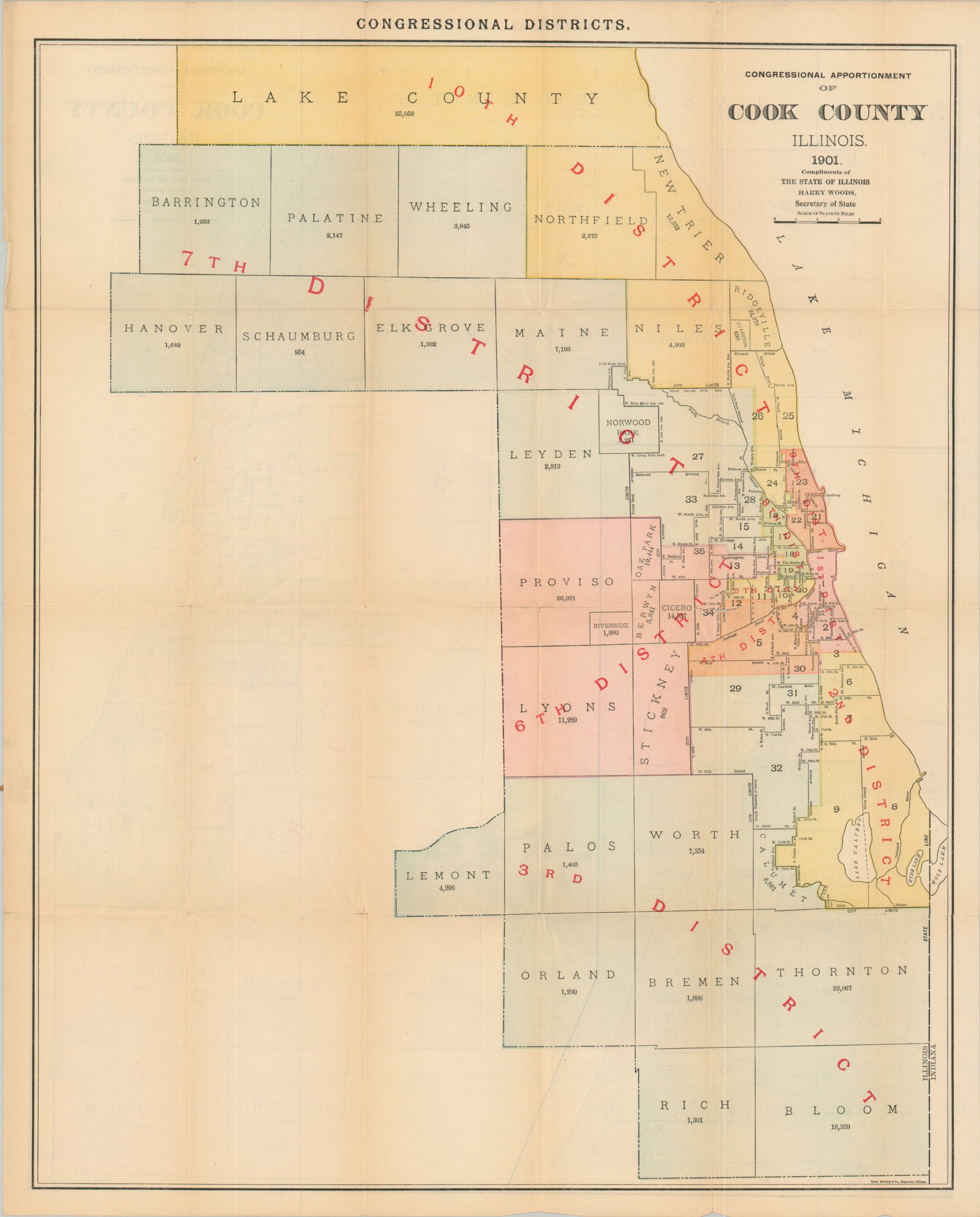
Congressional Apportionment of Cook County Illinois
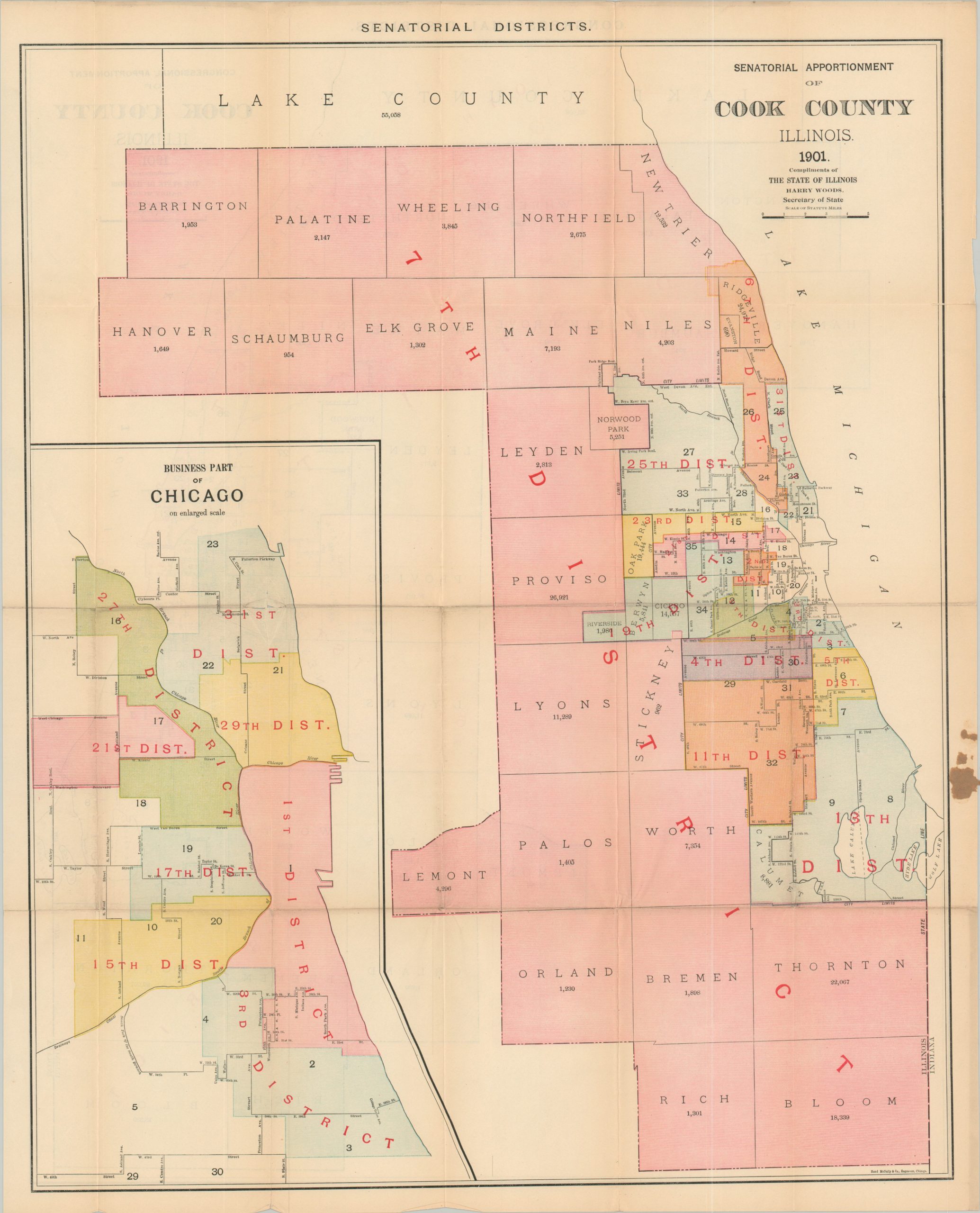
State districts across Cook County in the early 20th century.
Out of stock

Description
This interesting political map of Cook County, Illinois was published in Chicago by Rand McNally in 1901. It was distributed by Illinois Secretary of State Harry Woods to highlight the boundaries of new state congressional and senatorial districts, mandated by the state legislature the same year as printing. The population weight of Chicago when compared to the rest of the state is evident, as several districts are contained within the city limits. Major thoroughfares (especially those used as district boundaries) and townships with their respective populations are noted.
Source: Library of Congress;
Map Details
Publication Date: 1901
Author: Rand McNally
Sheet Width (in): 20.75
Sheet Height (in): 25.75
Condition: B+
Condition Description: Double-sided pocket map folded into 24 segments and disbound from original paper wraps (present, but separated). Creasing and wear along fold lines, including 2 spots of clean separation (about 4" total) repaired with archival tape. A small irregular hole at one of the fold intersections also repaired, with no loss to image. Some paper from the cover remains affixed to the margin, but the map is unaffected. Good condition overall.
Out of stock