Committee on Fire Prevention and Engineering Standards – Chicago, Ill
$350.00
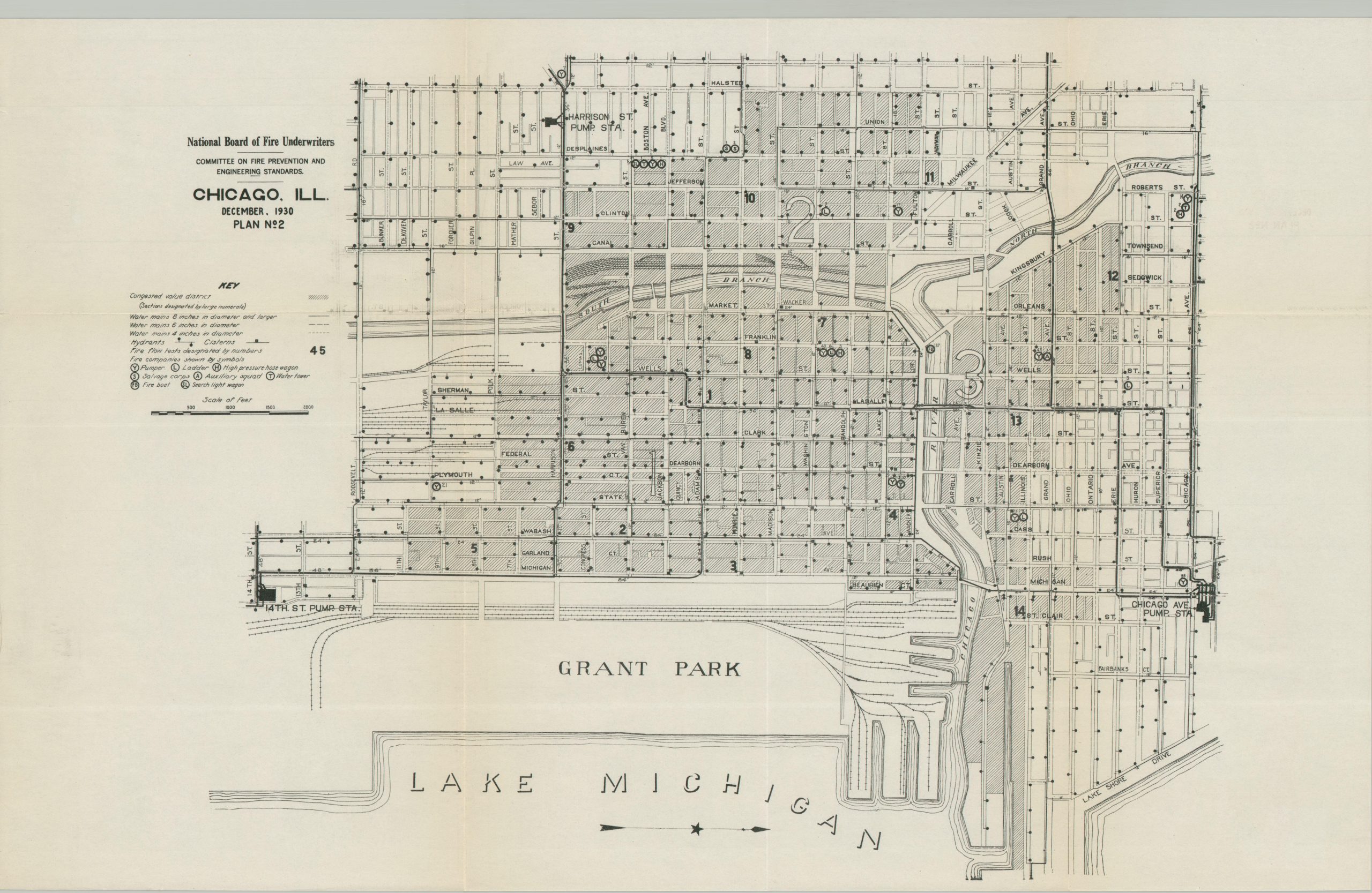
The fire infrastructure of Chicago’s downtown district during the Interwar Period.
1 in stock
Description
This uncommon map of Chicago’s Loop and adjacent areas provides a detailed overview of the local fire prevention infrastructure. Hydrants, cisterns, and water mains are noted, in addition to the specific capabilities of individual fire stations and companies. Urban conflagrations were greatly reduced during the Progressive Era thanks to improved building codes, new technologies, and fire-resistant construction materials.
Map Details
Publication Date: 1930
Author: National Board of Fire Underwriters
Sheet Width (in): 21.90
Sheet Height (in): 14.00
Condition: A
Condition Description: Map printed on thin paper, lightly creased along original folds. Very good to near fine condition overall.
$350.00
1 in stock