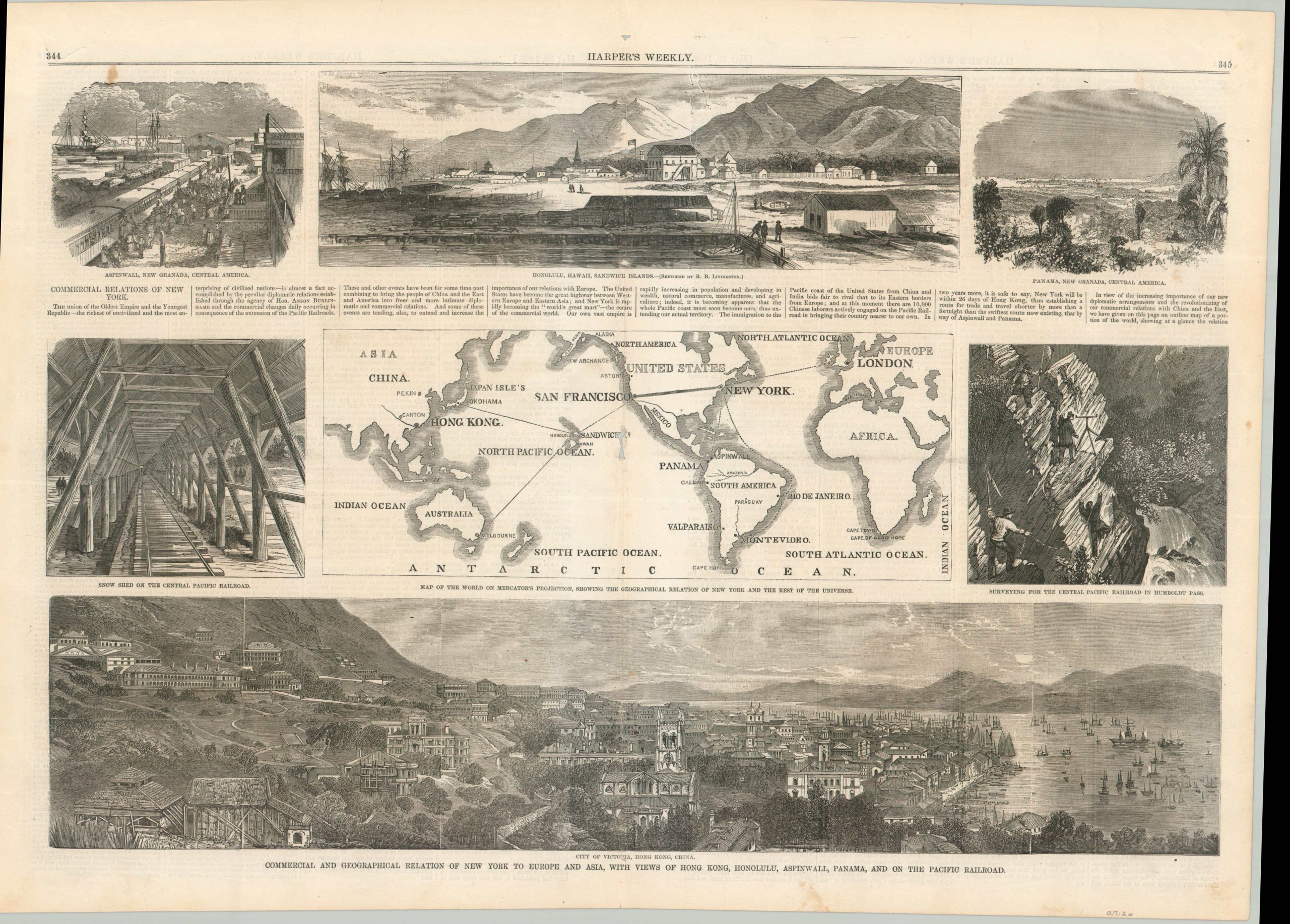
Commercial and Geographical Relation of New York to Europe and Asia, with Views of Hong Kong, Honolulu, Aspinwall, Panama, and on the Pacific Railroad.
$95.00
A cartographic manifestation of New York’s excitement about the Transcontinental Railroad.
1 in stock
Description
The impending completion of the first Transcontinental Railroad would unite the eastern and western seaboards of the United States, tying the coasts to the rest of the world. New York, home to one of the busiest ports in North America, stood poised to capitalize on the new geographic reality. This is made clear in this centerfold from the May 30th, 1868 edition of Harper’s Weekly.
The map, “showing the geographical relation of New York and the rest of the Univers” shows how the city, already closely linked with London, will become increasingly connected to the East. Surrounding the primary image are views of other important stops in the global network connecting New York to the world: Hong Kong, Honolulu, Panama, and the Pacific Railroad, which would be completed less than a year after publication.
Map Details
Publication Date: 1868
Author: Harper's Weekly
Sheet Width (in): 22.1
Sheet Height (in): 15.9
Condition: B
Condition Description: Centerfold woodcut sheet from the May 30, 1868 issue of Harper's Weekly. Several holes and toning along the centerfold (see scan), an irregular tear (repaired) in the upper left margin, and scattered soiling, mostly in the lower margin. About good condition overall.
$95.00
1 in stock