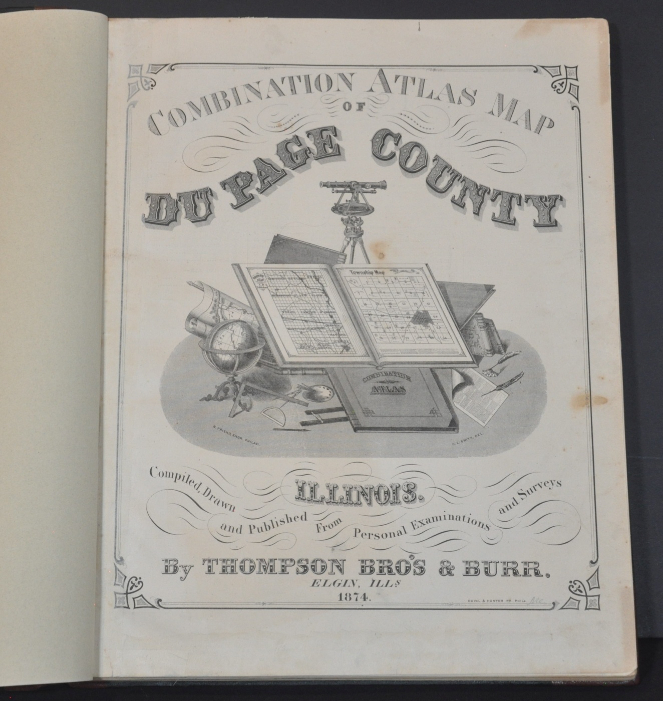
Combination Atlas Map of DuPage County Illinois
Restored 1874 Atlas of DuPage County, Illinois.
Out of stock


Description
This wonderful atlas of DuPage County, Illinois is an excellent example of county atlas publication that was happening across the Midwest and Northeast in the second half of the 19th century. It was issued by the firm of Thomson Brothers & Burr of Elgin, Illinois in 1874 and printed on a subscription basis.
Rather than publish atlases in advance in the hopes they will sell, Thomson Brothers & Burr would have solicited subscriptions and funding upfront. After securing orders (and obtaining payment) for advance copies, advertising, and even custom portraits and views of individuals and property, production could then begin. The resulting atlas would often be the most expensive book a family-owned and often occupied a point of pride on the mantle.
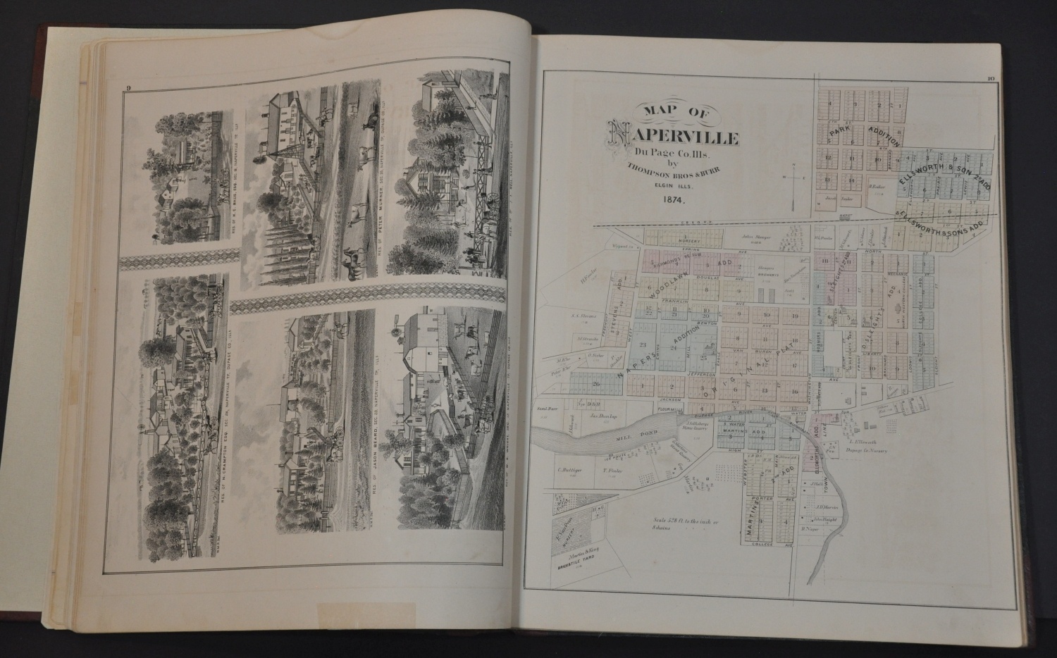
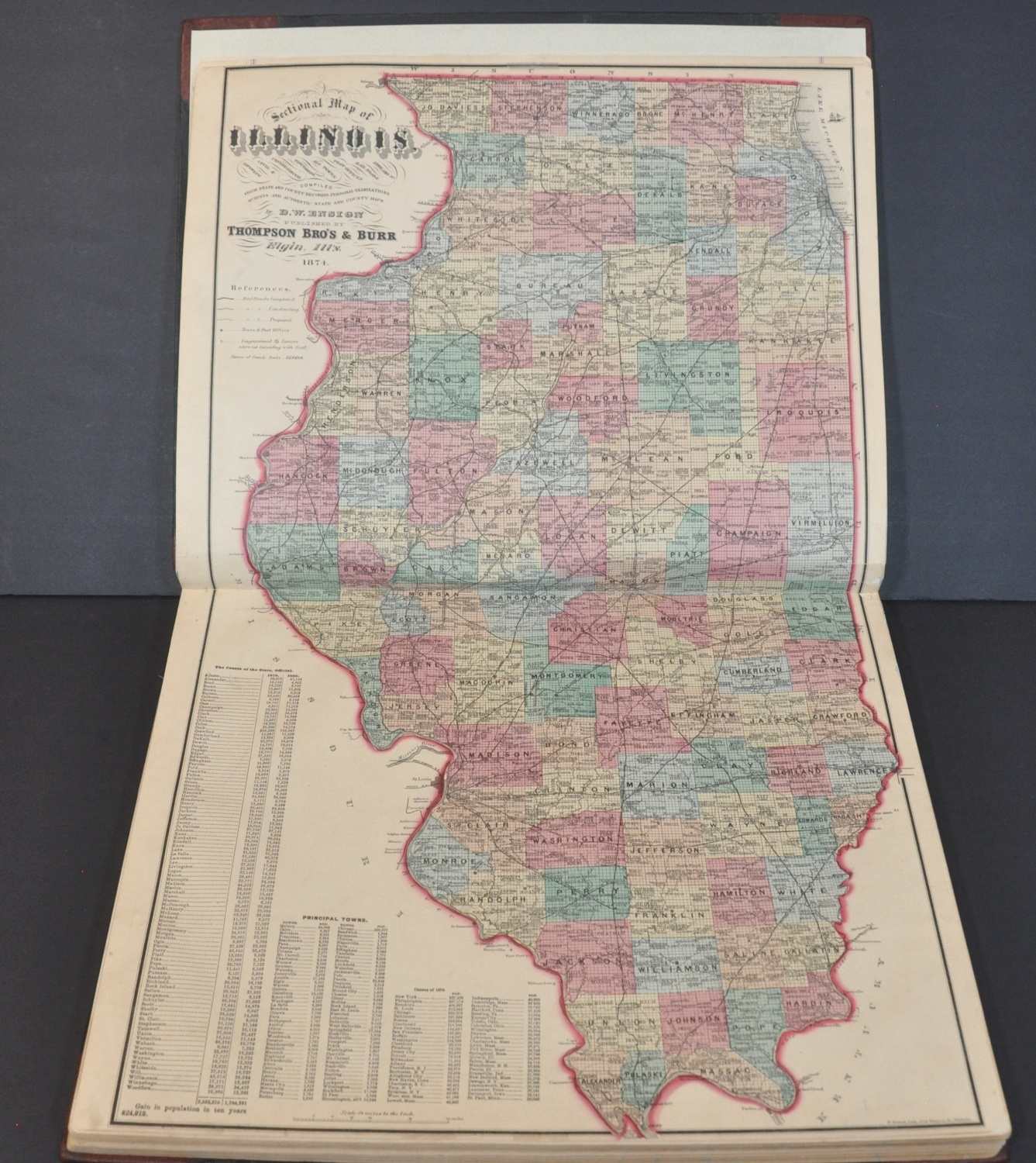
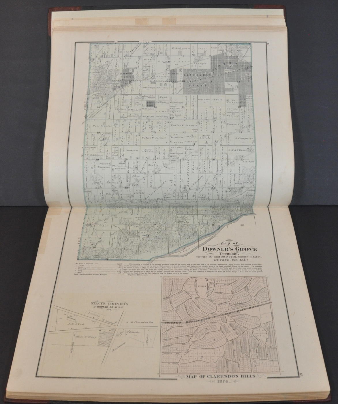
The plat maps show land ownership in the various townships throughout DuPage County and includes city plans of Downer’s Grover, Naperville, Elmhurst, and other local settlements. A double-page map of Illinois emphasizes the state’s railroad system (completed, under construction, and proposed) and includes a population index of counties and principal towns.
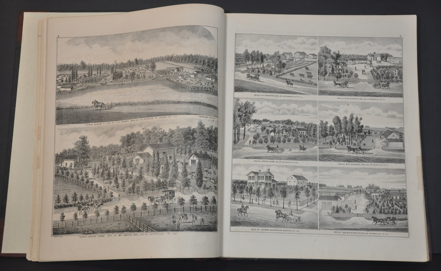
Typical of contemporary publications, the atlas includes numerous illustrated views of various properties. The high proportion of farms, mills, and rural residences highlight the largely agrarian composition of DuPage County in the 1870s. Images of Northwestern College (Naperville), Wheaton College, fully loaded train cars, and several manufactories reflect industrial growth and cultural elements as well.
Map Details
Publication Date: 1874
Author: Thomas Brothers & Burr
Sheet Width (in): 17.25
Sheet Height (in): 13.25
Condition: A-
Condition Description: Professionally restored with new leather spine, corners, and endpapers. Contents have also been repaired, including numerous small edge tears. A bit of scattered soiling ranging from light to moderate remains visible on a few sheets, but overall the contents are in very good condition. Complete, with 19 single page and 2 double page maps, plus numerous views and sheets of text.
Out of stock