
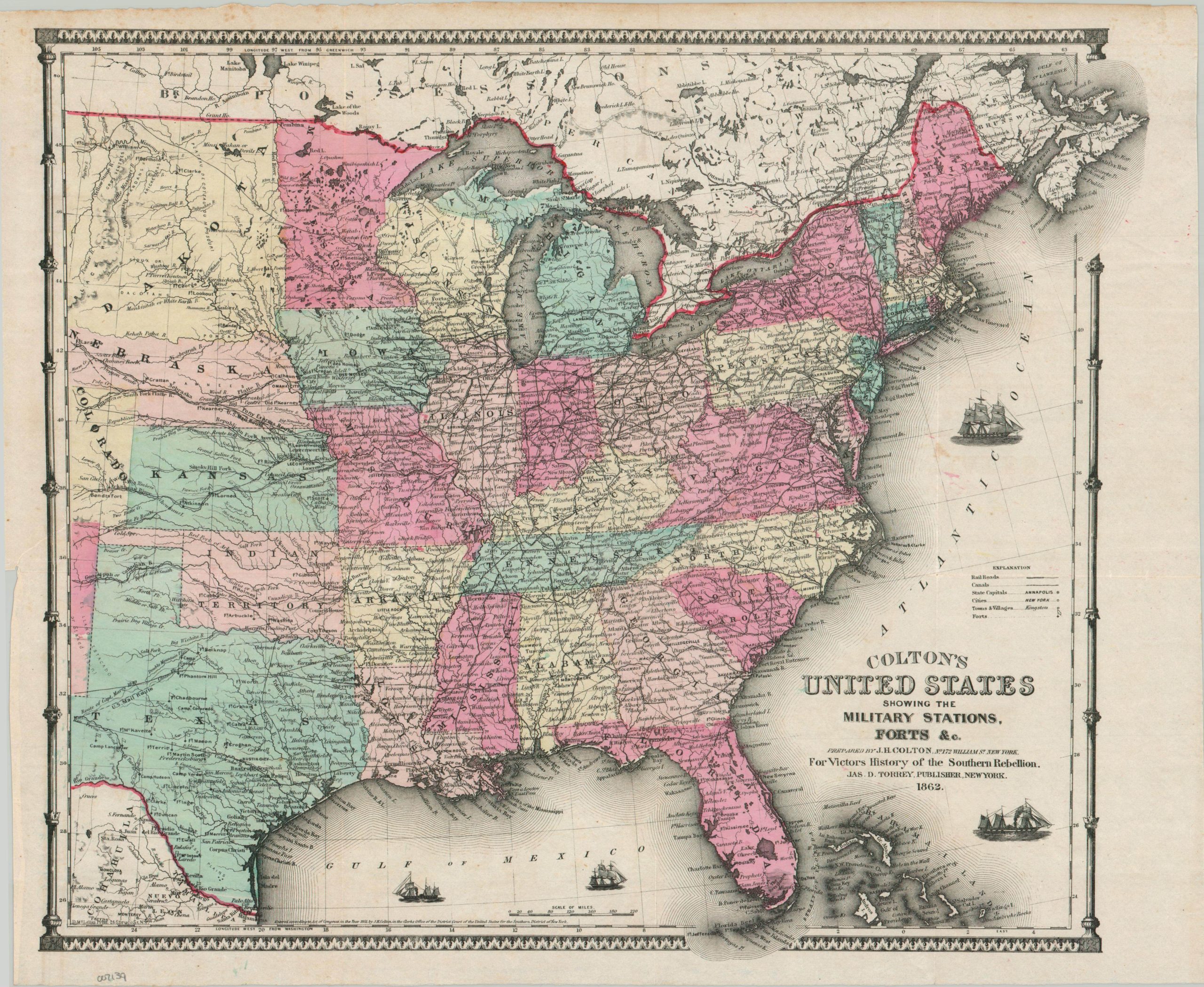
Colton’s United States Showing the Military Stations, Forts, &c.
$165.00
Fine military overview of the primary theaters issued in the midst of the American Civil War.
1 in stock
Description
This detailed map of the United States east of the Rocky Mountains shows the country in the second year of the ongoing Civil War. Heavy emphasis is given on transportation systems; including roads, railroads, and canals. Military forts are also identified with flags and individually labeled. The density of the settlements and transportation network, clearly visible in the North, alludes to the tremendous advantages enjoyed in those categories, but the dozens of ports available in the South reflect the practical difficulty of a successful Union blockade. Several ships – a paddlewheel steamer, clipper, and frigate – can be seen plying the Atlantic and Gulf of Mexico.
The map was originally issued in 1855 by Joseph Hutchins Colton, but has been updated to 1862 for inclusion in Victor’s History of the Southern Rebellion. Published in New York by James D. Torrey.
Map Details
Publication Date: 1862
Author: J.H. Colton
Sheet Width (in): 18.75
Sheet Height (in): 16.25
Condition: B+
Condition Description: Creased along fold lines, as issued, and a closed 2" tear on the center left (were previously bound) repaired on the verso with archival tape. Printed on a thin sheet with nice original hand color. Good to very good condition overall.
$165.00
1 in stock