Colton’s Road Map of Long Island
$900.00
Rare two-part road map of Long Island from the late 19th century.
1 in stock


Description
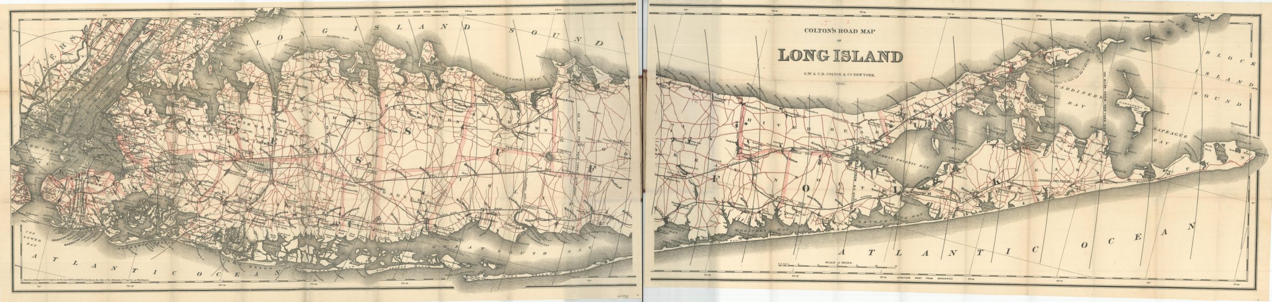
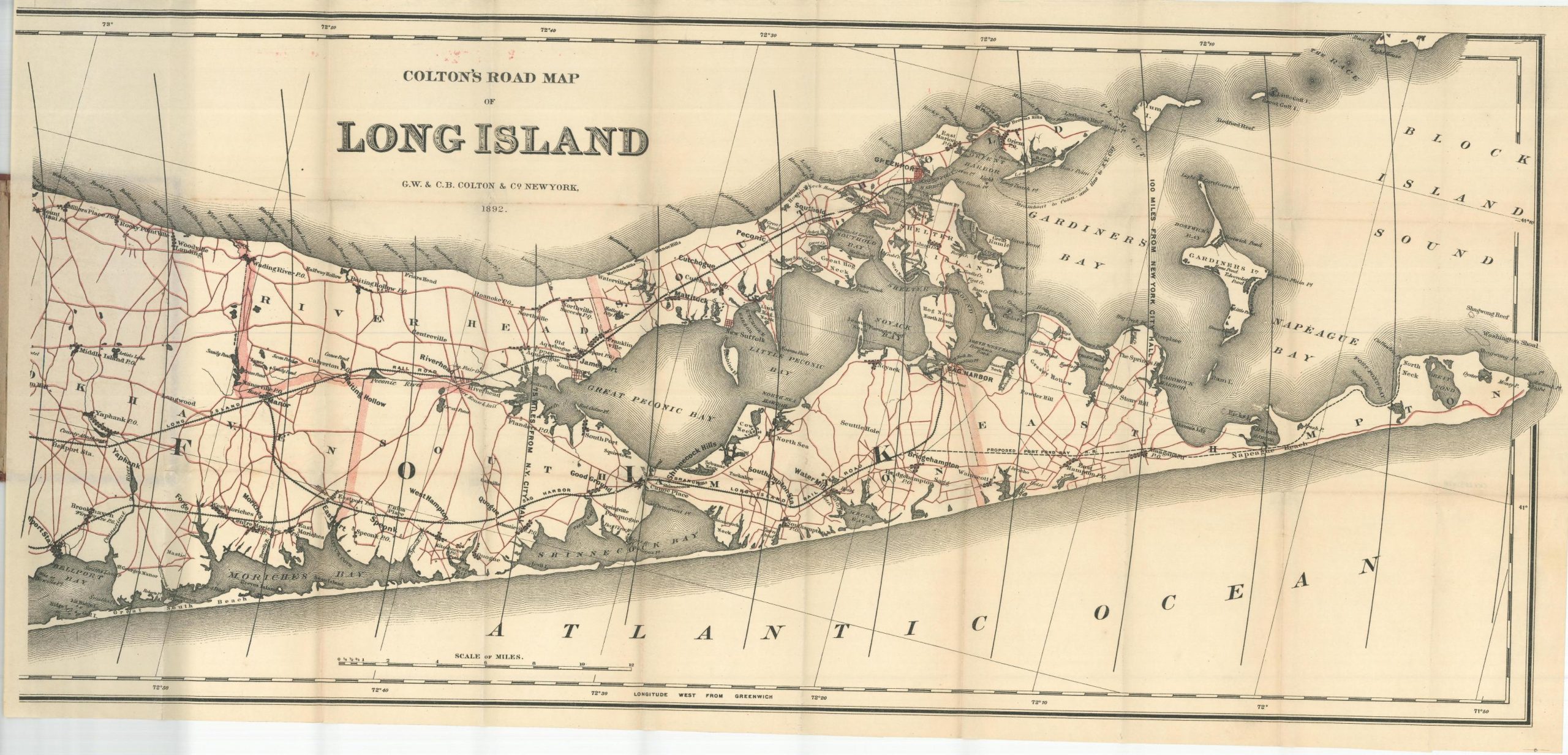
This fabulous road map of Long Island captures the region’s rapidly developing transportation network less than a decade after the completion of the Brooklyn Bridge, the first permanent connection between the island and the mainland. Split into two halves, the image presents a detailed overview of the roads, railroads, and ferry routes from the Hackensack River in New Jersey to Montauk Point Lighthouse.
Concentric circles radiating from the New York City courthouse show distances in five-mile increments and simple street plans reflect the outlines of major urban areas like Manhattan, Brooklyn, and Jamaica (Queens). A variety of locations of interest are labeled including post offices, country clubs, hotels, local industries, geographic features, and other attractions.
Around the time of publication, Long Island was becoming a summer refuge for wealthy residents of New York City and the map reflects an increasing contemporary trend of urbanization and development. Though there were a few early automobiles puttering around the streets of New York City, the indicated roads were primarily of use by horse-drawn carriages and bicyclists.
The map was published in New York by G.W. & C.B. Colton & Co. in 1892 – one of several editions published by the firm on a near-annual basis between 1891 and 1898. All are scarce, with only one entry in OCLC for the 1892 edition (at the New York Public Library).
Map Details
Publication Date: 1892
Author: G.W. & C.B. Colton
Sheet Width (in): See Description
Sheet Height (in): See Description
Condition: A
Condition Description: Two folding maps, each measuring approximately 31.5" x 15", affixed to original brown cloth boards (3.5" x 6.3"). Minor wear on the covers, some misprinted red ink above the title, and minor wear along fold lines. Near fine condition overall.
$900.00
1 in stock