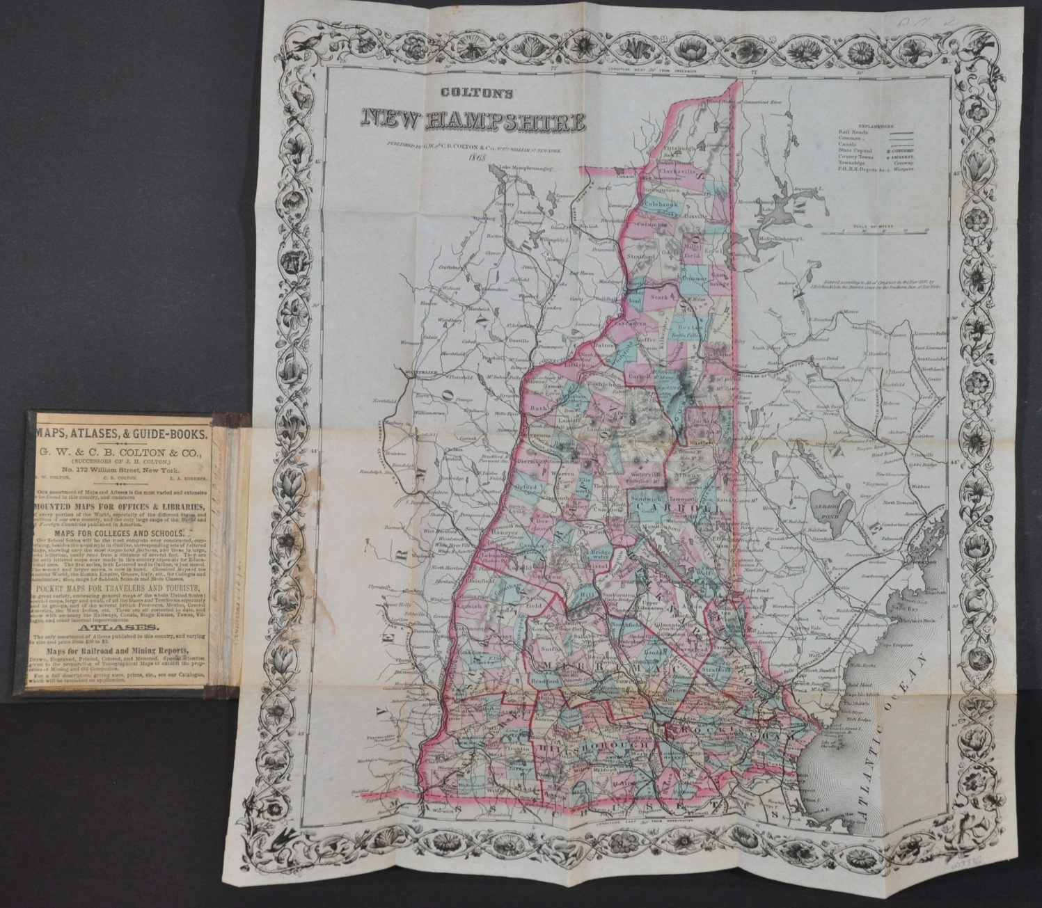
Colton’s New Hampshire
$200.00
New Hampshire shortly after the conclusion of the Civil War.
1 in stock
Description
This interesting pocket map of New Hampshire was published in New York by the firm of G.W. & C.B. Colton & Co. in 1868. The image, enclosed by a decorative border, presents a detailed overview of The Granite State in the years following the end of the U.S. Civil War.
The transportation network, comprised of roads, canals, and railroads, is emphasized throughout. Geographic features, local industries, and a variety of settlements are also identified according to the legend in the upper right. Topography is depicted in hachure, with a clear emphasis on the White Mountains in the northern part of the state.
The region was becoming increasingly popular as a tourist destination in the late 1860s, and the year following publication the Mount Washington Cog Railway was constructed – the first of its kind in the United States.
Map Details
Publication Date: 1868
Author: G.W. & C.B. Colton & Company
Sheet Width (in): 13.25
Sheet Height (in): 15.75
Condition: A-
Condition Description: Pocket map folded into 20 segments and affixed to original gilt embossed boards covered in brown cloth. Some staining in the lower left where fixed to the back cover and creasing along fold lines. Former separation along creases has been professionally repaired on the verso. Light soiling in the upper right corner and margin.
$200.00
1 in stock


