
Cologne Sheet M.32/4
$55.00
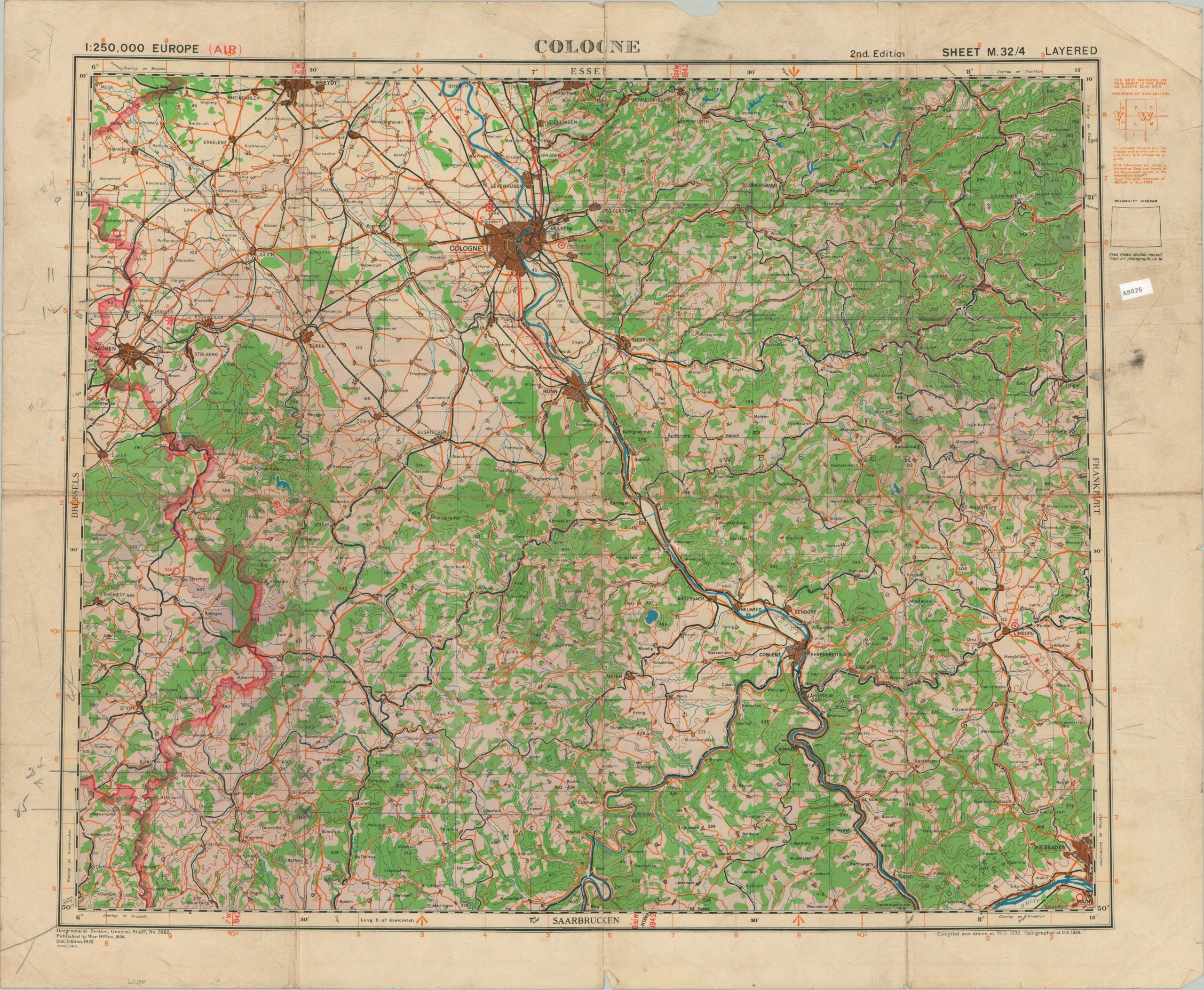
WWII plan of Cologne, Germany from 1942.
1 in stock
Description
This British military map covers a large area in eastern Germany around the city of Cologne. Issued at a scale of 1:250,000, the image offers a strategic overview of the region, bordered roughly by Aachen in the west and Wiesbaden in the east. The international boundary with France is highlighted in red. Topography is shown in contours and various settlements and geographic features are labeled.
Second Edition. Compiled by the Geographical Section, General Staff and published by the War Office in 1942. Red overprinting indicates it likely was intended for use by the RAF, circling key Luftwaffe sites. That same year, the city of Cologne was subject to the first ever 1,000 bomber raid. For further information on military map of the Second World War, check out the UK National Archives.
Map Details
Publication Date: 1942
Author: Geographical Section, General Staff
Sheet Width (in): 29.75
Sheet Height (in): 24.2
Condition: B
Condition Description: Heavy wear and separation along old fold lines, repaired on verso with archival tape. Scattered soiling visible throughout, concentrated most visibly in the margins. Numerous manuscript annotations in pencil.
$55.00
1 in stock