
Coffee Map of the Republic of Colombia
‘The World’s Largest Producer of Mild Coffees.’
Out of stock
Description
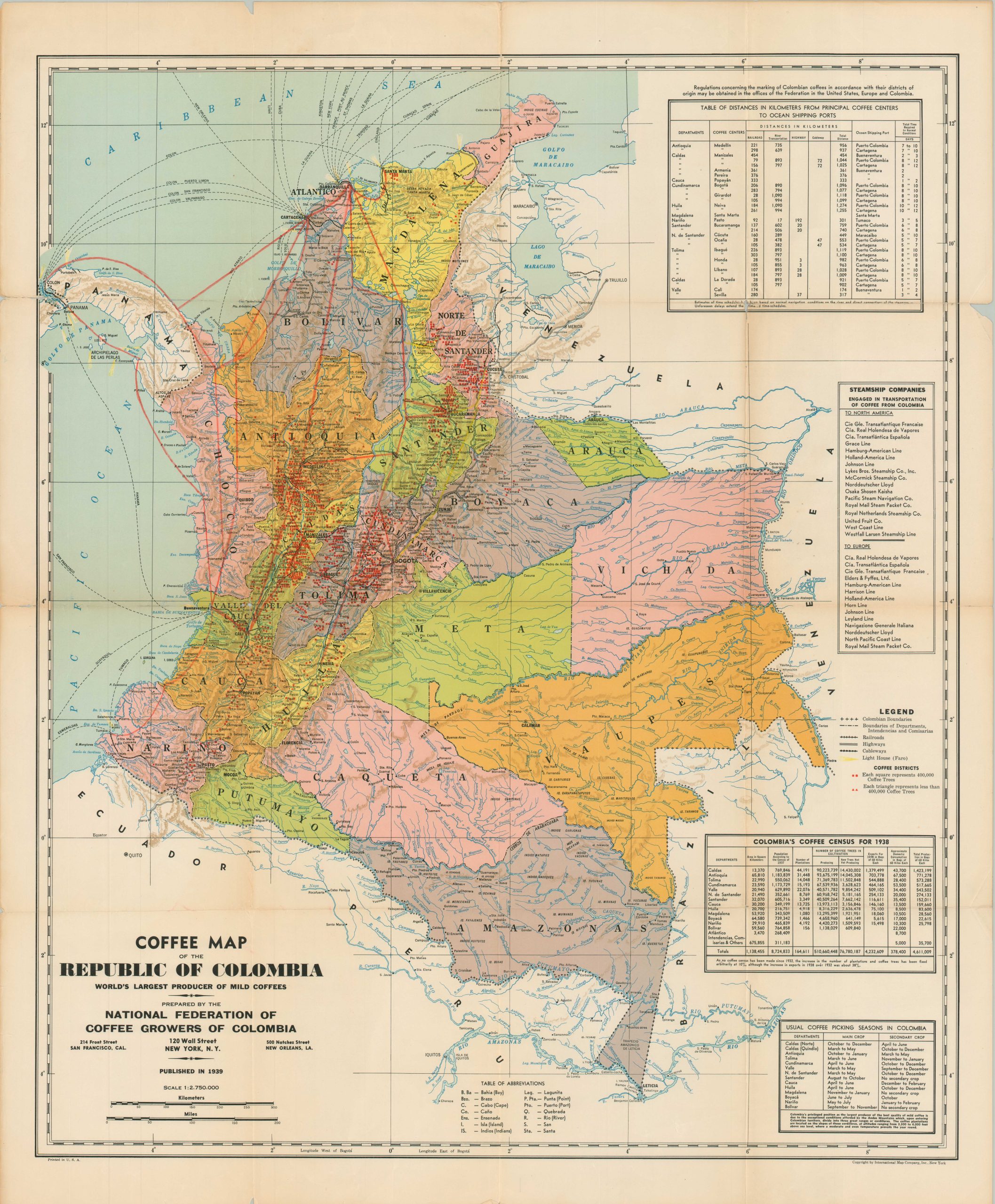
This detailed map of Columbia was prepared by the National Federation of Coffee Growers of Columbia in 1939 and copywritten by the International Map Company of New York. Each department (political unit) is brightly colored and labeled. Shaded topography gives a mild impression of the nation’s mountainous terrain.
Dozens of boxes and triangles are scattered throughout the image. Each notes an area containing either more (box) or less (triangle) than 400,000 coffee trees. Huge concentrations of the caffeinated plant can be found in Tolima, Caldas, and Antioquia. Statistics in the lower right show a national production of over 4.6 million 60-kilo bags in 1938!
A robust transportation network of railroads, highways, and cableways is noted according to the legend in the lower right. Further shipping routes – possibly used for aviation – have been added in red and yellow pencil by a previous owner. A list of steamship companies engaged in the coffee trade and a table of distances from shipping ports are provided in the upper right.
Map Details
Publication Date: 1939
Author: National Federation of Coffee Growers of Colombia
Sheet Width (in): 26.5
Sheet Height (in): 33
Condition: B+
Condition Description: Moderate wear, toning, and several spots of separation along originally issued fold lines (repaired on verso). Very minor image loss at fold intersections. A few small tears and chips along the edges of the sheet, confined to the margins. Manuscript route markings in red and yellow pencil. Good to very good condition overall.
Out of stock