
Coastwise Cruising Guide Sand Hook, N.J. to Cape Henlopen, Del. and points South
$95.00
A charming look at the waterways of the East Coast via a mix of leisure tour and serious maritime navigation.
1 in stock

Description
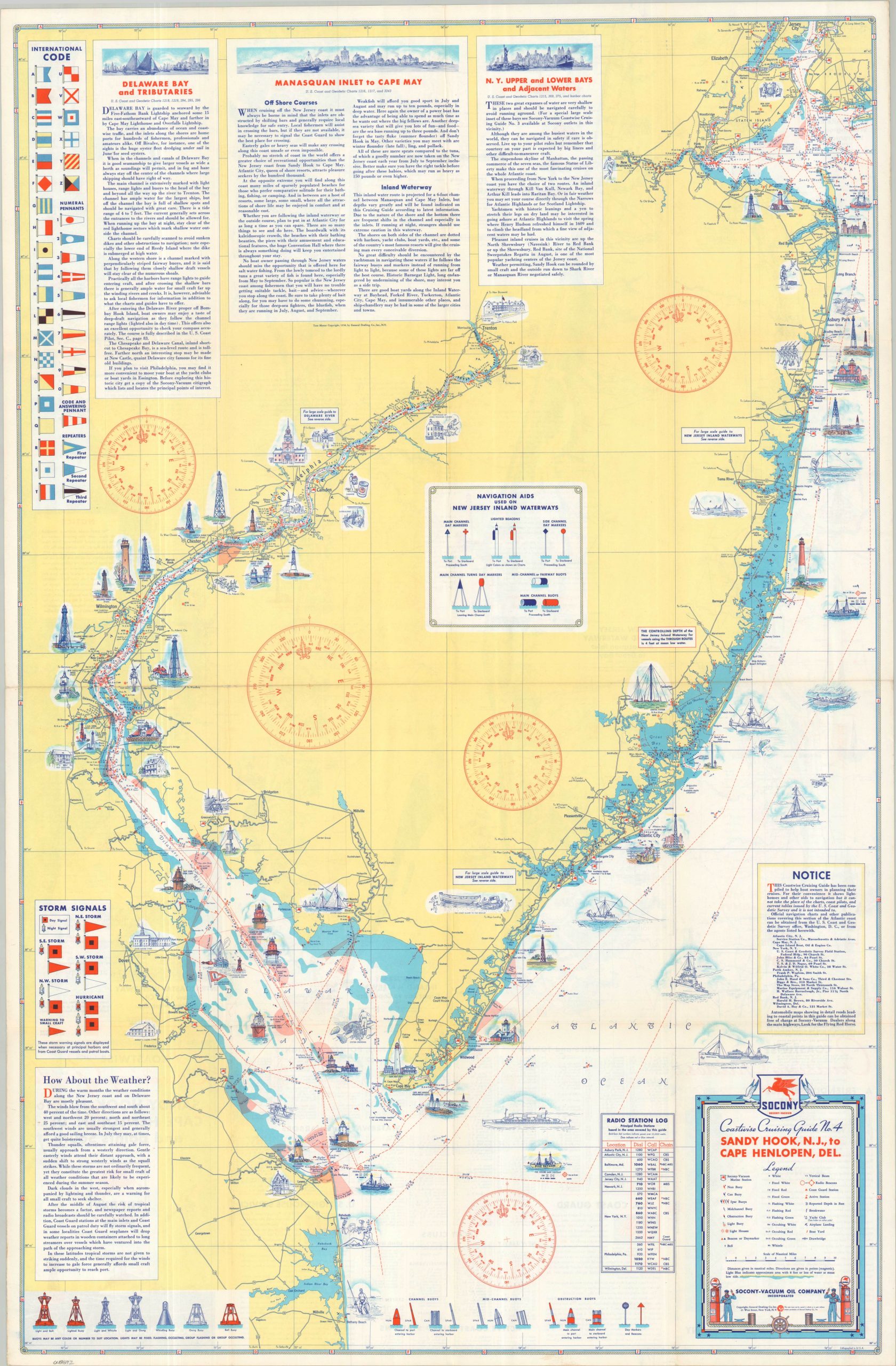
“This Coastwise Cruising Guide has been compiled to help boat owners in planning their cruises. For their convenience, it shows the lighthouses and other aids to navigation, but it cannot take the place of the charts, coast pilots, and current tables issued by the U.S. Coast and Geodetic Survey and it is not intended to.” – NOTICE
This practical guide to the waters of the Atlantic Coast was copyrighted in 1938 by the General Drafting Company. It is one of several Coastwise Cruising Guides (this example, #4) issued on behalf of Standard Oil of New York (SOCONY), a firm which had extensive maritime service infrastructure available to serve the prewar population of pleasure sailors.
One side of the sheet shows the coast between Jersey City and Delaware Bay, including much of the Delaware River. In addition to navigational details, the image includes decorative vignettes, descriptive text, and the locations of SOCONY stations (identified with the distinctive red Pegasus logo). Information about buoys, storm signals, flag semaphore, and local radio stations is also provided. The verso of the sheet presents similar details about important regional waterways like the Delaware River, New Jersey Inland Waterway, and Intracoastal Waterway.
Map Details
Publication Date: 1938
Author: General Drafting Company
Sheet Width (in): 24.75
Sheet Height (in): 38.00
Condition: A
Condition Description: Double-sided map with light wear and faint discoloration along originally issued fold lines. Minor marginal wear. Very good to near fine condition overall.
$95.00
1 in stock