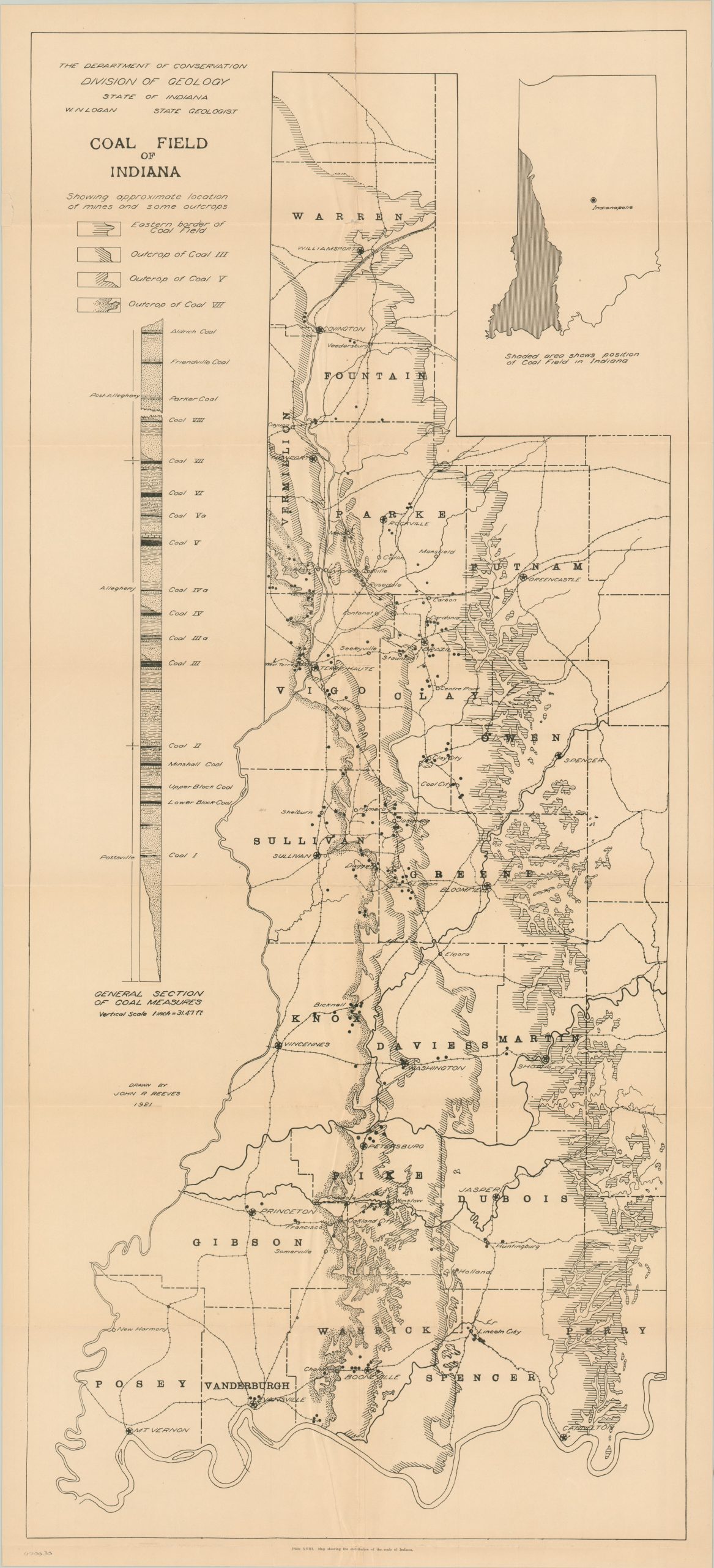
Coal Field of Indiana
$125.00
Scarce map of the coal fields in southwest Indiana published shortly after the high point of regional production.
1 in stock
Description
Coal was discovered along the banks of the Wabash River as early as 1736 and has played a major part in the region’s economic and industrial growth. Deep (underground) mining provided the foundation for the Hoosier coal trade, peaking at 30 million short tons annually prior to the outbreak of WWI. After WWII, the development of large scale industrial equipment made surface mining more cost efficient, and it continues to be the primary method for coal removal in the state.
This map depicts the vast coal region in Indiana from Evansville to Williamsport, outlined in a contextual inset in the upper right hand corner. In addition to showing towns, rail lines, and mine locations, the map also provides information on the types and measurements of coal on the left side of the image. Although a transition to cleaner energy alternatives is needed to attempt to offset the growing climate crises, coal mining still employs nearly 3,000 workers annually in Indiana.
Map Details
Publication Date: 1921
Author: John Reeves
Sheet Width (in): 19.5
Sheet Height (in): 42
Condition: B
Condition Description: The map is in fair condition with several creases along the centerfold. There are holes in the fold intersections that have been repaired on the verso.
$125.00
1 in stock