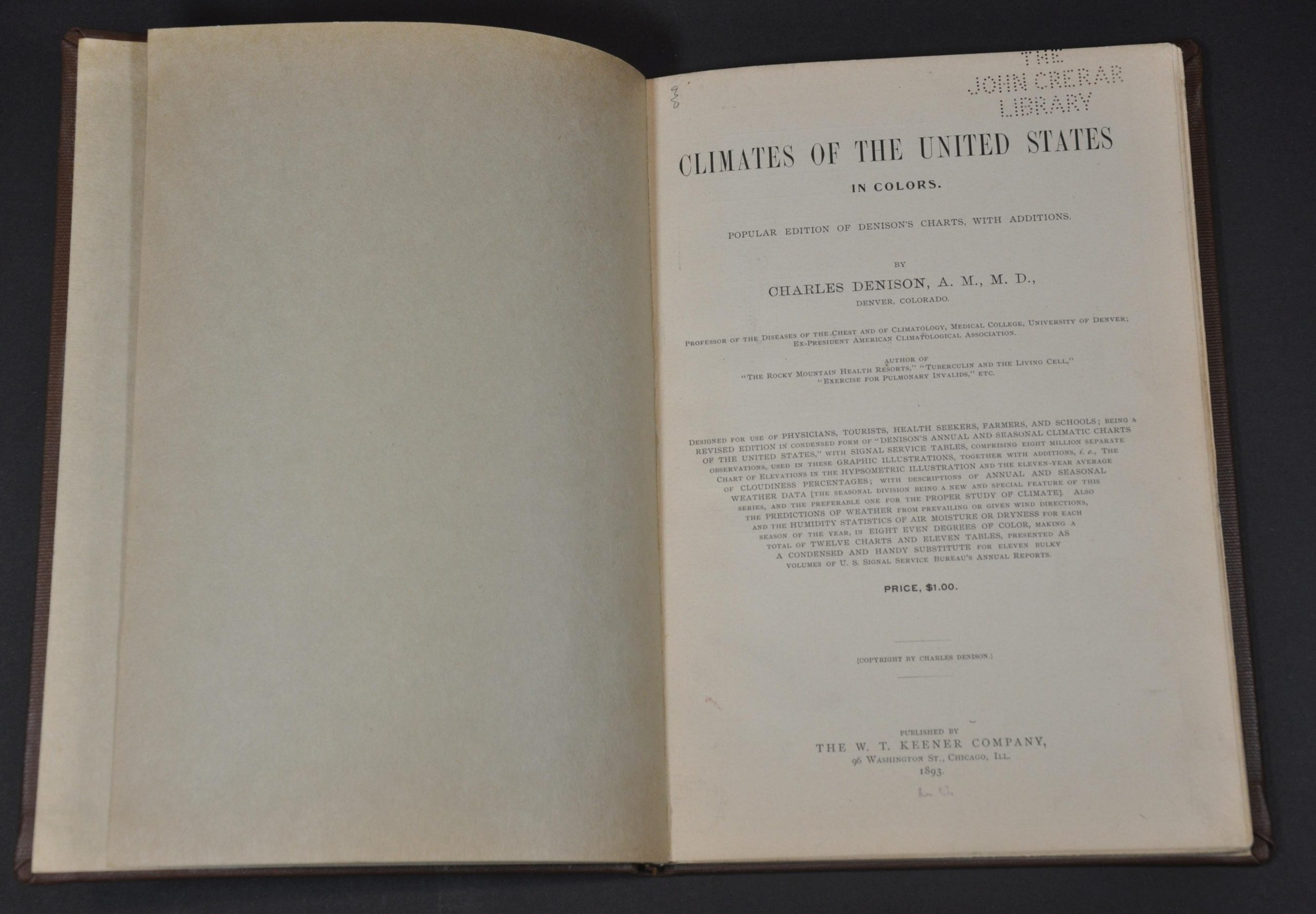
Climates of the United States in Colors
$175.00
Visualizing climate data in the late 19th century.
1 in stock
Description
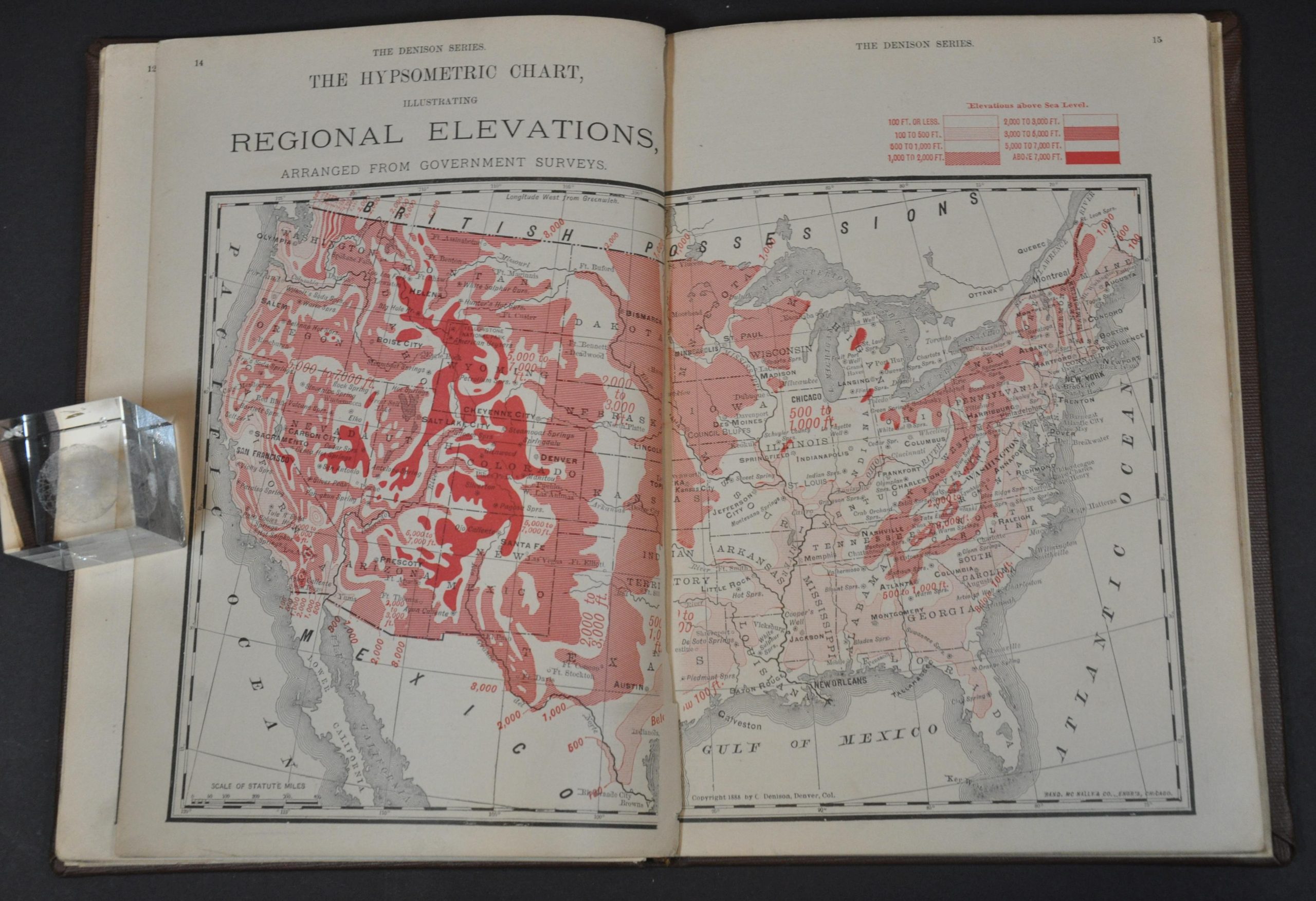
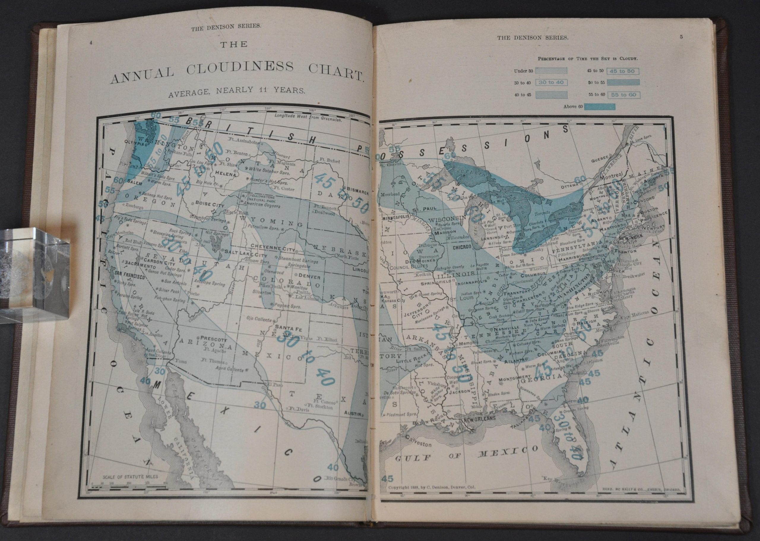
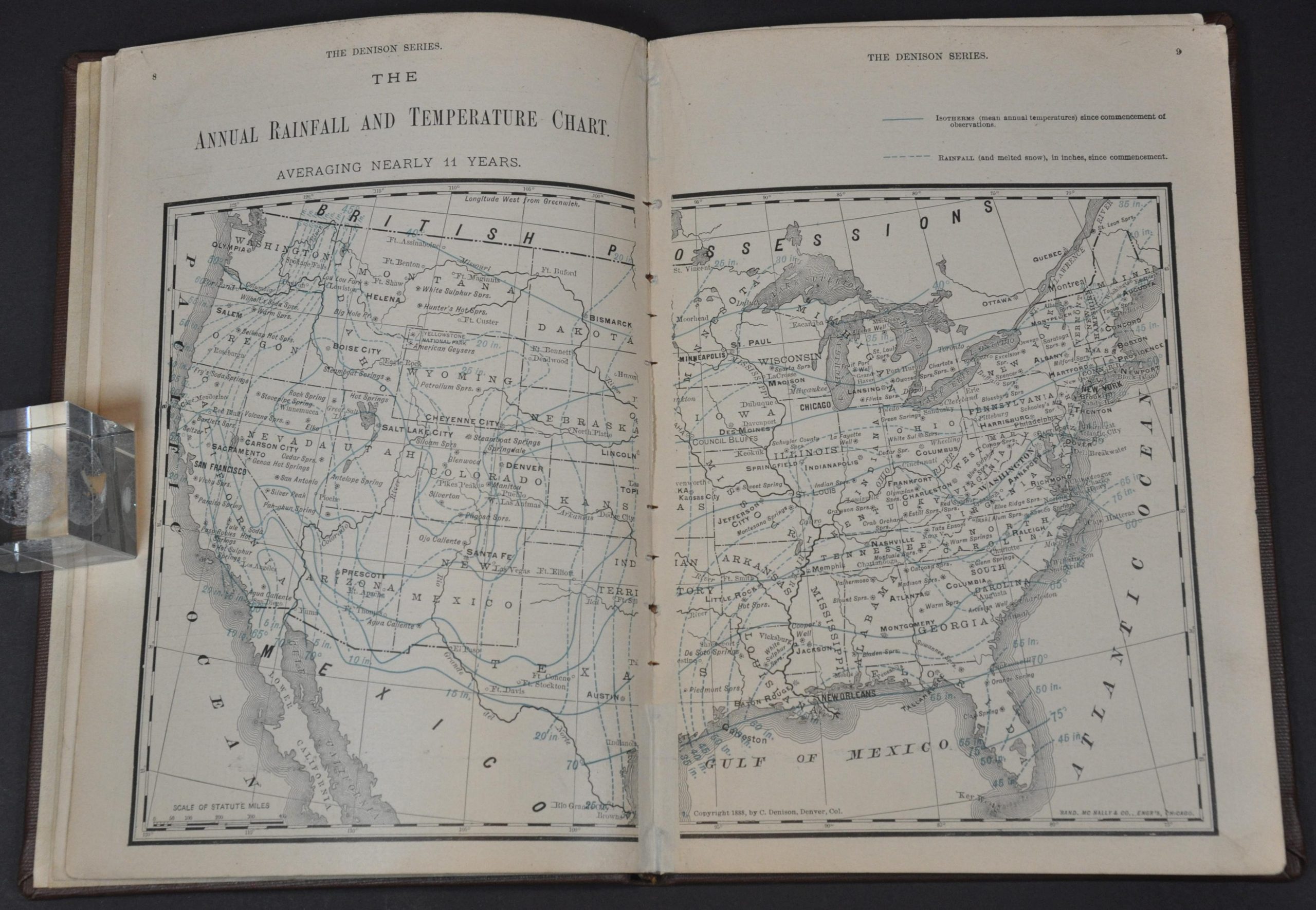
“Designed for use of physicians, tourists, health seekers, farmers, and schools; Being a revised edition in condensed form of “Denison’s Annual and Seasonal Climatic Charts of the United States,” with signal service tables, comprising eight million separate observations, used in these graphic illustrations, together with additions, i.e., the chart of elevations in the hypsometric illustration and the eleven-year average of cloudiness percentages; with descriptions of annual and seasonal weather data [the seasonal divisions being a new and special feature of this series, and the preferable one for the proper study of climate]. Also the predictions of weather from prevailing or given wind directions, and the humidity statistics of air moisture or dryness for each season of the year, in eight even degrees of color, making a total of twelve charts and eleven tables, present as a condensed and handy substitute for eleven bulk volumes of U.S. Signal Service Bureau’s Annual Reports.” – Title Page.
That long-winded introduction offers a wordy summation of Charles Denison’s influential work combining climate data with medical best practices, especially for those suffering from respiratory diseases. The small volume outlines the geography of good health across the United States, allowing the audience to quickly identify regions that are particularly dry and sunny. Tables of statistics and vibrantly colored maps, issued by Rand McNally, make a convincing argument for the healthful qualities found in the weather of the American West.
After suffering from tuberculosis in the early 1870s, Denison (1845-1909) moved to Colorado and became enchanted with the benefits of the dry climate. In addition to his cartographic work, he served as a physician, taught medicine at the University of Denver, and opened a clinic for victims of TB and other lung-related ailments. Dennison’s findings and subsequent recommendations would influence treatment for chronic diseases like tuberculosis, asthma, and rheumatoid arthritis well into the first half of the 20th century.
Map Details
Publication Date: 1893
Author: Charles Denison
Sheet Width (in): 7.25
Sheet Height (in): 10.25
Condition: A-
Condition Description: Ex-libris from The John Crerar Library in Chicago. Complete, 48 pp. climate atlas bound in custom full brown cloth with gilt spine. Complete and in very good condition, with a bookplate, several old rubberstamps, and a few punch-outs noting the previous owners.
$175.00
1 in stock