Cleveland
$45.00
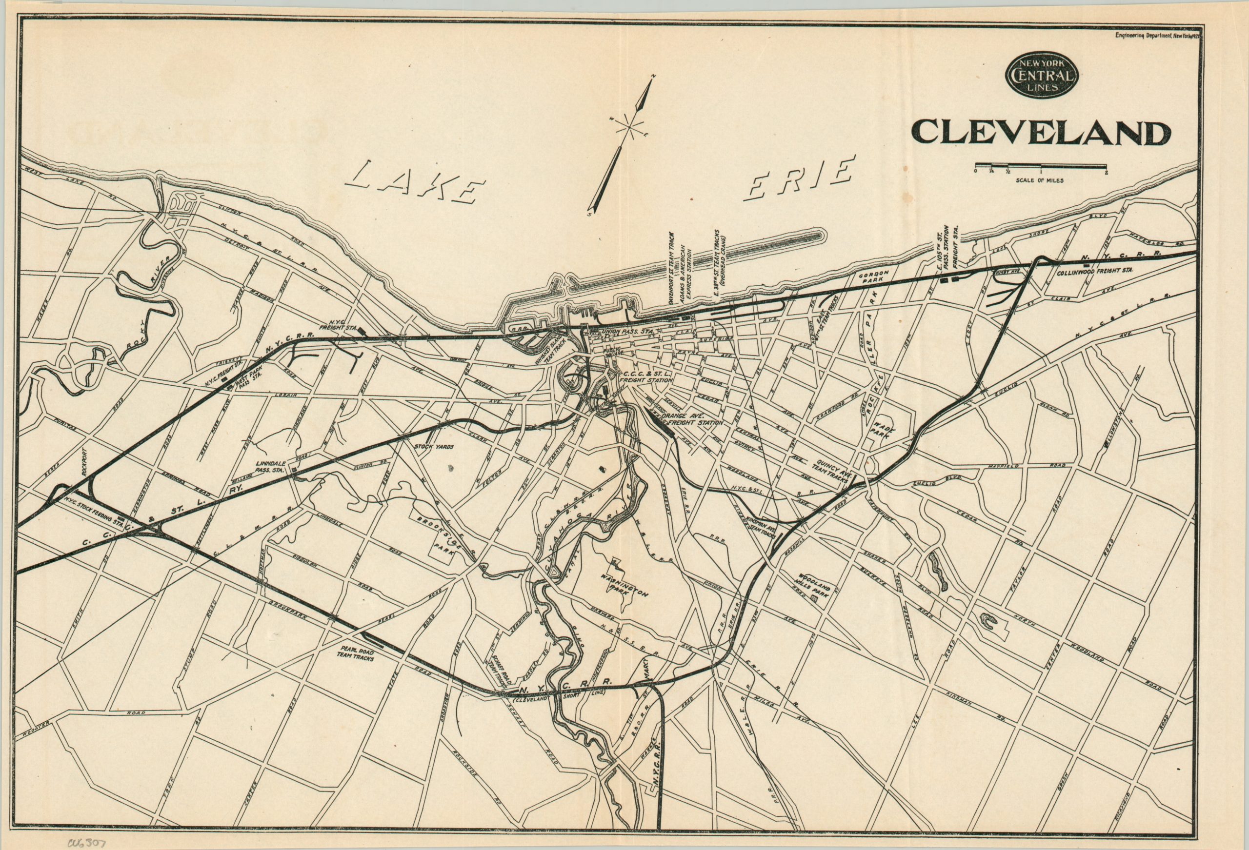
Cleveland at the beginning of the Prohibition Era.
1 in stock
Description
This simple street plan of Cleveland, Ohio was designed and published by the Engineering Department of the New York Central Railroad in 1921. Major railway infrastructure (depots, stations, warehouses, etc.), large parks, and geographic features are labeled throughout. The lines of the New York Central Railroad and the Cleveland, Cincinnati, Chicago & St. Louis Railway (an affiliate of the NYC) are boldly shown.
Map Details
Publication Date: 1921
Author: New York Central Lines Engineering Department
Sheet Width (in): 14.5
Sheet Height (in): 9.75
Condition: A-
Condition Description: Wrinkling along old vertical folds, irregular margins, and scattered spotting in the upper right. Good condition overall. Blank on verso.
$45.00
1 in stock