
Cleveland Harbor, Ohio – Eastern Approach
$200.00
Facilitating Cleveland’s rapid industrial growth in the late 19th century.
1 in stock
Description
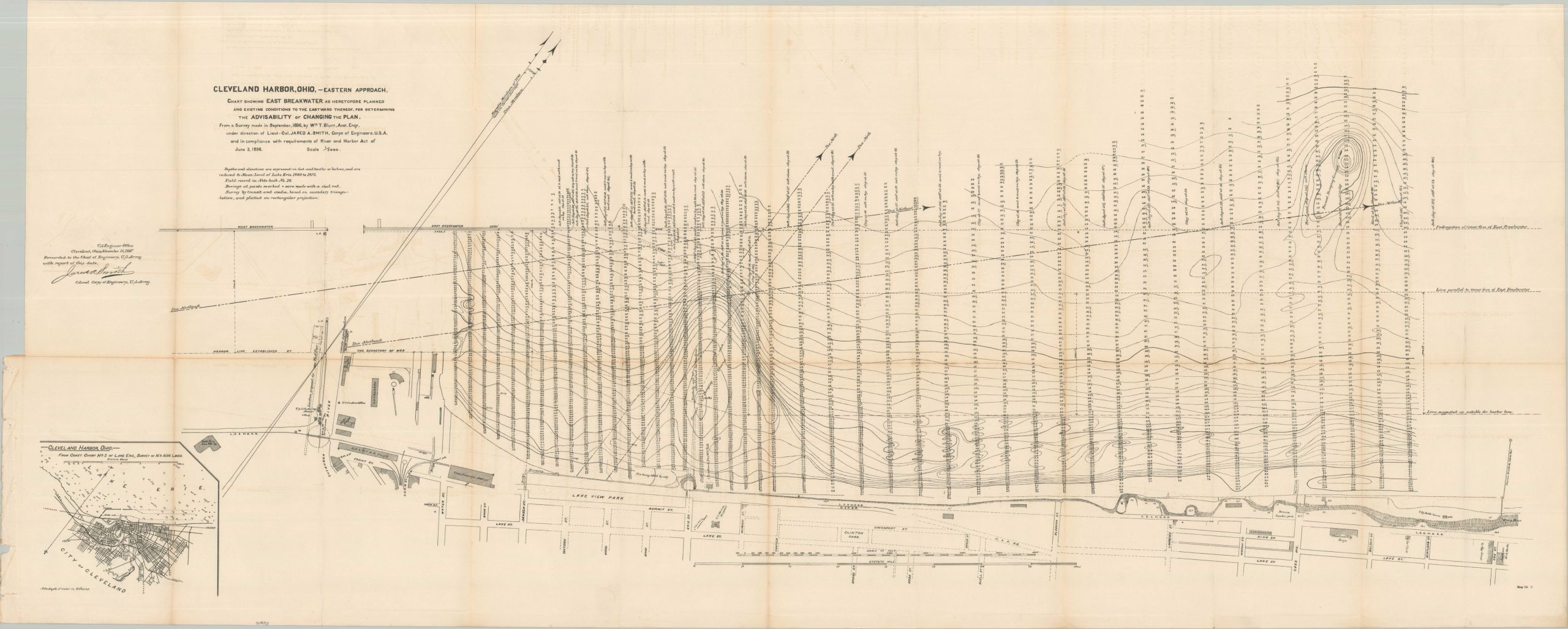
‘Chart Showing East Breakwater as Heretofore Planned and Existing Conditions to the Eastward Thereof, for Determining the Advisability of Changing the Plan.’ – Subtitle.
This fascinating technical assessment was created by members of the Army Corps of Engineers to catalog ongoing efforts to improve the harbor at Cleveland, Ohio. The city’s rapid industrial expansion along the shores of Lake Erie found its old waterfront infrastructure to be unsuitable, and various plans were devised for remedying the situation, including the creation of additional piers and a large eastern breakwater (note the inset, lower left). The 2000′ extension is outlined in two possible locations, amid scores of depth soundings and contoured topography of the lakebed.
Interesting details can also be gleaned about the portion of Cleveland’s waterfront that is also included within the image. A concentration of industry – ironworks, rail infrastructure, warehouses, etc. – can be seen in the lower left (the southwest). Lake Street runs along the bottom of the page, ‘above’ the bluffs that are depicted with traditional hachuring.
Parks, the bathhouse, U.S. Marine Hospital, Life Saving Station, and the city pump house are among the labeled features. See how close the last is to the dumping grounds! This proximity contributed to significant outbreaks of typhoid fever and cholera in the late 19th and early 20th centuries.
Map Details
Publication Date: 1897
Author: William Blunt and Jared Smith
Sheet Width (in): 51.75
Sheet Height (in): 20.75
Condition: B+
Condition Description: Large fold-out map extracted from a broken Congressional report, creased along original folds. Moderate offsetting from the printed black ink and one 3" separation, repaired on verso with archival tape. Good condition overall.
$200.00
1 in stock