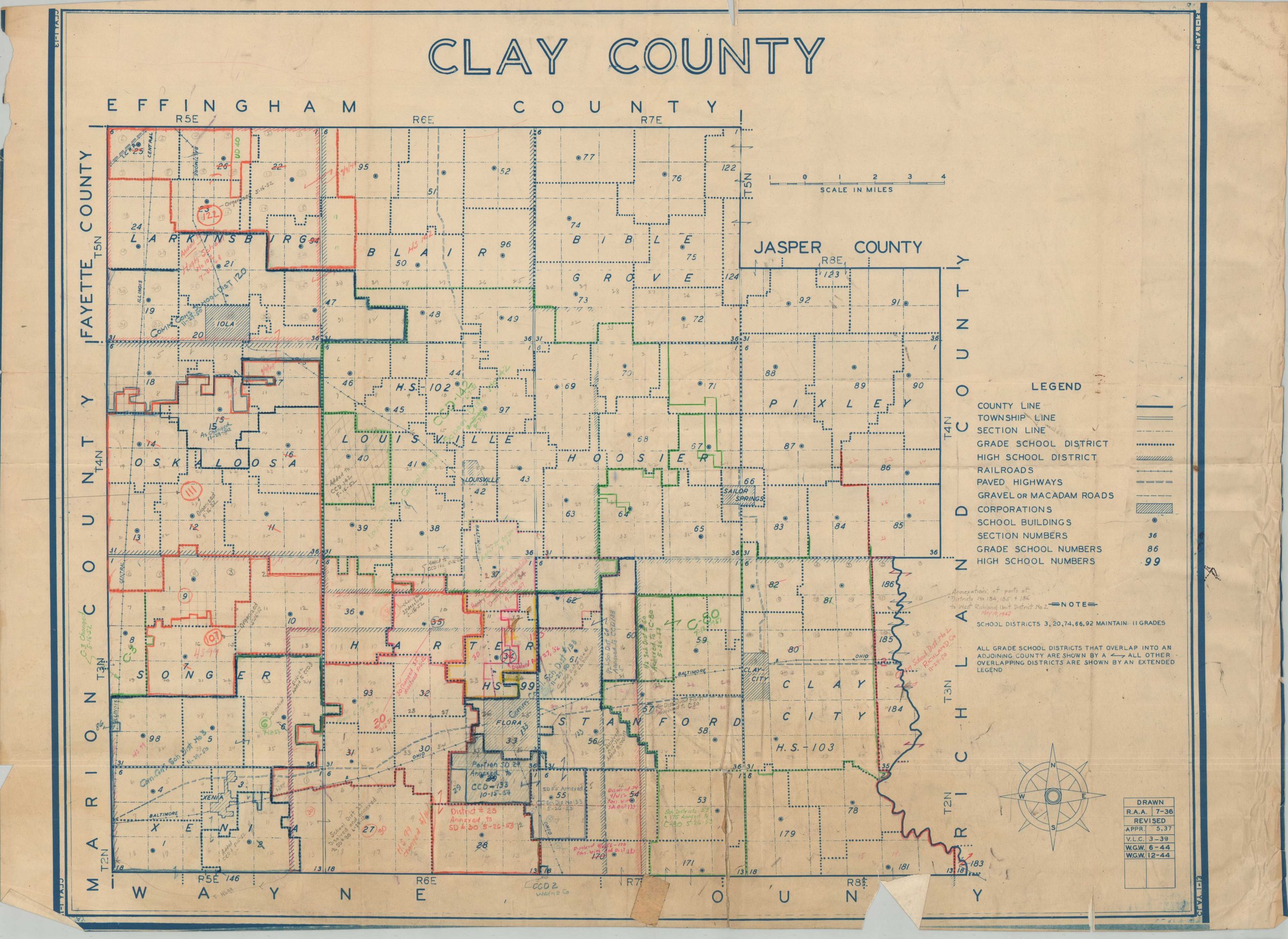
Clay County
$95.00
Clay County, Illinois during the mid-20th century.
1 in stock
Description
This interesting plan of Clay County, Illinois provides a detailed overview of the county’s school districts, transportation routes, and boundary lines. Towns and townships are labeled, along with railroads and adjacent counties. A table in the lower right indicates the map was originally drawn in 1936, with revisions performed regularly through 1943. Manuscript annotations indicate further use in redesignating school districts into the early 1950s.
At the time, Flora was considered by some to be a ‘sundown town’, a place where it was unsafe for African-Americans to remain (as a resident or visitor) after sunset. Originally compiled and published by the Illinois Department of Revenue Property Tax Division, but the map was repurposed for a different use as part of a railroad archive.
Source: Medium;
Map Details
Publication Date: c. 1953
Author: Illinois Department of Revenue Property Tax Division
Sheet Width (in): 35.5
Sheet Height (in): 26
Condition: B-
Condition Description: Blueprint style map on a single-sided sheet with soft creasing and several areas of separation along old folds. Numerous tears and areas of wrinkling along the outer edges of the sheet, with very minimal loss to the paper. Heavy manuscript annotations throughout in a variety of pencil and ink shades. Scattered soiling and spotting consistent with age and use. Between fair and good condition overall.
$95.00
1 in stock