Clason’s Road Map of California and Nevada
$150.00
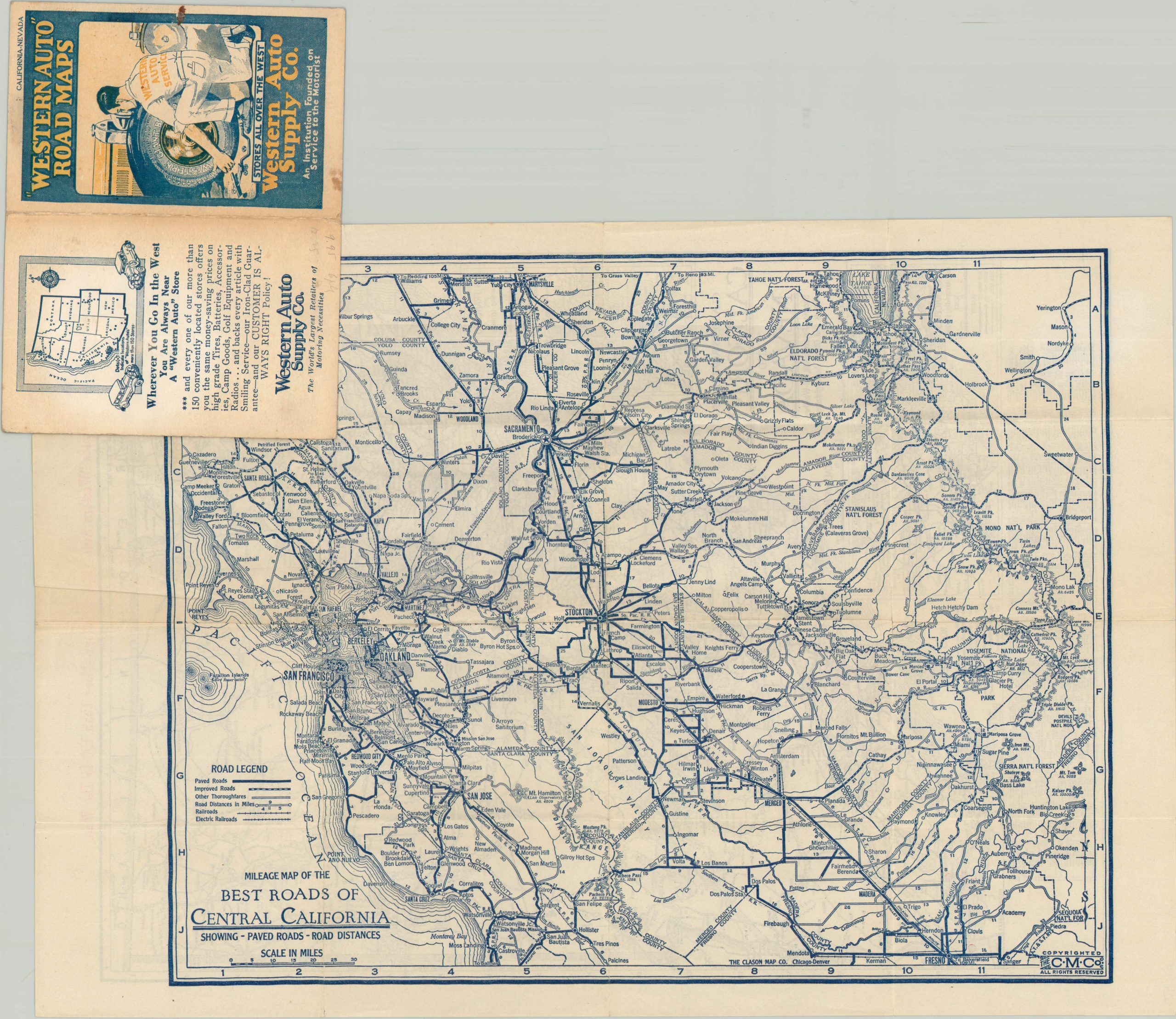
Double sided pocket map showing the roads in California and Nevada.
1 in stock

Description
This detailed transportation map was published in 1930 by the Clason Map Company and shows the most up to date road information for motorists in Nevada and California. Three separate road surfaces are identified, along with distance markers and highway numbers according to the accompanying legend in the lower center. Inset maps of San Francisco and Los Angeles are provided in the lower left.
Orange dots throughout highlight the location of West Auto Supply Company store locations, while a pictorial advertisement on the front cover shows a technician with a curiously long arm. The verso of the map shows a similar mileage map of the best roads throughout Central California.
Map Details
Publication Date: 1930
Author: Clason Map Company
Sheet Width (in): 11.90
Sheet Height (in): 17.00
Condition: B
Condition Description: Issued folded into 16 panels and affixed to original paper covers, which are present and in good condition. Heavy creasing and moderate wear along fold lines, including several areas of separation. A dark spot in the upper center of the image.
$150.00
1 in stock