
Clason’s Midget Map of Indiana
$80.00
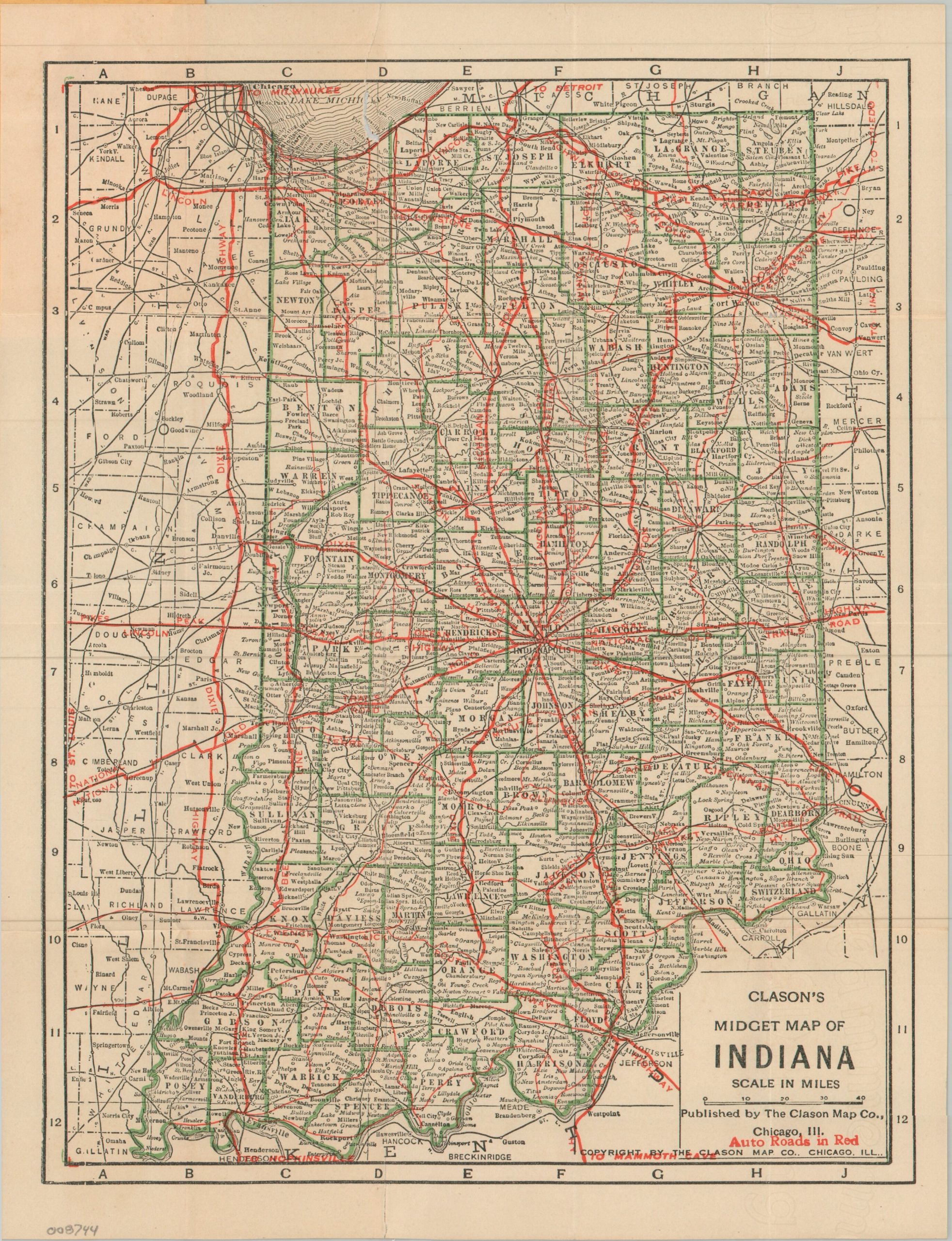
A ‘midget map’ of Indiana’s roads during the early 1920s.
1 in stock
Description
This somewhat unusual road map of Indiana was published around 1920 by the Clason Map Company of Chicago. Bright red overprinting identified the primary automobile routes across the Hoosier States, many of which are labeled (rather than numbered). Popular transcontinental thoroughfares like the Lincoln Highway are named in addition to regional roads such as the Minute Man Route. Because of it’s small size (the covers measure a diminutive 2″ x 3.5″) and large scale, the utility of such a map is rather suspect.
It perhaps functions more effectively as a promotional piece – in this case, for Greening’s Big Nurseries of Monroe, Michigan. According to the front cover, the company is ‘Growers of Every Thing for Orchard, Park and Ornamental Gardens’, with the primary location right off the Dixie Highway. An applied rubber stamp indicates this example was distributed by agent William Rockwell of Brookville, Indiana. Hoosiers were apparently willing to travel for ‘Genuine Greening Grown Stock!’
Map Details
Publication Date: c. 1920
Author: Clason Map Company
Sheet Width (in): 8.9
Sheet Height (in): 11.9
Condition: B
Condition Description: Small color printed pocket map folded and affixed to original yellow covers. Several tears along old folds, repaired on verso, with an irregular spot in the upper center resulting in minor image loss along the southern shoreline of Lake Michigan. About good condition overall.
$80.00
1 in stock