Clason’s Map of the Chicago Loop
Compact pocket map of Chicago’s Loop published during the Prohibition Era.
Out of stock
Description
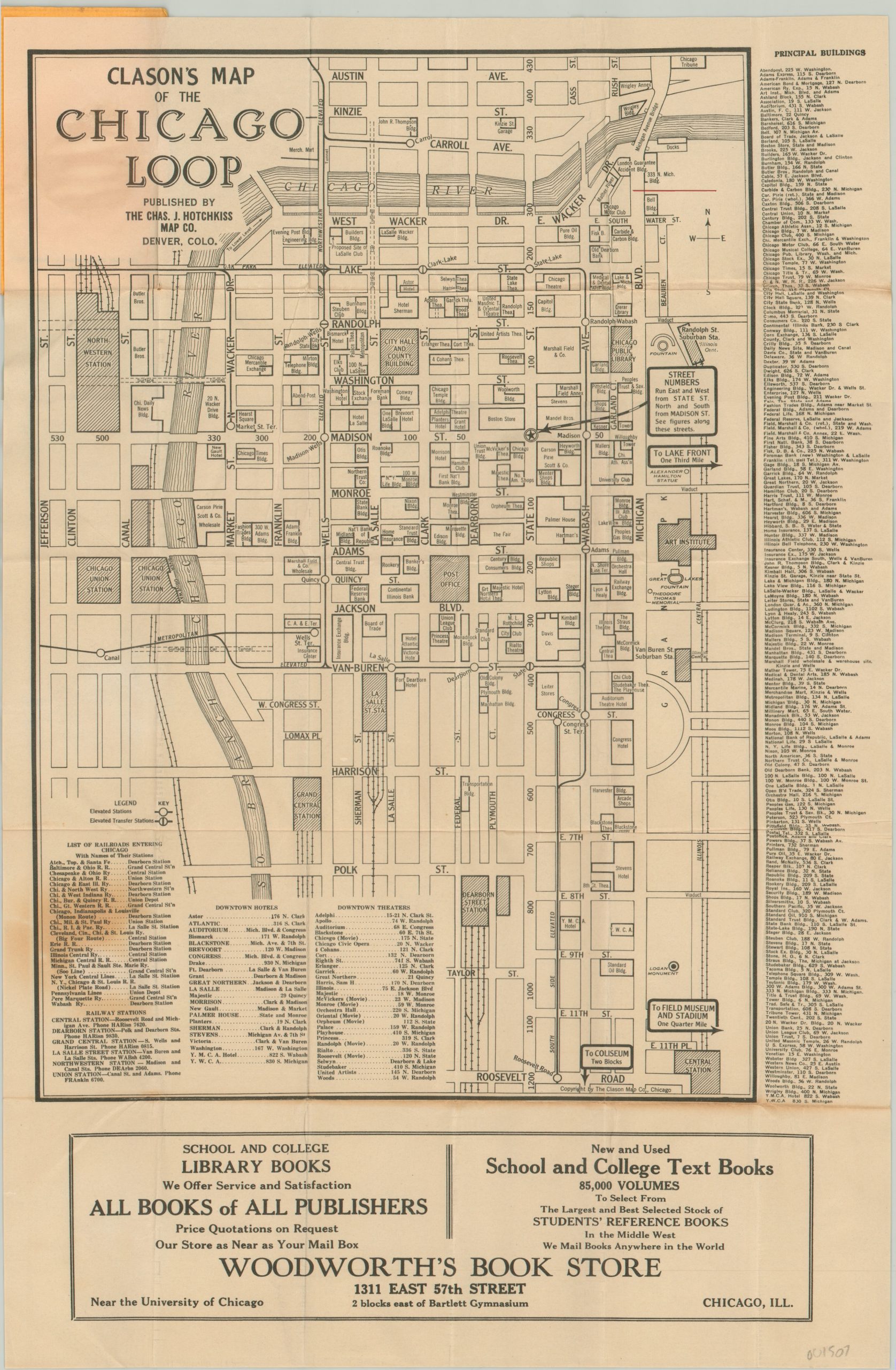
Dated using the absence of Shedd Aquarium and Adler Planetarium (open in 1930) and the presence of the Carbon & Carbide building (completed 1929), this map provides a detailed snapshot of the composition of the Chicago Loop at the end of the Roaring Twenties. The Tribune Tower, recently completed in 1925, represents the upper limit of the image, which extends south as far as Roosevelt Road and west to Union Station.
Prominent buildings are individually labeled and identified in an index surrounding the map. The junction at State and Madison is highlighted with a star, indicating that intersection as the directional cut-off point for street names, and elevated stations are also shown with a special symbol.
The map was published by the Clason Map Company on behalf of Woodworth’s Book Store, a longtime Chicago institution whose successors still operate in northern Indiana. The firm was located on 57th Street, near the University of Chicago, and among textbook sales offered services such as developing Kodak film, the repair of fountain pens, and restringing tennis rackets!
Map Details
Publication Date: c. 1930
Author: Clason Map Co.
Sheet Width (in): 10.60
Sheet Height (in): 16.40
Condition: B
Condition Description: Originally folded into 30 panels and tucked neatly into original yellow paper covers. Moderate wear and creasing along fold lines, and severe discoloration in one spot in the lower left. A bit of toning also present elsewhere in the image. The map is attached to the original covers, which are intact but the spine is about halfway separated. Good condition overall, with a few defects.
Out of stock