Clason’s Double Indexed Map of Chicago
$75.00
The Chicago of Al Capone.
1 in stock
Description
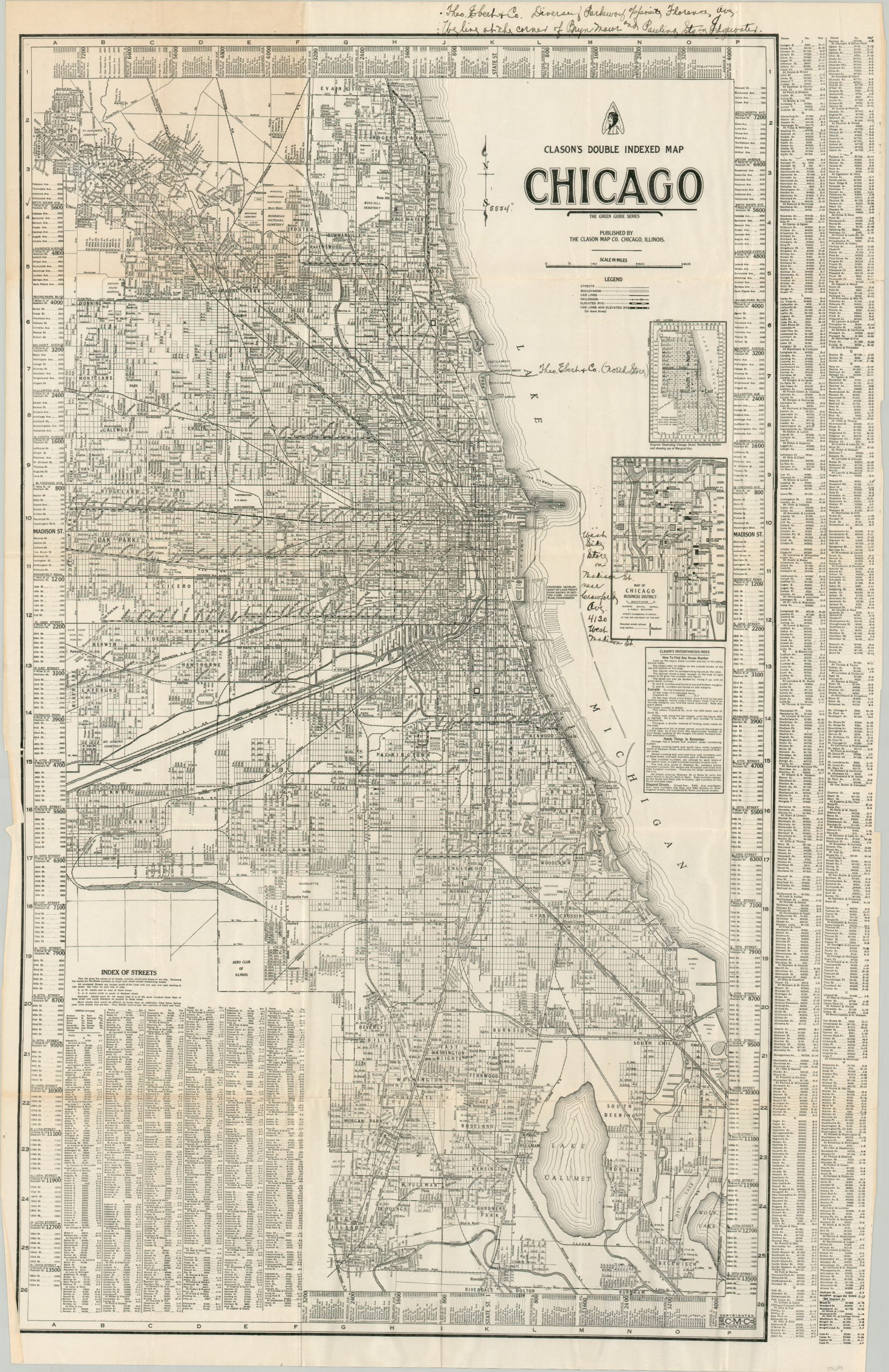
This interesting map of Chicago, Illinois was published locally by the Clason Map Company around 1926, based on the presence of Soldier Field and the absence of any reference to Midway Airport. It provides a detailed look at the Windy City during the Roaring 20s, when Al Capone was at his height, jazz music blared, and speakeasies flourished with bootleg booze.
The image presents a complex network of transportation routes – streets, electric & steam railroads, streetcar lines, and the iconic elevated lines, known affectionately as the ‘L’. Neighborhoods, parks, and cemeteries are labeled, along with unique locations of interest like the Aero Club of Illinois, Union Stockyards, Hawthorne Race Track, and the tuberculosis sanitarium. Also of interest is the outline of proposed developments along the lakefront. A nearby inset in the center-right shows the Chicago Loop (the business district), while the borders provide street numbering information and an alphabetical street index. Handwritten annotations note the location of Theo. Ebert & Co. (a decorating and design company) on the north and west sides of the city.
Map Details
Publication Date: c. 1926
Author: Clason Map Company
Sheet Width (in): 22
Sheet Height (in): 34
Condition: B+
Condition Description: Large pocket map folded into 30 panels and disbound from original paper wraps (present). Toning in the upper left panels and moderate wear along folds. Old manuscript annotations in pen. Good condition overall. Blank on verso.
$75.00
1 in stock