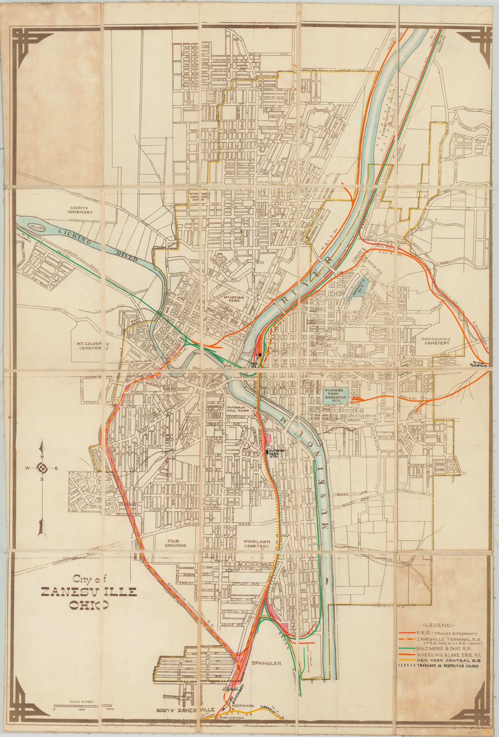
City of Zanesville, Ohio
$129.00
Detailed city plan of Zanesville, Ohio updated for use by the Pennsylvania Railroad.
1 in stock
Description
This interesting map of Zanesville, Ohio captures the city at the confluence of the Muskingum and Licking Rivers with a high level of detail. The National Road can be seen bisecting the city horizontally, and the only “Y” bridge in the nation can be found at the intersection of the two rivers.
Though the map was likely originally published as a street guide (albeit anonymously), this particular example has been updated for use in the Central Engineering Department of the Pennsylvania Railroad. The process included dissecting and mounting the map to linen for preservation and convenient storage, and adding bright color (by hand) to identify railroad property and track ownership across the city limits.
A custom index has been added to the lower right identifying the primary local railroad operators. Of particular interest is the Zanesville Terminal Railroad – one of the numerous electric lines across the country that provided interurban transportation prior to its decline in the 1950’s.
Map Details
Publication Date: c. 1932
Author: Anonymous
Sheet Width (in): 21.90
Sheet Height (in): 32.75
Condition: B
Condition Description: Dissected into 20 panels and mounted on linen with black leather covers. Two panels show moderate discoloration from adhesive used to affix the covers to the verso. Narrow right margin. Otherwise the map is in very good condition, with scattered wear and soiling consistent with its age and use.
$129.00
1 in stock

